Arkansas and Red Rivers Workshop in Tulsa, Oklahoma
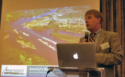
Bill Dennison ·As part of our continuing series of stakeholder expert workshops for developing a Mississippi River basin report card, a team of IAN Science Integrators and Science Communicators traveled to Tulsa, Oklahoma on 14-15 May 2014. Heath Kelsey, Bill Nuttle, Bill Dennison, Caroline Wicks, and Brianne Walsh. Anthony Kung, the visiting graduate student from the University of Queensland, came along as an observer as well. Since one of our Army Corps of Engineers partners had her travel plans thwarted, we were able to draft Anthony into helping out as a rapporteur.
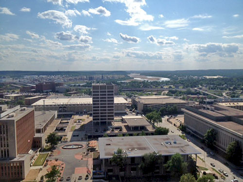
The workshop venue was at the Mayo Hotel in downtown Tulsa. This hotel was simply spectacular in all respects. It was built in 1925 at the height of the oil boom in the Tulsa region in the midst of the Art Deco era. It became quite rundown, but was recently renovated, maintaining the original character of the building. We had a very nice reception on the roof and could view the Arkansas River. The staff were helpful, the food was good and the rooms palatial. We learned that the list of previous guests was impressive, including Elvis, Lucille Ball, Ronald Reagan, and Will Rogers. We even were interrupted by a Secret Service Agent to ask us to make way for a VIP. The VIP turned out to be former First Lady Laura Bush! This was one classy place.

The Arkansas and Red Rivers are long rivers stretching from the Rocky Mountains in Colorado to the lower Mississippi River. There are strong east-west gradients in elevation, rainfall and land use. We enjoyed the running debate about the correct pronunciation of the Arkansas River - to the people from Kansas it is the "Ar-KAN-sas" River and the people in Oklahoma call it the "Ar-kan-saw" River, like the pronunciation of the state of Arkansas.
The lower portions of both the Arkansas and Red Rivers are maintained for navigation, connecting to the lower Mississippi River. The Arkansas River navigation is the McClellan-Kerr Arkansas River Navigation System and it was built between 1967-1971. It extends for 445 miles as far up as the Tulsa region using 18 locks and dams. The Red River navigation is the J. Bennett Johnston Waterway and it was completed in 1994. It extends 236 miles as far up as Shreveport, LA using five locks and dams. The confluences of both the Arkansas and Red Rivers with the Mississippi River are interesting. The Arkansas and White Rivers converge at the Mississippi River junction. The Red River enters the Atchafalaya River, a distributary of the Mississippi at the convergence of the Ouachita River. The navigation systems for these rivers are 'teenagers' compared with the much older Mississippi, Ohio, Illinois and Tennessee River navigation systems.

Historically, the Red River was unnavigable due to the presence of a large log jam observed by the early European explorers. Various efforts to remove this log jam, known as the 'Great Raft' were made, and Captain Henry Shreve (creator of Shreveport) began the project in the 1830s using specially designed barges. The use of dynamite finally cleared the river on the 1870s.
The importance of recreation in the waterways of the Arkansas and Red Rivers was interesting. In the upper reaches of the Arkansas River in the Rocky Mountains, there is an active river rafting/kayaking program as well as an active trout fishery. Recreational use in the reservoirs and the various lock and dam sections is high as well. Several Bass-master fishing tournaments have occurred in the watershed, attracting people from well beyond the watershed.

Water supply is a major issue in the semi-arid climate of the watershed, particularly acute in the western most sections. The Mark Twain quote was apropos: "Whiskey is for drinking, water is for fighting over." The tradeoffs between water for navigation, agriculture, recreation and ecosystem services are particularly important in these watersheds.
The Army Corps of Engineers maintain the navigation infrastructure for the Arkansas and Red Rivers and as a result, they play an important role in the balancing act between competing interests for water allocation. In addition, they are active in managing the extensive use of the reservoirs created by their dams. We had two Army Corps of Engineers colonels attend the workshop and they were actively engaged in conversations about developing report card indicators and metrics. We were even able to convince Colonel Paul to join in singing our workshop song to conclude the workshop.

The combination of working in a wonderful venue (thanks to Barbara Allison), excellent participants (thanks to Jordy Jordahl), and a series of productive discussions (thanks to the IAN team) made this workshop quite enjoyable. Since this is the final full workshop with the sub-basin groups before we launch into report card production mode in preparation for the October Mississippi River summit, it is nice to end on a high note.
About the author
Bill Dennison

Dr. Bill Dennison is a Professor of Marine Science and Interim President at the University of Maryland Center for Environmental Science (UMCES).
Next Post > Bahamian adventures: Columbus on the Niña and seagrass scientists on the R/V Calanus
Comments
-
Atika 7 months ago
Thank you for sharing this great information with us, i really appreciate your post!