Missouri River: Environmental Literacy
Heath Kelsey ·‘Environmental literacy‘ series
The seven environmental literacy principles for the Missouri River are the following:
- The Missouri River is the longest tributary (2,300 miles) of the Mississippi River.
- Navigation on the Missouri River is supported by a series of levees and dikes from the mouth to Sioux City, Iowa, about 760 miles.
- A series of reservoirs north of Sioux City on the Missouri River serves multiple uses.
- Precipitation is relatively low and extremely variable in the western portion of the basin, except the extreme west where snowpack accumulates in the Rocky Mountains.
- The Missouri River basin is an important historical location in the expansion of the United States.
- The Missouri River basin has a diversity of important and interesting natural features.
- The basin supports important habitat for migratory bird species.
1. The Missouri River is the longest tributary (2,300 miles) of the Mississippi River.
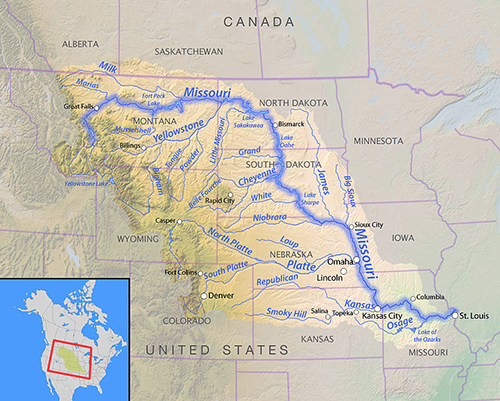
The Missouri River flows west to east through Montana and North Dakota, then south through South Dakota, then as the border between Nebraska and Iowa and between Kansas and Missouri, then through Missouri joining the Mississippi River near St. Louis. Total drainage area is 529,000 square miles. The Yellowstone, Platte, and Kansas rivers are major tributaries to the Missouri.
The Missouri River is the longest river in North America, and forms the world’s fourth longest river system when combined with the lower Mississippi River. The Missouri River watershed includes potions of Colorado, Wyoming, Montana, North Dakota, South Dakota, Minnesota, Nebraska, Iowa, Kansas, and Missouri, as well as parts of Saskatchewan and Alberta in Canada.
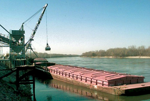
2. Navigation on the Missouri River is supported by a series of levees and dikes from the mouth to Sioux City, Iowa, about 760 miles.
Although navigation use of the river is not extensive in annual tonnage and value, water uses downstream of Sioux City such as municipal water supply, crop irrigation, and recreation, are supported by the need to maintain flows necessary for navigation in that corridor. Competition to barge transportation on the Missouri is provided by rail and highway. Recent increases in hydraulic fracking in the northern basin in western North Dakota and eastern Montana at the Bakken shale deposit have created conflicts in rail travel. Rail cars used for oil and gas extraction are causing delays in other rail uses in this area, including crop transportation.
3. A series of reservoirs north of Sioux City on the Missouri River serves multiple uses.
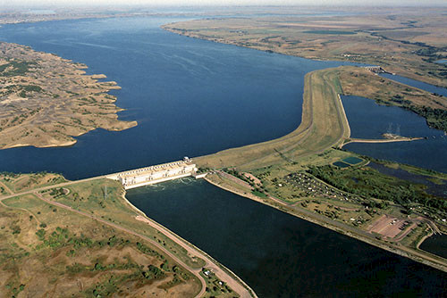
Major reservoirs on the mainstem Missouri include Gavins Point, Fort Randall, Big Bend, Oahe, Garrison and Fort Peck. The system provides massive water storage, and is the basis for complex disputes and competition for water rights. Water flows from these reservoirs are regulated to support multiple water uses, including flood control, water supply, water quality, protection of fish and wildlife, hydropower, navigation, recreation, and irrigation.
Support for navigation during low flow periods effectively ensures that adequate water will be available for most of the other uses as well. Reservoir levels and water releases are important factors during periods of expected or actual high flow. Reservoirs are lowered (water is released) in winter and early spring to prepare for snowmelt in June/July. There are many smaller public and private reservoirs elsewhere in the basin, but much of the watershed is not provided flood protection by reservoirs. Sedimentation behind the reservoir dams is reducing flood storage, and will eventually cause the reservoirs to be ineffective impoundments.
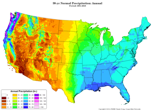
4. Precipitation is relatively low and extremely variable in the western portion of the basin, except the extreme west where snowpack accumulates in the Rocky Mountains.
Precipitation annually is 40+ inches in the eastern portion of the basin. The major divide in climate and landscape is the 100th meridian, which passes just east of Bismarck, ND and very near Dodge City, KS. Generally lower rainfall west of the 100th meridian is accompanied by changes in irrigation from surface to groundwater, particularly near the Ogallala Aquifer in the Nebraska area of the basin.
5. The Missouri River basin is an important historical location in the expansion of the United States.
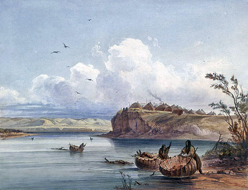
Lewis and Clark followed the Missouri in their 1804-1806 expedition to explore the newly acquired Louisiana Purchase, and establish a passage to the west coast. Numerous Native American tribes occupied the territory. Currently 28 tribes reside in the basin, mostly in North and South Dakota and Montana.
6. The Missouri River basin has a diversity of important and interesting natural features.
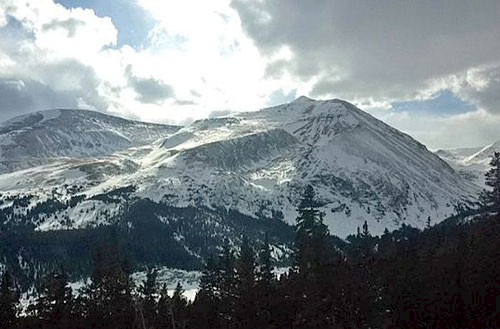
The basin has a diversity of landscapes, including high elevation mountains and prairie and grasslands. Mount Lincoln in Colorado is over 14,000 ft in elevation, while the Missouri River is only 400 ft at the river mouth, where it joins the Mississippi near St. Louis, MO. The Black Hills region in central South Dakota is a unique and complex geologic formation with equally unique ecology. The name “Black Hills” comes from the dark coloration of the Ponderosa Pines. Most of the Ogallala aquifer is also located within the basin. The aquifer is over 1000 ft thick in the Nebraska portion of the aquifer, but is declining from crop irrigation.
7. The basin supports important habitat for migratory bird species.
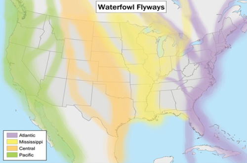
The “Prairie Pothole” region, which encompasses the eastern third of the watershed (and extends farther east), is extremely important habitat for waterfowl, accounting for a large percentage of waterfowl nesting in North America. Unfortunately, wetland, grasslands, riparian, and aquatic habitats are being reduced through conversion to farmland or developed uses, and from river channelization. Several plans are in place or are being considered to restore some of these habitats.
About the author
Heath Kelsey

Heath Kelsey has been with IAN since 2009, as a Science Integrator, Program Manager, and as Director since 2019. His work focuses on helping communities become more engaged in socio-environmental decision making. He has over 10-years of experience in stakeholder engagement, environmental and public health assessment, indicator development, and science communication. He has led numerous ecosystem health and socio-environmental health report card projects globally, in Australia, India, the South Pacific, Africa, and throughout the US. Dr. Kelsey received his MSPH (2000) and PhD (2006) from The University of South Carolina Arnold School of Public Health. He is a graduate of St Mary’s College of Maryland (1988). He was also a Peace Corps Volunteer in Papua New Guinea from 1995-1998.