Assessing bacteria in South Carolina: redesigning the "How's the Beach?" app
Emily Nastase ·'How’s the Beach?' is an app that presents health advisories to the public about bacterial levels in Myrtle Beach, SC and Sarasota Beach, FL. The University of South Carolina and IAN are collaborating to expand the scope of this app to include popular waterways and shellfish harvesting sites around the Charleston Harbor. In addition to expanding the project, USC and IAN have joined forces with Charleston Waterkeeper and the Southeast Coastal Ocean Observing Regional Association (SECOORA) with the goal of redesigning this app to be more user-friendly and include more information. The partnership has brought new resources to the project and introduced a variety of unique perspectives into the mix.
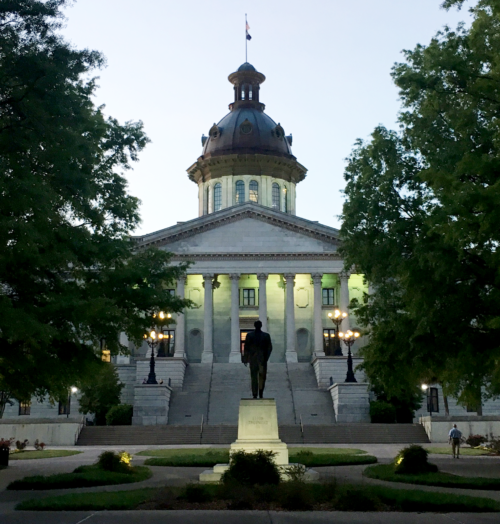
To kick-off the project, Heath and I ventured down to Columbia and Charleston, South Carolina to meet up with the old and new project partners and hash out the future for this app. First, I met Dwayne, who happens to be Heath’s old advisor from his days at USC. Dwayne is the Director of Graduate Studies in the Department of Environmental Health Sciences. He is relaxed, fun, and he likes to make up history for South Carolina (something he admitted about himself). I also met Dwayne’s team that works on synthesizing the data and creating the model for the app. Our first meeting for the project was a water quality modeling work group meeting. We borrowed a computer lab from USC, phoned in our new partners from Charleston Waterkeeper and SECOORA, and hashed out some details of editing the existing model. This meeting was followed by lunch, a few hours of solo work and brainstorming, and then happy hour with the gang!

Day two of our travels to South Carolina began with Heath giving a lecture to Dwayne’s graduate class on report cards: what they are, how they’re made, and how they improve the health of different ecosystems. The class seemed genuinely interested in Heath’s talk and asked a lot of engaging questions. Dwayne brought me into the mix by asking how I utilize my artistic abilities to communicate science, and what my role in this water quality project is.
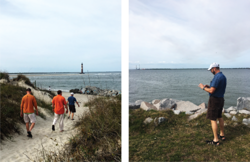
After Dwayne’s class, we meandered from Columbia to Charleston on the small back-country roads of rural South Carolina, while getting Dwayne’s narrative on the history of the region (which I was advised to take with a grain of salt). It was a beautiful drive that spanned about three hours before we came to the edge of Charleston. Dwayne volunteered to take us on a scenic drive through the area to acquaint me with the region since this was my first time in Charleston. He brought us out to Folly Island, where we walked out to a viewpoint for the Morris Island Lighthouse in Charleston Harbor, and James Island, where we wandered around Fort Johnson.

The next day we ventured over to the Charleston Waterkeeper office to meet with our new partners and discuss the future of this project. Cheryl Carmack, one of the lead scientists for Charleston Waterkeeper, was excited to help out. Charleston Waterkeeper has a lot of experience with public outreach and water quality sampling around Charleston Harbor, so Cheryl provided us with some great input and some fresh ideas for the goals of our 'How’s the beach?' app. She then graciously offered to show us some of the sites that they regularly collect water samples from. We ventured to Brittlebank Park, Folly Island, USS Yorktown (an old naval ship that is parked in the harbor), Fort Moultrie and Sullivan’s Island, and out to Hobcaw Creek.

Even though this trip was not wholly structured and filled with meetings and workshops, I found it to be very productive. All of our team members and new partners have the same vision for the future of this project and we have the collective resources to really improve upon the existing app. Moving forward, IAN will release a newsletter that details the progress made from this trip, the anticipated future of the app, and a conceptual diagram that explains how bacteria enter into recreational waterways. Dwayne’s team in USC is currently working to revise the model to more accurately predict bacterial levels. When those revisions have been made, IAN and USC will add in the new data from Charleston Harbor and redesign the app!