Environmental literacy of the Tuul River, Mongolia
Bill Dennison ·Environmental literacy principles for the Tuul River, Mongolia
- The Tuul River in northcentral Mongolia is a tributary to the Orkhon River. The Orkhon River flows through Lake Baikal, Russia via the Selenga River and into the Yenesei River, which is the largest tributary into the Arctic Ocean.
- Water from the Tuul River is heavily utilized, mostly for domestic and industrial use in their capital, Ulaanbaatar.
- The Tuul River has a sinuous flow path currently unimpeded by man-made dams and maintains connectivity with its floodplain.
- The Tuul River watershed is a forested and heavily grazed grassland steppe, with increasing livestock populations tended by nomadic herders.
- The Tuul River outside of Ulaanbaatar is heavily used for recreation such as tourist camps and for gold and other mining operations.
- The Tuul River and the people residing in the watershed are vulnerable to climate change.
- There are many locations with historical and spiritual importance in the Tuul River basin.
Geographic Context
Each of these literacy principles will be discussed in turn, but first some contextual geography will be provided for Mongolia. To orient those who live in the United States, the latitude and longitude of Mongolia, 41-52° N 87-120°E, is at a similar latitude and longitude as the state of Montana, 44-4°N 104-116°W, although east of the prime meridian. The average and range of elevations of Mongolia and Montana and Montana are similar as well. The average elevation of Mongolia is 5,183 ft or 1580 m, while Montana’s is 3,400 ft or 1,030 m. The highest places are 14,350 ft or 4,374 m for Mongolia and 12,799 ft or 3,901 m for Montana, and the lowest points are 1,699 ft or 518 m and 1,800 ft or 548 m respectively. Both Montana and Mongolia contain a triple continental divide; Mongolia’s flows to the Arctic Ocean, Pacific Ocean, and Central Asian Basin. Montana’s flows to the Arctic Ocean, Pacific Ocean, and Gulf of Mexico. Both locations have a semi-arid continental climate, and the Montana sagebrush steppe is similar to the Mongolian forested and grassland steppe.
Here, however, the similarities between geographies end. The total area of Mongolia, 604,600 mi2 or 1,564,116 km2, is 4.1 times the area of Montana, which is 147,040 mi2 or 380,800 km2. The livestock population is much larger in Mongolia: approximately 73 M versus Montana's population of approximately 3 M. Also, while the population densities of Mongolia 5.0 people/mi2 and Montana 6.8 people/mi2 are similar, their population distribution differs. Most of the population of Mongolia is concentrated in Ulaanbaatar, which has 1,300,000 people. In contrast the largest city in Montana, Missoula, claims around 70,000 people. Ulanbaatar, then, is more analogous to Denver, Colorado, with both cities having similar elevations and concentrated populations surrounded by low population densities.
Environmental literacy
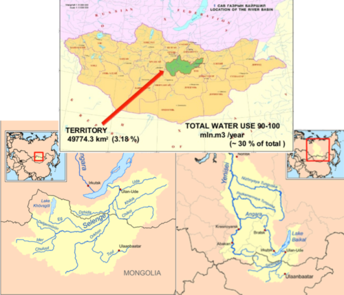
The Tuul River in northcentral Mongolia is a tributary to the Orkhon River. The Orkhon River flows through Lake Baikal, Russia via the Selenga River and into the Yenesei River, which is the largest tributary into the Arctic Ocean. The Tuul River is 437 mi or 704 km long and has a watershed area of 19,243 mi2 or 49,840 km2. Its headwaters are in the Khentii Mountains, and it flows generally from east to west before turning north. Its basin is one of the eleven river subbasins of the Selenga River. This differs from the destination of most of Mongolian water drainage, which ends up in the Central Asian Internal Basin and remains inland. Less water flows into Amur River and out into the Pacific Ocean.
Water from the Tuul River is heavily utilized, mostly for domestic and industrial use in the capital of Mongolia, Ulaanbaatar. The Tuul River provides drinking water for people and livestock, water supply for industrial uses and for gold mining. There is limited irrigation water used for agriculture in the Tuul River basin. The Tuul River is the principal water source for Ulanbaatar. A series of groundwater wells about 30 m deep are located upstream in the Tuul River floodplain and piped to the City Center Water Center. This water has both domestic and industrial uses.
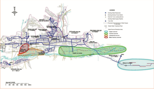
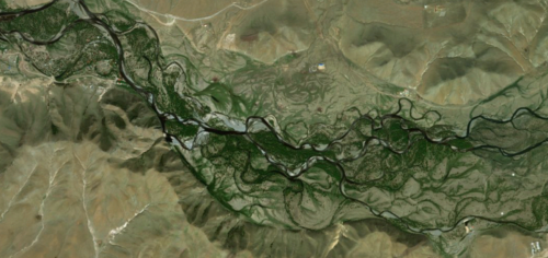
The Tuul River has a sinuous flow path currently unimpeded by man-made dams and maintains connectivity with its floodplain. The Tuul River is not channelized, and its sinuous flow path contains braided streams and islands. The Tuul River does occasionally flood; the latest large flood was reported in 2009. Its riparian vegetation is relatively intact upstream of Ulaanbaatar but fairly degraded downstream.
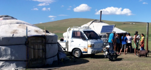
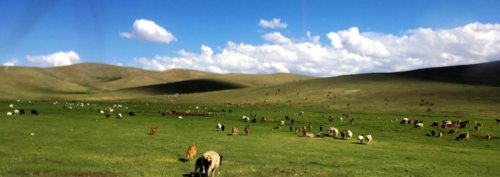
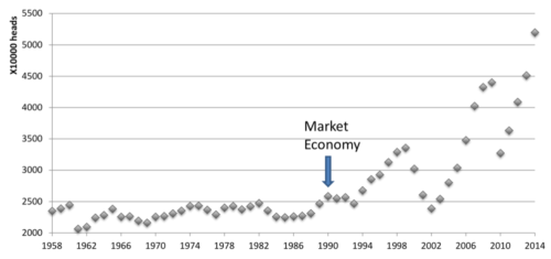
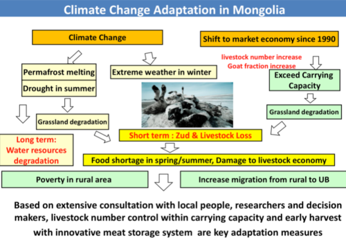
The Tuul River watershed is a forested and heavily grazed grassland steppe, with increasing livestock populations tended by traditional nomadic herders. The Tuul River watershed is forested in the upstream, mountainous region. The rest of the watershed is grassland steppe. Following the Soviet period ending in 1990, Mongolia grazing operates on a market economy, which expanded the livestock herd sizes and a large population of nomadic herders living in traditional gers, or yurts. Increased herd sizes of cattle, sheep and goats has led to a heavily grazed landscape. The demand for cashmere has stimulated an increase in the goat population, which is especially concerning due to the fact that goats uproot plants when feeding. Soil erosion is occurring in small streams and creeks in heavily grazed areas.
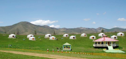
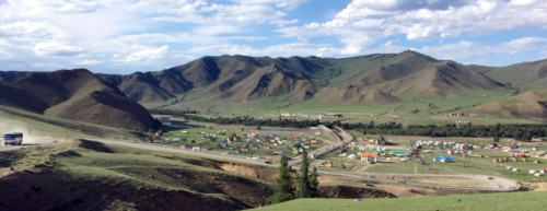
The Tuul River outside of Ulaanbaatar is heavily used for a) recreation including tourist camps, and for b) gold mining operations. People use the river for recreation and as a tourist attraction; there are many tourist camps along its banks. These tourist camps are heavily occupied during school holidays and during festivals like Naadam. Multiple mining operations along the Tuul River, downstream of Ulaanbaatar, also effect the river’s water quality. Many alluvial gold mines along the river excavate large amounts of soil out of which they sift the gold using water pumped out of the Tuul River. Some, but not all of the mines have rehabilitation programs to revegetate the gold mining areas. “Ninja” miners, who mine illegally, also create problems in terms of topsoil removal.
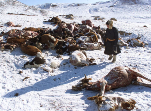
The Tuul River and the people residing in the watershed are vulnerable to climate change. Climate change impacts are now manifest in Mongolia. The average air temperature has increased 2°C since 1940. This increased temperature accentuates summer droughts, causing the grassland steppe to output less food for livestock. Severe winters, known as dzuds, have become more frequent, with significant negative impacts on livestock. These climate impacts have driven many nomadic herders to Ulaanbaatar, swelling the population of the capital city. The ‘ger districts’ are regions on the outskirts of Ulaanbaatar where the herders have resettled. Because the ger districts do not have sewers and sewage treatment facilities, there is a potential for increased influx of nutrients into the Tuul River, or eutrophication, through tributaries such as Selbe and Dundgol. This can lead to hypoxia, or lack of oxygen in the water.
There are many locations that have historical and spiritual importance in the Tuul River basin. The oldest protected area in the world is Bogd Khan Mountain on the outskirts of Ulaanbaatar. It was established as a protected area in 1783 and Man and Biosphere (MAB) under UNESCO it as a World Heritage Site in 1996. Another UNESCO World Heritage Site, announced in 2015, is the Burkhan Kahldun Mountain, which helps form the Tuul River headwaters. It is also thought to be the birthplace of Genghis Khan. The Tuul River supports Ulaanbaatar, the capital of Mongolia. Ulaanbaatar contains almost half of the Mongolian population and is still rapidly growing. It is a cultural center as well that supports artists, poets, musicians, singers and dancers.
About the author
Bill Dennison

Dr. Bill Dennison is a Professor of Marine Science and Interim President at the University of Maryland Center for Environmental Science (UMCES).
Next Post > The Billion Oyster Conference and New York City: Part 1
Comments
-
Atika 3 months ago
Thank you for sharing this great information with us, i really appreciate your post!