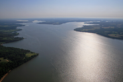
A collection of images for use in science communication with a focus on Chesapeake Bay and its watershed


Home :: Register :: FAQ :: Login
Browse All :: Album list :: Last uploads :: Last comments :: Most viewed :: Most downloaded :: Top rated :: Lightbox :: Advanced Search

Install the IAN Image and Video Library Browser Sidebar for easier navigation and searching.
Image & Video Library Guide - Contains a list of instructions on navigating, uploading and downloading files.
Home > Aerial and Satellite > Aerial and Satellite / Chesapeake Bay
Elk River
Looking up the Elk River. The Bohemia River is on the right.

Elk River Looking up the Elk River. The Bohemia River is on the right. shoreline river Chesapeake Bay agriculture

High Resolution Image (5485 KB) only available for download by registered users (FREE!) - Login or Register Now (Free, Quick & Easy!)

 
Elk River
Looking up the Elk River. The Bohemia River is on the right.
Conowingo Dam, Susquehanna River Looking upstream towards the Conowingo Dam on the Susquehanna River. Maryland is on the left and Pennsylvania is on the right agriculture Chesapeake Bay farms river sediment trees shoreline rocks Conowingo Dam, Susquehanna River Looking upstream towards the Conowingo Dam on the Susquehanna River. Maryland is on the left and Pennsylvania is on the right agriculture Chesapeake Bay farms river sediment trees shoreline rocks Elk River Looking up the Elk River. The Bohemia River is on the right. shoreline river Chesapeake Bay agriculture Elk River Looking up the Elk River. The Bohemia River is on the right. shoreline river Chesapeake Bay agriculture Sassafras River Looking up the Sassafras River shoreline river Chesapeake Bay agriculture
Rate this file (No vote yet)
Rubbish
Poor
Fair
Good
Excellent
Great
File information
Filename:iil_ian_jt_0592.jpg
Album name:JaneT / Aerial and Satellite / Chesapeake Bay
Keywords:shoreline river Chesapeake Bay agriculture
Photographer's Name:Jane Thomas
Photographer's Company:IAN, UMCES
Date Photo was taken (MM/DD/YYYY):05/24/2007
Media Type (Photo, Satellite Image, Vector Graphic, Map, Animation, Video):Photo
File Size:5485 KB
Date added:May 30, 2007
Dimensions:3504 x 2336 pixels
Displayed:46 times
Downloaded:4 times
Image Description:Looking up the Elk River. The Bohemia River is on the right.
Color Space:sRGB
Components Configuration:YCbCr
Customer Render:0
Date Time:2007:05:30 11:53:51
DateTime Original:2007:05:24 07:34:20
DateTime digitized:2007:05:24 07:34:20
Exif Image Height:2336 pixels
Exif Image Width:3504 pixels
Exif Interoperability Offset:834
Exif Offset:428
Exif Version:version 2.21
Exposure Bias:0 EV
Exposure Mode:0
Exposure Program:Landscape
Exposure Time:1/320 sec
FNumber:f 11
Flash:No Flash
Flash Pix Version:version 1
Focal length:18 mm
ISO:100
Make:Canon
Metering Mode:Multi-Segment
Model:Canon EOS 30D
Orientation:Normal (O deg)
Resolution Unit:Inch
Scene Capture Mode:0
Software:Adobe Photoshop CS2 Windows
White Balance:0
X Resolution:72
Y Resolution:72
YCbCrPositioning:Datum Point
IPTC Title:Elk River
IPTC Copyright:Copyright to the photographer. Free for any use if appropriate credit is reproduced with the image.
IPTC Keywords:shoreline river Chesapeake Bay agriculture
IPTC Category:
URL:http://ian.umces.edu/imagelibrary/displayimage-1536.html
Lightbox:Add to Lightbox