

Annapolis
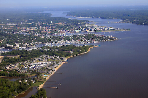
View across Annapolis. From front to back: Back Creek, Spa Creek, Severn River. Also visible are the US Naval Academy, and the Route 450 and Route 50 bridges. The Anne Arundel wastewater treatment plant is visible front left.
Chesapeake Bay river shoreline city buildings Annapolis Anne Arundel boats boat docks marina| Property | Value |
|---|---|
| Author(s) | Jane Thomas |
| Author Company | Integration and Application Network |
| Date Created | 2007-05-24 |
| Album | Human > Development/Infrastructure |
| Type | Photo |
| Dimensions | 3504 x 2336 |
| Filesize | 5.0 MB |
| Number of Downloads | 390 |
| Filetype(s) | JPG |
| License | Attribution-ShareAlike 4.0 International (CC BY-SA 4.0) |
| Required Attribution | Jane Thomas, Integration and Application Network (ian.umces.edu/media-library) |