

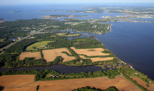
Kent Narrows
Looking west from Grasonville over Kent Narrows to Kent Island. The Kent Island bridge is visible. Eastern Bay is on the southern (left) side of Kent Narrows; the Chester River is on the northern (right) side.
Chesapeake Bay aerial agriculture farms Chester River shoreline| Property | Value |
|---|---|
| Author(s) | Jane Thomas |
| Author Company | Integration and Application Network |
| Date Created | 2007-05-24 |
| Album | Ecosystems > Coastal/Marine |
| Type | Photo |
| Dimensions | 3458 x 2058 |
| Filesize | 4.4 MB |
| Number of Downloads | 297 |
| Filetype(s) | JPG |
| License | Attribution-ShareAlike 4.0 International (CC BY-SA 4.0) |
| Required Attribution | Jane Thomas, Integration and Application Network (ian.umces.edu/media-library) |