Queensland floods; 2011
Bill Dennison ·We arrived in Brisbane on January 9, 2011 and were surprised at the green and lush vegetation. It was raining and our friends informed us that it had been raining for weeks, and that the dam was at 120% capacity, compared with the 13% capacity on one of our previous visits. We spent a day in Brisbane getting things set up for our six month sabbatical and then headed to the ferry across Moreton Bay to Stradbroke Island where we had booked a two week holiday house to acclimate to Australia before we began our our sabbaticals. It continued to rain intermittently and we began to pay attention to the news reports that flash flooding had begun to occur in Toowoomba, a beautiful town up on top of the Great Dividing Range (note Australian mountains are nothing more than hills by most standards). Toowoomba is not in the Moreton Bay catchment (watershed in American terminology), but the intense rain event also affected the escarpment of the Great Dividing Range that drains to the east into Moreton Bay. The scenes that began to come from Toowoomba were frightening: automobiles being picked up and tossed into muddy turbulent waters with families trapped inside, building and homes disintegrating with the rushing flood waters, people hanging onto street signs waiting to be rescued. And this was only the beginning of an unfolding epic event. The intense rains that fell in the western portions of the Brisbane River catchment, on top of the steady rains that had saturated the earth and overfilled the reservoirs came rushing down into the rural regions of SouthEast Queensland. Farm towns and isolated properties were deluged by the runoff and several people as well as countless livestock lost their lives.
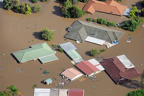
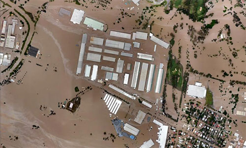
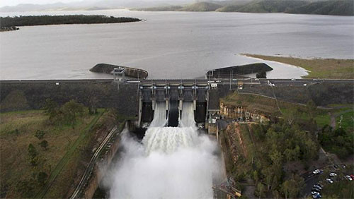
The Brisbane River catchment is made up of four subcatchments; Lockyer Creek (the worst affected), the Bremer River which joins the Brisbane River in the vicinity of the city of Ipswich, and the Upper Brisbane River and Stanley Rivers which are intercepted by two large dams which provide drinking water a flood protection for many of the two million inhabitants of SouthEast Queensland. As the runoff from the intense rains flowed down Lockyer Creek and the Bremer River, Ipswich braced for flooding, but fortunately people had time to evacuate their homes and businesses, however they had little time to pack up or otherwise protect their valuables. The flood waters began to rise in Ipswich, topping the levees and eventually rising to the incredible level of 20 meters, or 60 feet. Needless to say, entire houses and buildings were completely submerged. A day later the flood waters began to rise in Brisbane, topping out at 4.6 meters or 15 feet. While not as high in Brisbane compared with Ipswich, many more homes and businesses were affected.

The flood levels were roughly equivalent to the 1974 event which was a defining point in the history of the region. In 1974, a degraded tropical cyclone (the Southern hemisphere version of a hurricane) dumped a lot of water on the Brisbane region and flooded Ipswich and Brisbane. There are a various plaques on buildings in downtown Brisbane with the 1974 flood levels noted. Before 1974, the other big flood was in 1893, which was actually a double flood. The timing of these previous events led to a common belief that these were one in a hundred year events, not likely to be experienced twice within a lifetime.

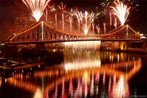
One of the important urban myths in Brisbane is that the dams, particularly the Wivenhoe dam, would protect Brisbane from floods like those of 1893 or 1974. Since only two of four subcatchments of the Brisbane River are intercepted by these dams, that would be only half correct. Over the past several decades, Brisbane, Australia's third largest city and the capital of Queensland, has embraced the river. Bikeways, parks, a passenger ferry service (CityCat), festivals (Riverfire attracts a million people each year), and new commercial and residential properties that have river vistas have sprung up in the past twenty years. Brisbane calls itself the "River City" and has been upgrading sewage and storm water infrastructure to improve water quality. This has increased the amount of infrastructure vulnerable to flooding, so a equivalent flood level of 2011 was much more damaging than the similar level of 1974.


About the author
Bill Dennison

Dr. Bill Dennison is a Professor of Marine Science and Interim President at the University of Maryland Center for Environmental Science (UMCES).