Sea turtles, dugong and a major city skyline
Bill Dennison ·Moreton Bay, adjacent to Brisbane, the Capital of Queensland, Australia, supports large populations of green sea turtles (Chelonia mydas) and dugong (Dugong dugon). The turtles and dugong feed on seagrasses growing on the shallow sand banks of Eastern Moreton Bay. These shallow sand banks are flushed with clean ocean water that enters and exits Moreton Bay through an opening (South Passage) between the large sand islands, North Stradbroke and Moreton Islands. Repeated turtle and dugong grazing results in a seagrass community that can regenerate shoots and self fertilize its roots through a quasi-symbiotic relationship with microbes that live adjacent to the seagrass roots.
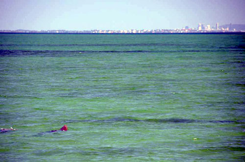
On a field trip to Eastern Moreton Bay led by Dr. Chris Roelfsema, along with Dr. Megan Saunders and PhD student Mitch Lyons, we were able to experience magical views of a small herd of a dozen dugong actively feeding on Moreton Banks seagrasses, with the city skyline of Brisbane clearly visible. Solitary turtles were also popping up for air while feeding in the vicinity. I am convinced that this is the only place on the planet where you see be surrounded by healthy, robust populations of dugong and sea turtles and see a major city skyline. The Caribbean populations of sea turtles and the dugong cousins, the manatee, have been decimated by historical overfishing for centuries. So the apart from some large aggregations of manatees around power plant cooling water outlets during winter, there is little opportunity to see healthy populations. In the tropical Indo-Pacific, dugong and sea turtles are still actively hunted and populations near large cities are very sparse. Brisbane uniquely has both clean water, healthy seagrass meadows supporting turtles and dugong, and a city skyline easily visible from Moreton Bay.
There is a story of encountering dugong in Moreton Bay which was recounted by Thomas Welsby in his book 'Sport and pastime in Moreton Bay'. Welsby talks about a conversation he had with Fred Campbell about seeing dugong in July 1893 (months after the substantial floods of February 1893). Campbell ". . . saw a herd of dugong that extended from near that beacon [at the western entrance to the Rous Channel] almost to the lower sandhills on Moreton Island . . .". Campbell went on to say " . . . there must have been several hundreds of them, all feeding quietly in about two fathoms of water . . .". This account of observing dugong several months after a series of Brisbane River floods is quite similar to our experience several months following the 2011 floods.
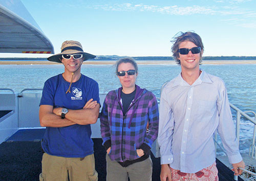
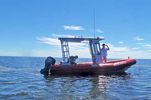
The field trip was part of a remote sensing ground truthing exercise by the Biophysical Remote Sensing group, led by Prof. Stuart Phinn at the University of Queensland. To make this field trip, we drove a university van from Brisbane to Cleveland, jumped onto the water taxi to Dunwich, and were picked up by Emma Lewis from the Moreton Bay Research Station. At the research station, we transferred our gear to the new rigid inflatable boat operated by the research station. The boat, named the Glaucys, the genus name for a beautiful pelagic nudibranch (shell-less mollusk). The Glaucus was an excellent Moreton Bay boat, and included features like twin four stoke outboards, and a canopy that not only protected us from the sun, but allowed great dugong viewing while standing on top. We launched the boat in One Mile Harbour and went to Amity, Moreton and Wanga Wallen Banks.
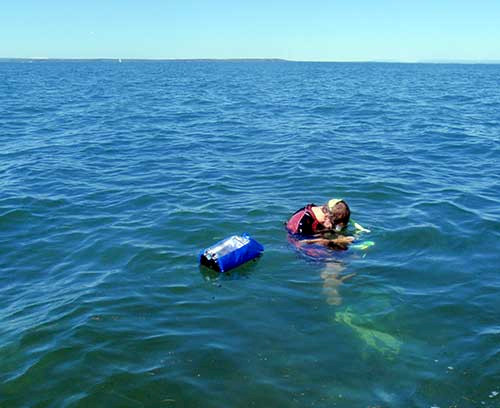
To ground truth the satellite images, a series of transacts were used to collect visual cover data so that the satellite image could be accurately classified. The technique for collecting the field data was very efficient. The boat was driven to one end of the transect and a snorkeler jumped into the water with an underwater camera and a GPS (Global Positioning System) that trailed in a float behind the snorkeler. While the boat leapfrogged ahead, the snorkeler took a photograph of the bottom every two meters for a distance of 500 m, and the time stamp on the photograph is used with the time stamp of the GPS to determine the precise location of the image. The underwater images are later analyzed for bottom cover, including the different seagrass species, and then the spectral signals of satellite image pixels classified according to ground-truthed data. Since the GPS is accurately recording position, the snorkeler's track can deviate from an exact transect, and time isn't wasted trying to find or adhere to a precise transect.
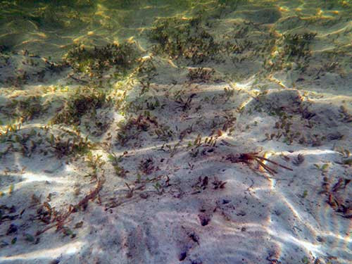
In addition to observing dugong and turtles feeding, we were able to check out the mangroves of Wanga Wallen Bank, see large flocks of cormorants, longtom flying fish, and enjoy spectacular views of the Glasshouse Mountains, Peel, Crab, Moreton and North Stradbroke Islands. It was a stellar day, productive and enjoyable, and we were all wistful on the trip back to Brisbane, as Moreton Bay and Stradbroke Island had cast their spell on us.
Reference: The Collected Works of Thomas Welsby; Volume II. 1967. Jacaranda Press, Brisbane. 427 pp.
About the author
Bill Dennison

Dr. Bill Dennison is a Professor of Marine Science and Interim President at the University of Maryland Center for Environmental Science (UMCES).
Next Post > Integrating science with people: Creating the corpus callosum connections
Comments
-
gyanpro 8 years ago
Can some one explain me why a dugong is also called a sea cow. How they resemble each other?