Environmental Literacy for Guanabara Bay, Brazil
Bill Dennison · | Environmental Literacy |‘Environmental Literacy’ series
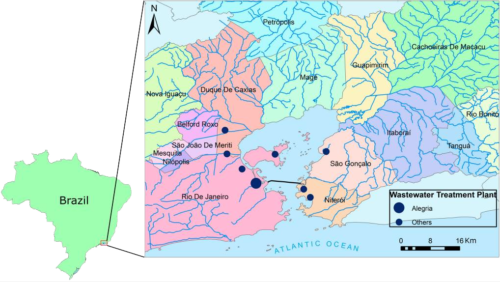
- Guanabara Bay is a tropical (22°S) embayment with a restricted opening which forms a natural harbor in Southeast Brazil with a monsoonal/savanna climate.
- The watershed around Guanabara Bay is an internationally iconic location, including metropolitan areas like Rio de Janeiro, Niteroi and Sao Goncalo, beaches like Copacabana and Ipanema, and sights like Sugarloaf and Corcovado.
- Guanabara Bay basin supports 8.6 million people living in 16 municipalities, with intense urban and industrial development with largely unsewered or untreated runoff contributing to bacterial contamination, eutrophication and litter.
- Guanabara Bay is shallow and muddy except for a deep central channel with a sandy bottom, contains many islands, supports remnant mangrove stands, artisanal fisheries, and an endangered dolphin species.
- Strong water quality gradients are found in Guanabara Bay, with severely degraded areas in the northwest, and relatively healthy areas where oceanic flushing occurs.
- There is a strong scientific foundation of research and monitoring of Guanabara Bay, significant public concern for ecological status, but public frustration about the lack of progress in Guanabara Bay restoration.
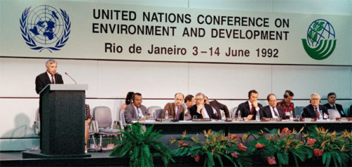
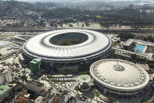
- Rio de Janeiro was the site of a significant United Nations summit (1992), the host of the football World Cup (2014) and the Summer Olympics (2016) in which environmental and social issues are played out on the world stage.
1. Guanabara Bay is a tropical (22oS) embayment with a restricted opening which forms a natural harbor in Southeast Brazil with a monsoonal/savanna climate.
Guanabara Bay was originally thought to be a river, and the name of Rio de Janeiro (River of January) was its original name, based on the European discovery by the Portuguese explorer Gaspar de Lemos on 1 January 1502. Rio de Janeiro is now the name of the city and state adjacent to the Bay. Guanabara Bay forms a wonderful natural harbor with a restricted opening and a wide embayment. The Bay opening is relatively deep (20-30 m) which flushes oceanic water into the Bay with has an average 0.7 m tidal range, exchanging 50% of the water every 11 days. The tropical climate includes prevailing southeast trade winds. These coastal breezes moderate the hot summer temperatures. The rainy season is summer (January-April) and the rest of the year is typically dry. The south-facing coastline is often impacted by large fronts originating from the southern ocean, leading to rapid weather changes and strong storm waves. The south flowing warm water Brazil Current is offshore, which is a typically western ocean boundary current like the Gulf Stream in the North Atlantic and Kuroshio in the North Pacific, however the Brazil Current is a weaker and slower moving current.
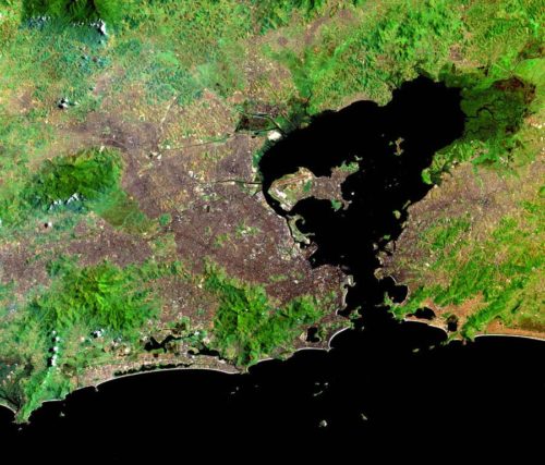
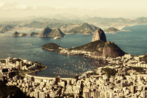
2. The watershed around Guanabara Bay is an internationally iconic location, including metropolitan areas like Rio de Janeiro, Niteroi and Sao Goncalo, beaches like Copacabana and Ipanema, and sights like Sugarloaf and Corcovado.
The Guanabara Bay watershed is fairly flat, extending inland to a range of coastal mountains. Rio de Janeiro was the original capital city of Brazil and still remains the economic engine for the country. The Port of Rio is located in downtown Rio de Janeiro and handles shipping of various goods and support tourism as well. In addition to the iconic attractions of the city of Rio de Janeiro, the watershed also hosts one of the most pristine mangroves in the area and the region offers several wonderful sightseeing and trail options where people can stay intuned with the environment.
3. Guanabara Bay basin supports 8.6 million people living in 16 municipalities, with intense urban and industrial development with largely unsewered or untreated runoff contributing to bacterial contamination, eutrophication and litter.
Rio de Janeiro is the second largest city in Brazil (after São Paulo) with an expanding population. The western side of the Bay, where the city of Rio de Janeiro is located, is characterized by more urbanized areas while the eastern side still retains several preserved areas and it is not fragmented. However, the east side of the Bay does include two large cities, Niterói and São Gonçalo. One of the fast growing regions is also located in the east side, in the surrounding area of Itaboraí, where they are building the Petrochemical Complex of Rio de Janeiro (COMPERJ), an industrial area of refineries.
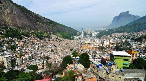
Urban development and sprawling slums (irregular housing and favelas) are largely un-sewered in the entire watershed, and summer monsoonal rains flush raw sewage into Guanabara Bay, leading to bacterial contamination, eutrophication, and trash pollution.
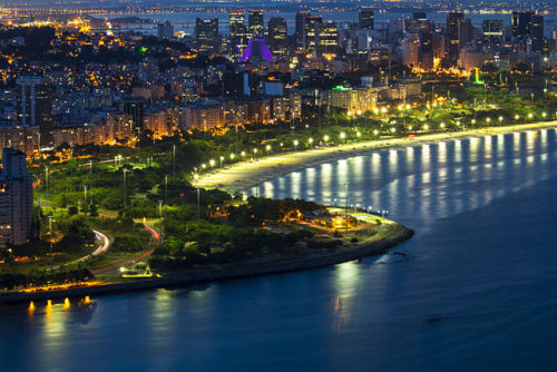
4. Guanabara Bay is shallow and muddy except for a deep central channel with a sandy bottom, contains many islands, supports remnant mangrove stands, artisanal fisheries, and an endangered dolphin species.
The bathymetry of Guanabara Bay is largely driven by scouring in the deep channel connecting the Bay to the South Atlantic Ocean and sedimentation in the shallows associated with the myriad of streams and rivers, which drain into Guanabara Bay. Extensive mangroves lined the shoreline of Guanabara Bay; with two extensive remnant mangrove forests remaining that is likely to keep pace with relative sea level rise. Despite the decline of fisheries in the bay due to degradation, fishing is still a source of income for some families and recreational fishing is also practice by a number of people. Of the many cetaceans that used to inhabit the bay, only the Guiana dolphin is still found around the mangrove's protected area.
![Land cover classification map of Guanabara Bay basin [pdf]. Credit: intechopen.com (Lucia Ferreira de Moraes) Land cover classification for Guanabara Bay basin](/site/assets/files/2555/landcovernew-500x310.png)
5. Strong water quality gradients are found in Guanabara Bay, with severely degraded areas in the northwest, and relatively healthy areas where oceanic flushing occurs.
Water quality gradients in the bay are affected by (1) seasonal changes between rainy and dry seasons; (2) contaminant discharges that is influenced by population distribution and sewage treatment implementation; and (3) marine water circulation. The northern and northwestern part of the bay has the worst water quality, which is the region with the highest load of wastewater and the lowest water circulation. The central channel and the eastern part of the bay has a significantly better water quality because of seawater dilution due to tidal mixing.
![Water quality index for Guanabara Bay [pdf]. Credit: INEA water quality](/site/assets/files/2555/water-quality-500x323.png)
6. There is a strong scientific foundation of research and monitoring of Guanabara Bay, significant public concern for ecological status, but public frustration about the lack of progress in Guanabara Bay restoration.
There are a significant number of federal, state, and private universities in the Guanabara Bay watershed, as well as various governmental agencies, which conduct research and monitoring efforts. Several researchers in a broad range of fields study Guanabara Bay. The State Environment Institute (INEA) conducts water quality monitoring in the Bay and in several rivers of the watershed. In 2011, a "Pact for Sanitation" was enacted by the government of the State of Rio de Janeiro aiming to universalize public sanitation in the area. Even though some effort is being taken, the goals of the pact are not being accomplished in a timely manner. Therefore, the poor water quality of the Bay and its tributaries is still a big problem of concern.
![Main conservation units at Guanabara Bay basin [pdf]. Credit: intechopen.com (Lucia Ferreira de Moraes) Main conservation units in Guanabara Bay basin](/site/assets/files/2555/conservation-units-500x325.png)
7. Rio de Janeiro was the site of a significant United Nations summit (1992), the host of the football World Cup (2014) and the Summer Olympics (2016) in which environmental and social issues are played out on the world stage.
The Rio Summit sponsored by the United Nations in 1992 was a landmark conference on Sustainable Development and was held in Rio de Janeiro. The event included representatives from several countries and an important achievement of the meeting was the Climate Change Convention that led to the Kyoto Protocol and the Paris Agreement. Some documents produced in the Rio Earth Summit were Agenda 21, Rio Declaration on Environment and Development, and the Forest Principles. Another event held in Rio de Janeiro was the 2014 FIFA World Cup. This event was highly anticipated and the Maracana Stadium was enhanced and refurbished prior to the World Cup. People traveled from all over the world to visit Rio for the Cup.
The next important event occurring in Rio is the 2016 Olympics, which is raising social awareness about Guanabara Bay`s polluted waters. The clean-up of Guanabara Bay was one of the commitments made during the selection of Rio as the venue for the sporting event, however, not much progress has been made (AP, June 6,2016).
References:
- Bidone E.D. and Lacerda L.D. 2003. The use of DPSIR framework to evaluate sustainability in coastal areas. Case Study: Guanabara Bay basin, Rio de Janeiro, Brazil. Regional Environmental Change 4: 5-16.
- Fistarol et al. 2015. Environmental and sanitary conditions of Guanabara Bay, Rio de Janeiro. Frontiers in Microbiology 6:1232
- Ferreira de Moraes, Luzia Alice. Remnant Vegetation Analysis of Guanabara Bay Basin, Rio de Janeiro, Brazil, Using Geographical Information System. intechopen.com [pdf]
- Soares-Comes et al. 2016. An environmental overview of Guanabara Bay, Rio de Janeiro. Regional Studies in Marine Science. Available online 4 February 2016
- Barchfield, Jenny. When Rio fails, sister city shows sewage cleanup possible. Associated Press. Online. June 6, 2016. http://bigstory.ap.org/article/d3943de029894db390f7acea156918c7/when-rio-fails-sister-city-shows-sewage-cleanup-possible
About the author
Bill Dennison

Dr. Bill Dennison is a Professor of Marine Science and Vice President for Science Application at the University of Maryland Center for Environmental Science.