
Blog Highlights
- Our first report card in South America – The Orinoco River Basin, Columbia
- Mackay Report Card workshop – Mackay, Queensland Australia
- Scientists underwater: Reginald Truitt, Gilbert Klingle, the Bentharium, and the Aquascope
- Resilience based management of the Great Barrier Reef – Developing an Index of Resilience to Climate Change Impacts to the Great Barrier Reef Workshop 3, Townsville, Australia
- Brainstorming in the Innovation Room with World Wildlife Fund
Mackay Report Card
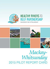 Heath Kelsey attended a workshop in Mackay, Queensland Australia on February 24, to facilitate the design of the Mackay Report Card with partners from the Queensland Department of Environment and Heritage Protection. Discussion was related to report card design and development issues, and we developed the storyboard for the Mackay Report Card. Jane Hawkey has been creating the draft from those sketches. The Mackay report card is the third in a series of local report cards, including Gladstone Harbour and the Fitzroy region. IAN helped develop and launch the first Great Barrier Reef Report Card in 2010. The partnership developed for the Mackay project includes a wide array of industry, port, environment, and recreation leaders in the community.
State of the South Atlantic 2015
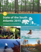 The primary objective of this report card was to develop a short synthesis report assessing 11 habitats, using a variety of ecological indicators. The assessment evaluates the ecological integrity of the South Atlantic using natural and cultural resource indicators with indicators scored across the entire region, for individual ecosystems, and within subregions following watershed and ecoregional boundaries. Overall, the South Atlantic scored a C. Piedmont areas scored the lowest, likely due to impacts from their major urban megaregions. The Marine region scored the highest; however, it did not include fishing impacts. The Coastal Plain scores were in the middle. These scores show that, while the South Atlantic is not completely healthy, there's hope for making future improvements. To explore geospatial indicator data and to stay up-to-date on future progress, visit the State of the South Atlantic.
The changing North Woods and moose newsletter
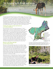 A scenario planning exercise focused on climate change, land use, and moose in the Northeast U.S. is being undertaken by the Wildlife Conservation Society, North Atlantic Landscape Conservation Cooperative, Northeast Climate Science Center (U.S. Geological Survey), and the University of Maryland Center for Environmental Science. Phase 1 of the scenario planning process involves the identification of key features and drivers within the focus system. This newsletter summarizes the scientific state of knowledge and associated uncertainties from a workshop held at the Massachusetts Division of Fisheries and Wildlife headquarters in Westborough, MA on 4–5 February 2015.
Great Barrier Reef Foundation workshop
 In early March, Bill Dennison, Heath Kelsey, and Jane Thomas traveled to Townsville, Australia for the third Great Barrier Reef Climate Change Resilience Index workshop. IAN was tasked with facilitating a workshop to coordinate a team of investigators to develop a climate change resilience index from a series of indicators. Resilience indicators that are being developed include calcification by crustose coralline algae, stress biomarkers in corals, habitat monitoring by automated image analysis, 3D reefscape mapping, and seagrass productivity and temperature sensitivity. This project is part of a joint project of UMCES and Charles Darwin University. We will be producing an 8-page newsletter that describes the development of indicators to measure the resilience of coral reef ecosystems in the Great Barrier Reef.