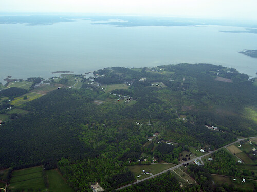
IAN Image and Video Library

Mobjack Bay - Coastal/Marine - Photo (JPG)


Completely cost and royalty free for any use, with attribution, except redistribution or sales. Attribution: Author Name, Integration and Application Network, University of Maryland Center for Environmental Science (ian.umces.edu/imagelibrary/).

Home :: Register :: FAQ :: Login
Browse All :: Album list :: Last uploads :: Last comments :: Most viewed :: Most downloaded :: Top rated :: Lightbox :: Advanced Search

Browser Sidebar for easier navigation and searching.
Library Guide - Contains a list of instructions on navigating, uploading and downloading files.
IAN Symbol Libraries - Download all (or a custom set) of the vector illustrations in our image library.

  RSS Feed Icon Subscribe


Photo   Vector Graphic   Raster Graphic   Map   Satellite   Animation   Video Select/Unselect All

  Advanced Search

Home > Ecosystems > Coastal/Marine
Mobjack Bay
Looking south at Mobjack Bay over the town of Susan, Virginia

Mobjack Bay Looking south at Mobjack Bay over the town of Susan, Virginia aerial,forest,field,farmhouse,farm,town,roads,residential,development,homes,Mathews County,Virginia,Mobjack Bay,Susan,Virginia

High Resolution Image (5019 KB) only available for download by registered users - Login or Register Now (Free & Quick!)

 
Mobjack Bay
Looking south at Mobjack Bay over the town of Susan, Virginia
Gwynn Island Docks on Gwynn Island aerial,docks,homes,islresidential,development,waterfront,property,Gwynn Island,Piankatank River,Chesapeake Bay,Mathews County,Virginia Stutts Creek Stutts Creek, on the western side of Chesapeake Bay aerial,Stutts Creek,Mathews County,Virginia,rural,development,waterfront,property,tributary,trees,town,creek,docks,forest Port Hollywood Looking west atop Port Hollywood at the head of Horn Harbor in the foreground to the East River in the midground, and the North River in the backdrop. The latter two flow into Mobjack Bay, seen to the south.  aerial,Susan,Virginia,Port,Hollywood,Virginia,Mobjack Bay,Mathews County,Virginia,East River,North River,agriculture,boats,creek,docks,farm,field,forest,harbor,homes,inlet,mouth,residential,development,rural,development,town,trees,tributary,waterfront, Mobjack Bay Looking south at Mobjack Bay over the town of Susan, Virginia aerial,forest,field,farmhouse,farm,town,roads,residential,development,homes,Mathews County,Virginia,Mobjack Bay,Susan,Virginia Susan, Viriginia South side of Susan, Virginia, on Mobjack Bay aerial,agriculture,docks,farm,farmhouse,field,forest,residential,development,rural,development,row,crops,town,tributary,waterfront,property,Mathews County,Virginia,Mobjack Bay,Susan,Virginia Pepper Creek Fields and marsh lining Pepper Creek, which enters Mobjack Bay aerial,agriculture,creek,boats,docks,marsh,mouth,waterfront,property,wetlands,field,tributary,rural,development,Pepper Creek,Mathews County,Virginia,Mobjack Bay
Rate this file (No vote yet)
Rubbish
Poor
Fair
Good
Excellent
Great
File information
Filename:iil_ian_bf_0760.JPG
Album name:bfertig / Coastal/Marine
Keywords: aerial, forest, field, farmhouse, farm, town, roads, residential, development, homes, Mathews County, Virginia, Mobjack Bay, Susan, Virginia
Author Name:Ben Fertig
Author Company:IAN, UMCES
Date created (MM/DD/YYYY):05/01/2008
Media Type:Photo
File Size:5019 KB
Date added:May 08, 2008
Dimensions:3264 x 2448 pixels
Displayed:55 times
Downloaded:2 times (Details)
Image Description:Looking south at Mobjack Bay over the town of Susan, Virginia
Color Space:sRGB
Components Configuration:YCbCr
Compressed Bits Per Pixel:5
Customer Render:0
Date Time:2008:05:02 22:30:13
DateTime Original:2008:04:30 21:27:42
DateTime digitized:2008:04:30 21:27:42
Digital Zoom Ratio:1
Exif Image Height:2448 pixels
Exif Image Width:3264 pixels
Exif Interoperability Offset:892
Exif Offset:434
Exif Version:version 2.2
Exposure Bias:0 EV
Exposure Mode:0
Exposure Time:1/160 sec
FNumber:f 4
File Source:Digital Still Camera
Flash:Unknown: 80
Flash Pix Version:version 1
Focal length:7.272 mm
Make:Canon
Max Aperture:f 3.2
Metering Mode:Multi-Segment
Model:Canon PowerShot S80
Orientation:Normal (O deg)
Resolution Unit:Inch
Scene Capture Mode:1
Software:Adobe Photoshop CS2 Windows
White Balance:0
X Resolution:180
Y Resolution:180
YCbCrPositioning:Center of Pixel Array
IPTC Title:Mobjack Bay
IPTC Copyright:Copyright to the photographer. Free for any use if appropriate credit is reproduced with the image.
IPTC Keywords:aerial,forest,field,farmhouse,farm,town,roads,residential development,homes,Mathews County, Virginia,Mobjack Bay,Susan, Virginia
URL:http://ian.umces.edu/imagelibrary/displayimage-2390.html
Lightbox:Add to Lightbox


Please note: The IAN/UMCES Symbol and Image Libraries are provided completely cost and royalty free for any use, with attribution, except redistribution or sales. Required Attribution: Author Name, Integration and Application Network, University of Maryland Center for Environmental Science (ian.umces.edu/imagelibrary/).