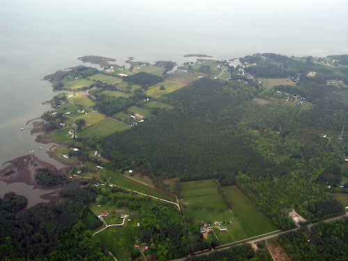
A collection of images for use in science communication with a focus on Chesapeake Bay and its watershed


Home :: Register :: FAQ :: Login
Browse All :: Album list :: Last uploads :: Last comments :: Most viewed :: Most downloaded :: Top rated :: Lightbox :: Advanced Search

Install the IAN Image and Video Library Browser Sidebar for easier navigation and searching.
Image & Video Library Guide - Contains a list of instructions on navigating, uploading and downloading files.
Home > Aerial and Satellite > Aerial and Satellite / Chesapeake Bay
Susan, Viriginia
South side of Susan, Virginia, on Mobjack Bay

Susan, Viriginia South side of Susan, Virginia, on Mobjack Bay aerial agriculture docks farm farmhouse field forest residential development rural development row crops town tributary waterfront property Mathews County, Virginia Mobjack Bay Susan, Virginia

High Resolution Image (5368 KB) only available for download by registered users (FREE!) - Login or Register Now (Free, Quick & Easy!)

 
Susan, Viriginia
South side of Susan, Virginia, on Mobjack Bay
Port Hollywood Looking west atop Port Hollywood at the head of Horn Harbor in the foreground to the East River in the midground, and the North River in the backdrop. The latter two flow into Mobjack Bay, seen to the south.  aerial Susan, Virginia Port Hollywood, Virginia Mobjack Bay Mathews County, Virginia East River North River agriculture boats creek docks farm field forest harbor homes inlet mouth residential development rural development town trees tributary waterfront Mobjack Bay Looking south at Mobjack Bay over the town of Susan, Virginia aerial forest field farmhouse farm town roads residential development homes Mathews County, Virginia Mobjack Bay Susan, Virginia Susan, Viriginia South side of Susan, Virginia, on Mobjack Bay aerial agriculture docks farm farmhouse field forest residential development rural development row crops town tributary waterfront property Mathews County, Virginia Mobjack Bay Susan, Virginia Pepper Creek Fields and marsh lining Pepper Creek, which enters Mobjack Bay aerial agriculture creek boats docks marsh mouth waterfront property wetlands field tributary rural development Pepper Creek Mathews County, Virginia Mobjack Bay Pepper Creek Fields and marsh lining Pepper Creek, which enters Mobjack Bay aerial Mobjack Bay Mathews County, Virginia Pepper Creek field forest bay trees marsh
Rate this file (No vote yet)
Rubbish
Poor
Fair
Good
Excellent
Great
File information
Filename:iil_ian_bf_0761.JPG
Album name:bfertig / Aerial and Satellite / Chesapeake Bay
Keywords:aerial agriculture docks farm farmhouse field forest residential development rural development row crops town tributary waterfront property Mathews County, Virginia Mobjack Bay Susan, Virginia
Photographer's Name:Ben Fertig
Photographer's Company:IAN, UMCES
Date Photo was taken (MM/DD/YYYY):05/01/2008
Media Type (Photo, Satellite Image, Vector Graphic, Map, Animation, Video):Photo
File Size:5368 KB
Date added:May 08, 2008
Dimensions:3264 x 2448 pixels
Displayed:6 times
Downloaded:0 times
Image Description:South side of Susan, Virginia, on Mobjack Bay
Color Space:sRGB
Components Configuration:YCbCr
Compressed Bits Per Pixel:5
Customer Render:0
Date Time:2008:05:02 22:30:51
DateTime Original:2008:04:30 21:27:47
DateTime digitized:2008:04:30 21:27:47
Digital Zoom Ratio:1
Exif Image Height:2448 pixels
Exif Image Width:3264 pixels
Exif Interoperability Offset:876
Exif Offset:418
Exif Version:version 2.2
Exposure Bias:0 EV
Exposure Mode:0
Exposure Time:1/125 sec
FNumber:f 4
File Source:Digital Still Camera
Flash:Unknown: 80
Flash Pix Version:version 1
Focal length:7.272 mm
Make:Canon
Max Aperture:f 3.2
Metering Mode:Multi-Segment
Model:Canon PowerShot S80
Orientation:Normal (O deg)
Resolution Unit:Inch
Scene Capture Mode:1
Software:Adobe Photoshop CS2 Windows
White Balance:0
X Resolution:180
Y Resolution:180
YCbCrPositioning:Center of Pixel Array
IPTC Title:Susan, Viriginia
IPTC Copyright:Copyright to the photographer. Free for any use if appropriate credit is reproduced with the image.
IPTC Keywords:aerial agriculture docks farm farmhouse field forest residential development rural development row crops town tributary waterfront property Mathews County, Virginia Mobjack Bay Susan, Virginia
IPTC Category:
URL:http://ian.umces.edu/imagelibrary/displayimage-2389.html
Lightbox:Add to Lightbox