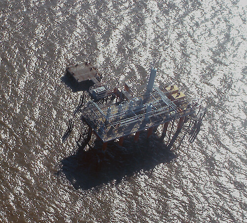
A collection of images for use in science communication with a focus on Chesapeake Bay and its watershed


Home :: Register :: FAQ :: Login
Browse All :: Album list :: Last uploads :: Last comments :: Most viewed :: Most downloaded :: Top rated :: Lightbox :: Advanced Search

Install the IAN Image and Video Library Browser Sidebar for easier navigation and searching.
Image & Video Library Guide - Contains a list of instructions on navigating, uploading and downloading files.
Home > Specific Projects > Coastal Louisiana > Aerial / Satellite
Oil rig
Oil rig in coastal Louisiana

Oil rig Oil rig in coastal Louisiana clear coastal Louisiana gas oil Port Fourchon development industry

High Resolution Image (3353 KB) only available for download by registered users (FREE!) - Login or Register Now (Free, Quick & Easy!)

 
Oil rig
Oil rig in coastal Louisiana
Atchafalaya River mouth Mouth of the Atchafalaya River, coastal Louisiana geomorphology clear coastal processes hurricane coastal erosion Wax Lake Diversion Natural sediment deposition at the Wax Lake Diversion in coastal Louisiana sea level rise clear geomorphology hurricane mud flat coastal erosion Oil rig Oil rig in coastal Louisiana clear coastal Louisiana gas oil Port Fourchon development industry Coastal Community in degrading wetland Coastal Community in degrading wetland in coastal Louisiana      coastal Louisiana clear coastal processes sea level rise Barrier Island protection levees Aerial photo of protection levees on a barrier island in Coastal Louisiana coastal Louisiana hurricane clear geomorphology coastal processes coastal erosion overwash sea level rise
Rate this file (current rating : 0 / 5 with 1 votes)
Rubbish
Poor
Fair
Good
Excellent
Great
File information
Filename:ill-ian-tc-0133.jpg
Album name:tcarruth / Aerial / Satellite
Rating (1 votes):
Keywords:clear coastal Louisiana gas oil Port Fourchon development industry
Photographer's Name:Tim Carruthers
Photographer's Company:IAN, UMCES
Date Photo was taken (MM/DD/YYYY):11/19/2005
Media Type (Photo, Satellite Image, Vector Graphic, Map, Animation, Video):Photo
File Size:3353 KB
Date added:Sep 01, 2006
Dimensions:1560 x 1410 pixels
Displayed:160 times
Downloaded:6 times
Image Description:Oil rig in coastal Louisiana
Color Space:sRGB
Date Time:2006:08:31 17:46:50
Exif Image Height:1410 pixels
Exif Image Width:1560 pixels
Exif Offset:344
Orientation:Normal (O deg)
Resolution Unit:Inch
Software:Adobe Photoshop CS2 Windows
X Resolution:72
Y Resolution:72
IPTC Title:Oil rig
IPTC Copyright:Copyright to the photographer. Free for any use if appropriate credit is reproduced with the image.
IPTC Keywords:clear coastal Louisiana gas oil Port Fourchon development industry
IPTC Category:
URL:http://ian.umces.edu/imagelibrary/displayimage-1148.html
Lightbox:Add to Lightbox