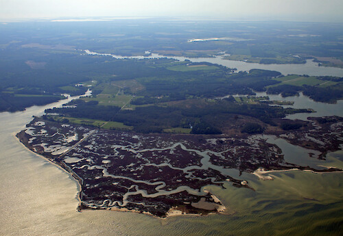
IAN Image and Video Library

Hacks Neck - Coastal/Marine - Photo (JPG)


Completely cost and royalty free for any use, with attribution, except redistribution or sales. Attribution: Author Name, Integration and Application Network, University of Maryland Center for Environmental Science (ian.umces.edu/imagelibrary/).

Home :: Register :: FAQ :: Login
Browse All :: Album list :: Last uploads :: Last comments :: Most viewed :: Most downloaded :: Top rated :: Lightbox :: Advanced Search

Browser Sidebar for easier navigation and searching.
Library Guide - Contains a list of instructions on navigating, uploading and downloading files.
IAN Symbol Libraries - Download all (or a custom set) of the vector illustrations in our image library.

  RSS Feed Icon Subscribe


Photo   Vector Graphic   Raster Graphic   Map   Satellite   Animation   Video Select/Unselect All

  Advanced Search

Home > Ecosystems > Coastal/Marine
Hacks Neck
Hacks Neck, between Butcher and Nandua Creeks on the eastern shore of Virginia

Hacks Neck Hacks Neck, between Butcher and Nandua Creeks on the eastern shore of Virginia Chesapeake Bay,Eastern,Shore,aerial,tributary,rural,Delmarva,tidal,estuary,Virginia,Accomack County,marshes,creek,shoals,SAV,seagrass,fields,farms,forest,agriculture

High Resolution Image (2194 KB) only available for download by registered users - Login or Register Now (Free & Quick!)

 
Hacks Neck
Hacks Neck, between Butcher and Nandua Creeks on the eastern shore of Virginia
Hyslop Marsh Hyslop Marsh, between Nandua and Craddock Creeks on the eastern shore of Virginia Chesapeake Bay,Eastern,Shore,aerial,tributary,rural,Delmarva,tidal,estuary,Virginia,Accomack County,marshes,creek Hyslop Marsh and Nandua Creek Hyslop Marsh and Nandua Creek on the eastern shore of Virginia Chesapeake Bay,Eastern,Shore,aerial,tributary,rural,Delmarva,tidal,estuary,Virginia,Accomack County,marshes,creek,shoals,farms,fields,forest,agriculture Hacks Neck Hacks Neck and Nandua Creek on the eastern shore of Virginia Chesapeake Bay,Eastern,Shore,aerial,tributary,rural,Delmarva,tidal,estuary,Virginia,Accomack County,marshes,creek,shoals,SAV,seagrass,fields,farms,forest,agriculture Hacks Neck Hacks Neck, between Butcher and Nandua Creeks on the eastern shore of Virginia Chesapeake Bay,Eastern,Shore,aerial,tributary,rural,Delmarva,tidal,estuary,Virginia,Accomack County,marshes,creek,shoals,SAV,seagrass,fields,farms,forest,agriculture Hacks Neck Hacks Neck, between Butcher and Nandua Creeks on the eastern shore of Virginia Chesapeake Bay,Eastern,Shore,aerial,tributary,rural,Delmarva,tidal,estuary,Virginia,Accomack County,marshes,creek,shoals,forest,fields,farms,agriculture New Point, Virginia New Point, Virginia, on the northern shores of Mobjack Bay Chesapeake Bay,aerial,tributary,rural,tidal,estuary,Mathews County,seagrass,SAV,shoals,submerged,aquatic,vegetation,houses,marshes,Virginia
Rate this file (No vote yet)
Rubbish
Poor
Fair
Good
Excellent
Great
File information
Filename:iil_ian_jt_0780.jpg
Album name:JaneT / Coastal/Marine
Keywords: Chesapeake Bay, Eastern, Shore, aerial, tributary, rural, Delmarva, tidal, estuary, Virginia, Accomack County, marshes, creek, shoals, SAV, seagrass, fields, farms, forest, agriculture
Author Name:Jane Thomas
Author Company:IAN, UMCES
Date created (MM/DD/YYYY):05/01/2008
Media Type:Photo
File Size:2194 KB
Date added:Jun 19, 2008
Dimensions:3390 x 2336 pixels
Displayed:42 times
Downloaded:2 times (Details)
Image Description:Hacks Neck, between Butcher and Nandua Creeks on the eastern shore of Virginia
Color Space:sRGB
Components Configuration:YCbCr
Customer Render:0
Date Time:2008:06:19 14:00:41
DateTime Original:2008:05:01 08:38:27
DateTime digitized:2008:05:01 08:38:27
Exif Image Height:2336 pixels
Exif Image Width:3390 pixels
Exif Interoperability Offset:852
Exif Offset:446
Exif Version:version 2.21
Exposure Bias:0 EV
Exposure Mode:0
Exposure Program:Landscape
Exposure Time:1/250 sec
FNumber:f 9
Flash:No Flash
Flash Pix Version:version 1
Focal length:22 mm
ISO:100
Make:Canon
Metering Mode:Multi-Segment
Model:Canon EOS 30D
Orientation:Normal (O deg)
Resolution Unit:Inch
Scene Capture Mode:0
Software:Adobe Photoshop CS2 Windows
White Balance:0
X Resolution:300
Y Resolution:300
YCbCrPositioning:Datum Point
IPTC Title:Hacks Neck
IPTC Copyright:Copyright to the photographer. Free for any use if appropriate credit is reproduced with the image.
IPTC Keywords:Chesapeake Bay,Eastern Shore,aerial,tributary,rural,Delmarva,tidal,estuary,Virginia,Accomack County,marshes,creek,shoals,SAV,seagrass,fields,farms,forest,agriculture
URL:http://ian.umces.edu/imagelibrary/displayimage-2629.html
Lightbox:Add to Lightbox


Please note: The IAN/UMCES Symbol and Image Libraries are provided completely cost and royalty free for any use, with attribution, except redistribution or sales. Required Attribution: Author Name, Integration and Application Network, University of Maryland Center for Environmental Science (ian.umces.edu/imagelibrary/).