

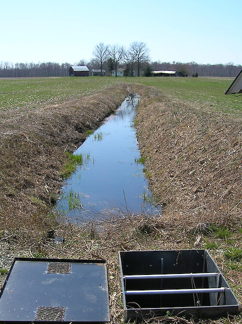
Drainage ditch and control structure
Drainage ditch and control structure. The drainage control structure allows scientists to control the amount of drainage that goes into the ditch from the field.
drainage field ditch agriculture choptank watershed| Property | Value |
|---|---|
| Author(s) | Caroline Donovan |
| Author Company | Integration and Application Network |
| Date Created | 2008-03-24 |
| Album | Human > Agriculture |
| Type | Photo |
| Dimensions | 1349 x 1803 |
| Filesize | 1.9 MB |
| Number of Downloads | 336 |
| Filetype(s) | JPG |
| License | Attribution-ShareAlike 4.0 International (CC BY-SA 4.0) |
| Required Attribution | Caroline Donovan, Integration and Application Network (ian.umces.edu/media-library) |