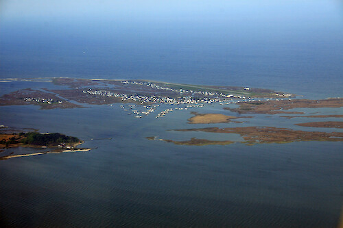
IAN Image and Video Library

Tangier Island - Coastal/Marine - Photo (JPG)


Completely cost and royalty free for any use, with attribution, except redistribution or sales. Attribution: Author Name, Integration and Application Network, University of Maryland Center for Environmental Science (ian.umces.edu/imagelibrary/).

Home :: Register :: FAQ :: Login
Browse All :: Album list :: Last uploads :: Last comments :: Most viewed :: Most downloaded :: Top rated :: Lightbox :: Advanced Search

Browser Sidebar for easier navigation and searching.
Library Guide - Contains a list of instructions on navigating, uploading and downloading files.
IAN Symbol Libraries - Download all (or a custom set) of the vector illustrations in our image library.

  RSS Feed Icon Subscribe


Photo   Vector Graphic   Raster Graphic   Map   Satellite   Animation   Video Select/Unselect All

  Advanced Search

Home > Ecosystems > Coastal/Marine
Tangier Island
Tangier Island, Virginia, where the inhabitants make their living crabbing and fishing in Chesapeake Bay

Tangier Island Tangier Island, Virginia, where the inhabitants make their living crabbing and fishing in Chesapeake Bay Chesapeake Bay,Eastern,Shore,aerial,Delmarva,Accomack County,Virginia,houses,marshes,boat,docks,tidal,estuary

High Resolution Image (5351 KB) only available for download by registered users - Login or Register Now (Free & Quick!)

 
Tangier Island
Tangier Island, Virginia, where the inhabitants make their living crabbing and fishing in Chesapeake Bay
Smith Island Smith Island. The settlement of Ewell is in the back left and the Martin National Wildlife Refuge is in the foreground. Chesapeake Bay,Eastern,Shore,Marylandaerial,Delmarva,Somerset County,marshes,tidal,estuary Smith Island Smith Island. The settlement of Ewell is in the background and the Martin National Wildlife Refuge is in the foreground. Chesapeake Bay,Eastern,Shore,Marylandaerial,Delmarva,Somerset County,marshes,tidal,estuary Smith Island The three settlements on Smith Island - Tylerton (front left), Rhodes Point (back left), and Ewell (back right). Chesapeake Bay,Eastern,Shore,Marylandaerial,Delmarva,Somerset County,marshes,tidal,estuary Tangier Island Tangier Island, Virginia, where the inhabitants make their living crabbing and fishing in Chesapeake Bay Chesapeake Bay,Eastern,Shore,aerial,Delmarva,Accomack County,Virginia,houses,marshes,boat,docks,tidal,estuary Tangier Island Tangier Island, Virginia, where the inhabitants make their living crabbing and fishing in Chesapeake Bay. Also visible is the Steven Thomas, the ferry that leaves from Crisfield, Maryland, for Tangier Island daily. Chesapeake Bay,Eastern,Shore,aerial,Delmarva,Accomack County,Virginia,houses,marshes,boat,docks,tidal,estuary Tangier Island Tangier Island, Virginia, where the inhabitants make their living crabbing and fishing in Chesapeake Bay. Also visible is the Steven Thomas, the ferry that leaves from Crisfield, Maryland, for Tangier Island daily. Chesapeake Bay,Eastern,Shore,aerial,Delmarva,Accomack County,Virginia,houses,marshes,boat,docks,tidal,estuary
Rate this file (No vote yet)
Rubbish
Poor
Fair
Good
Excellent
Great
File information
Filename:iil_ian_jt_0691.jpg
Album name:JaneT / Coastal/Marine
Keywords: Chesapeake Bay, Eastern, Shore, aerial, Delmarva, Accomack County, Virginia, houses, marshes, boat, docks, tidal, estuary
Author Name:Jane Thomas
Author Company:IAN, UMCES
Date created (MM/DD/YYYY):05/01/08
Media Type:Photo
File Size:5351 KB
Date added:Jun 19, 2008
Dimensions:3504 x 2336 pixels
Displayed:32 times
Downloaded:2 times (Details)
Image Description:Tangier Island, Virginia, where the inhabitants make their living crabbing and fishing in Chesapeake Bay
Color Space:sRGB
Components Configuration:YCbCr
Customer Render:0
Date Time:2008:06:19 13:44:07
DateTime Original:2008:05:01 07:57:37
DateTime digitized:2008:05:01 07:57:37
Exif Image Height:2336 pixels
Exif Image Width:3504 pixels
Exif Interoperability Offset:896
Exif Offset:472
Exif Version:version 2.21
Exposure Bias:0 EV
Exposure Mode:0
Exposure Program:Landscape
Exposure Time:1/200 sec
FNumber:f 10
Flash:No Flash
Flash Pix Version:version 1
Focal length:55 mm
ISO:100
Make:Canon
Metering Mode:Multi-Segment
Model:Canon EOS 30D
Orientation:Normal (O deg)
Resolution Unit:Inch
Scene Capture Mode:0
Software:Adobe Photoshop CS2 Windows
White Balance:0
X Resolution:300
Y Resolution:300
YCbCrPositioning:Datum Point
IPTC Title:Tangier Island
IPTC Copyright:Copyright to the photographer. Free for any use if appropriate credit is reproduced with the image.
IPTC Keywords:Chesapeake Bay,Eastern Shore,aerial,Delmarva,Accomack County,Virginia,houses,marshes,boat docks,tidal,estuary
URL:http://ian.umces.edu/imagelibrary/displayimage-2571.html
Lightbox:Add to Lightbox


Please note: The IAN/UMCES Symbol and Image Libraries are provided completely cost and royalty free for any use, with attribution, except redistribution or sales. Required Attribution: Author Name, Integration and Application Network, University of Maryland Center for Environmental Science (ian.umces.edu/imagelibrary/).