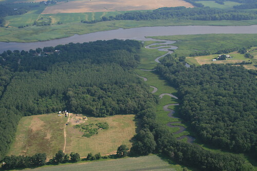
IAN Image and Video Library

Chester River - Freshwater - Photo (JPG)


A collection of images for use in science communication with a focus on Chesapeake Bay and its watershed


Home :: Register :: FAQ :: Login
Browse All :: Album list :: Last uploads :: Last comments :: Most viewed :: Most downloaded :: Top rated :: Lightbox :: Advanced Search

Browser Sidebar for easier navigation and searching.
Library Guide - Contains a list of instructions on navigating, uploading and downloading files.

RSS Feed Icon Subscribe
Home > Ecosystems > Freshwater
Chester River
Small creek draining into the Chester River, Char-Nor Manor, Maryland

Chester River Small creek draining into the Chester River, Char-Nor Manor, Maryland aerial agriculture Chesapeake Bay Eastern Shore estuary farms fields forest Kent County land use Maryland Queen Annes County trees

High Resolution Image (3747 KB) only available for download by registered users (FREE!) - Login or Register Now (Free, Quick & Easy!)

 
Chester River
Small creek draining into the Chester River, Char-Nor Manor, Maryland
Monocacy River Railroad bridge over the Monocacy River in Monocacy National Battlefield Civil War creek Maryland Monocacy National Battlefield National Park Service Plants riparian river trees Bush Creek Bush Creek, a tributary of the Monocacy River in Monocacy National Battlefield Civil War creek Maryland Monocacy National Battlefield National Park Service Plants riparian river trees Junction of Bush Creek and Monocacy River Junction of Bush Creek and Monocacy River in Monocacy National Battlefield Civil War creek Maryland Monocacy National Battlefield National Park Service Plants riparian river trees Chester River Small creek draining into the Chester River, Char-Nor Manor, Maryland aerial agriculture Chesapeake Bay Eastern Shore estuary farms fields forest Kent County land use Maryland Queen Annes County trees Chester River Small creek draining into the Chester River, Char-Nor Manor, Maryland aerial agriculture Chesapeake Bay Eastern Shore estuary farms fields forest Kent County land use Maryland Queen Annes County trees Chester River Small creek draining into the Chester River near Indian Town, Maryland aerial agriculture Chesapeake Bay Eastern Shore estuary farms fields forest Kent County land use Maryland Queen Annes County trees
Rate this file (No vote yet)
Rubbish
Poor
Fair
Good
Excellent
Great
File information
Filename:iil_ian_jt_0892.JPG
Album name:JaneT / Freshwater
Keywords:aerial agriculture Chesapeake Bay Eastern Shore estuary farms fields forest Kent County land use Maryland Queen Annes County trees
Author's Name:Jane Thomas
Author's Company:IAN, UMCES
Date image was created (MM/DD/YYYY):07/02/2009
Media Type (Photo, Satellite Image, Vector Graphic, Map, Animation, Video):Photo
File Size:3747 KB
Date added:Jul 05, 2009
Dimensions:3504 x 2336 pixels
Displayed:11 times
Downloaded:0 times (Details)
Color Space:sRGB
Components Configuration:YCbCr
Customer Render:0
Date Time:2009:07:02 08:26:33
DateTime Original:2009:07:02 08:26:33
DateTime digitized:2009:07:02 08:26:33
Exif Image Height:2336 pixels
Exif Image Width:3504 pixels
Exif Interoperability Offset:4724
Exif Offset:196
Exif Version:version 2.21
Exposure Bias:-0.333333333333 EV
Exposure Mode:0
Exposure Program:Aperature Priority
Exposure Time:1/250 sec
FNumber:f 7.1
Flash:No Flash
Flash Pix Version:version 1
Focal length:34 mm
ISO:100
Make:Canon
Metering Mode:Multi-Segment
Model:Canon EOS 30D
Orientation:Normal (O deg)
Resolution Unit:Inch
Scene Capture Mode:0
White Balance:0
X Resolution:72 dots per ResolutionUnit
Y Resolution:72 dots per ResolutionUnit
YCbCrPositioning:Datum Point
IPTC Title:Chester River
IPTC Copyright:Copyright to the photographer. Free for any use if appropriate credit is reproduced with the image.
IPTC Keywords:aerial agriculture Chesapeake Bay Eastern Shore estuary farms fields forest Kent County land use Maryland Queen Annes County trees
URL:http://ian.umces.edu/imagelibrary/displayimage-3377.html
Lightbox:Add to Lightbox


Creative Commons License
IAN Image and Video Library by Integration and Application Network, University of Maryland Center for Environmental Science is licensed under a Creative Commons Attribution 3.0 United States License.