

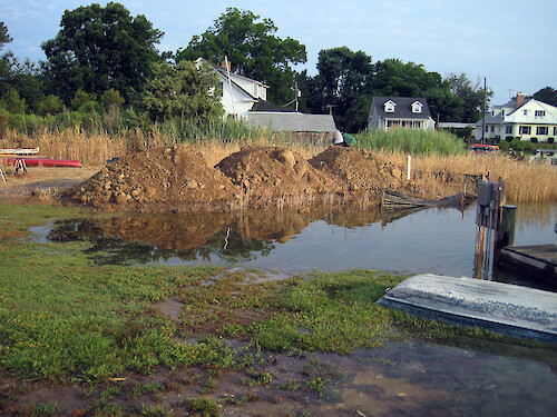
Homeowner is allowed to fill in wetlands
On a property that was grandfathered to build on a tiny waterfront lot, the owner was allowed by the local zoning department to fill in a low wetland where his well (white pipe) and dock electric service (right center of photo) were located. As this photo documents, this low area was frequently flooded.
sea level rise flooding critical area development Talbot County Maryland| Property | Value |
|---|---|
| Author(s) | Jane Hawkey |
| Author Company | Integration and Application Network |
| Date Created | 2011-12-13 |
| Album | Human > Development/Infrastructure |
| Type | Photo |
| Dimensions | 3072 x 2304 |
| Filesize | 5.8 MB |
| Number of Downloads | 365 |
| Filetype(s) | JPG |
| License | Attribution-ShareAlike 4.0 International (CC BY-SA 4.0) |
| Required Attribution | Jane Hawkey, Integration and Application Network (ian.umces.edu/media-library) |