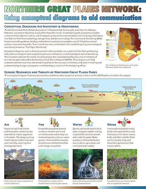
Northern Great Plains Network: Using conceptual diagrams to aid communication
Conceptual diagrams are effective tools in identifying resource condition trends and for communicating inventory and monitoring data back to national park management and the general public. This newsletter presents the project results from an IAN collaboration with four National Park Service (NPS) Northern Great Plains Network (NGPN) park units and the NGPN Inventory & Monitoring (I&M) Program. The diagrams detail the parks' current collective knowledge and highlight key resources and threats in and around these parks.
Keywords: