South East Queensland Floods 2011
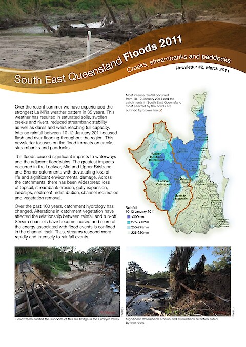
Intense rainfall between 10-12 January 2011 caused flash and river flooding throughout the region. This newsletter focuses on the flood impacts on creeks, streambanks and paddocks. The floods caused significant impacts to waterways and the adjacent floodplains. The greatest impacts occurred in the Lockyer, Mid and Upper Brisbane and Bremer catchments with devastating loss of life and significant environmental damage. Across the catchments, there has been widespread loss of topsoil, streambank erosion, gully expansion, landslips, sediment redistribution, channel redirection and vegetation removal. For further infomation, see the associated blog posts.
Keywords: