

Imagining a Participative Potomac: A Meeting at Hood College
Anna Calderón and Nick An ·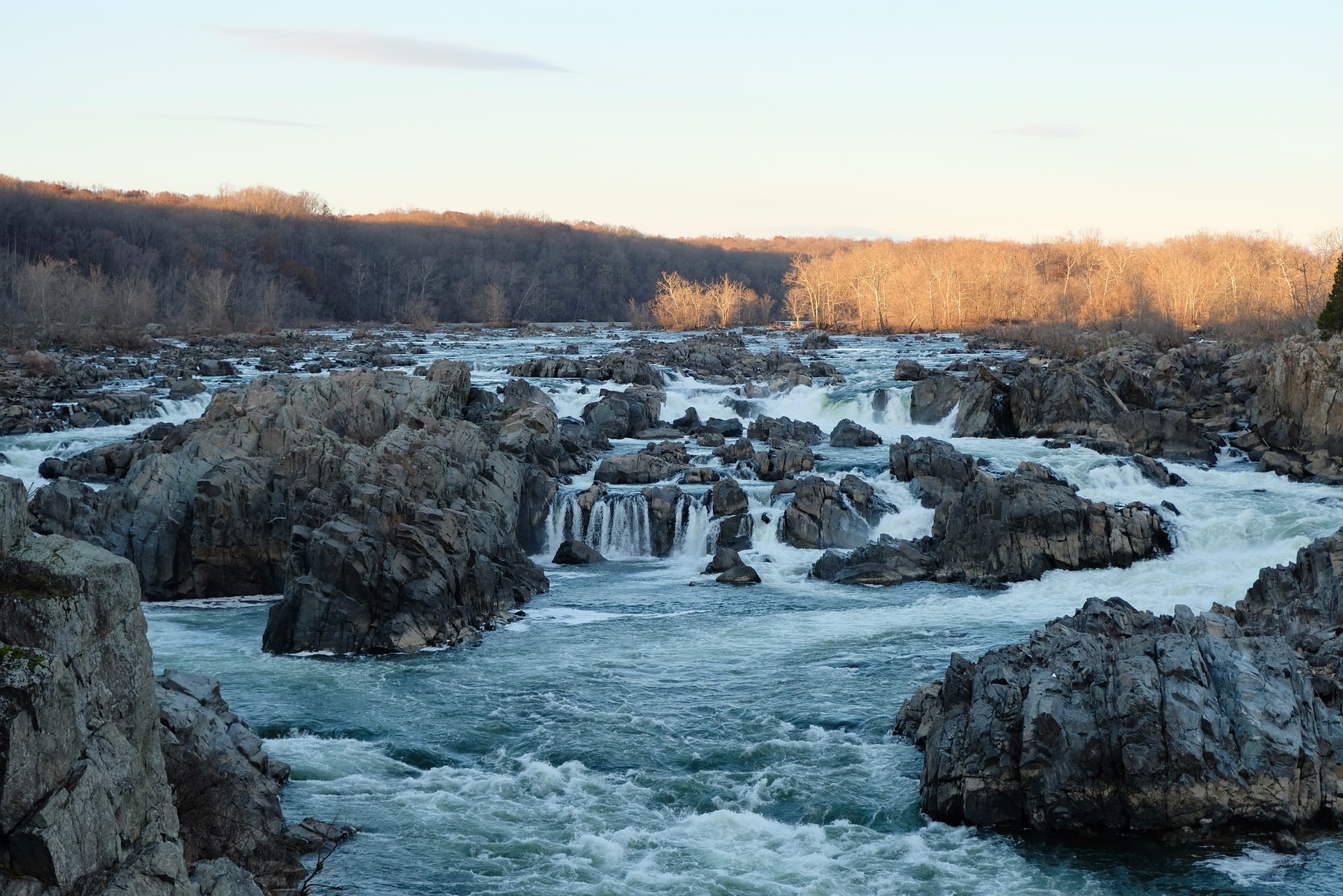 Photo by Sara L. Cottle on Unsplash, Published on February 18th, 2021.
The COAST Card project merges a report-card process, social network analysis, and systems dynamics models to analyze the efficiency of coastal management decisions in light of a rapidly changing climate and coastline.
This three-pronged framework is being utilized at four study sites spanning the globe: the Chesapeake Bay, Manila Bay in the Philippines, Tokyo Bay and the Ishigaki Island and Sekisei Lagoon in Japan, and the Goa Coast of India. Funded by the Belmont Forum Transdisciplinary Research for Ocean Sustainability Collaborative Research Action, the project is able to bring partners at each of these study sites together to co-develop the COAST Card framework. Ultimately, COAST Card began based on principles and intentions to have this framework continue on beyond its current scope, and for other coastal communities to adopt these methods. You can learn more about the COAST Card with this informational video.
As a smaller scale US study site, the COAST Card project will be focusing on the Potomac watershed as its case study within the Chesapeake Bay. The Potomac River, the southern headwaters of the Chesapeake Bay, is a crucial subsection of the Chesapeake Bay watershed. It’s the watershed’s second largest tributary, the home to iconic fish species, and the portion of the watershed that travels through our nation’s capital.
Although the Potomac Conservancy’s Potomac River Report Card is a pre-existing, consistently released report card focusing on the watershed, there are elements held within the COAST Card three-pronged framework that are still missing. There is, therefore, an opportunity for the COAST Card framework to be applied to the Potomac River, with a suite of stakeholder-identified indicators to address major issues within the region. These indicators, in addition to ecological markers, could potentially include public health, economic, and other societal indicators. A social network analysis could be created to analyze relationships within the community, and a systems model could be developed to better inform decision making. With these components combined, a COAST Card produced Potomac River Report Card could hopefully benefit the region in an innovative and unique way.
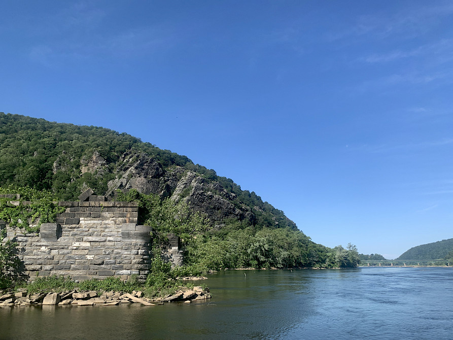
The Potomac and Shenandoah Rivers converge at Harper’s Ferry National Historic Park. To the side of the calm converging rivers, there is a large foothill and rock face, in addition to stone barriers placed in the center of the Potomac side of the tributary. Photo by Anna Calderón.
Within the Potomac watershed, the three counties that the project will focus on are St. Mary’s County at the mouth of the Potomac, Frederick County from the central area of the tributary, and Shenandoah County representing the Upper Potomac. The first workshop with key community members, in the format of an open house, will be focused on Frederick County.
On June 15th, a planning meeting for the open house took place at Hood College in Frederick, Maryland. The people present for this meeting included members of the COAST Card team from the UMCES office in addition to representatives from some major organizations that have ties with Frederick County and the Potomac Watershed – Hood College professors, the Potomac Riverkeeper, Metropolitan Washington Council of Governments, Frederick County Planning Department, and the Interstate Commission on the Potomac River Basin.
This planning meeting initiated discussions on what key components of the Potomac watershed we should focus on, and who should be brought into future workshops. A group exercise that was done to facilitate this conversation was naming important values and threats to the community. Each representative went around the room naming their top 3 values and threats with the Potomac watershed, which helped to generate relevant discussions between the group on what aspects of the watershed to focus on, helping identify potential indicators. Another group activity was a stakeholder mapping exercise that identified key community members who should be present for the formal July open house. This was done by using a map with axes of influence vs. interest to place groups with an emphasis on how to best engage them, such as identifying groups who have high influence, but require engagement and alignment to the cause to increase their interest.
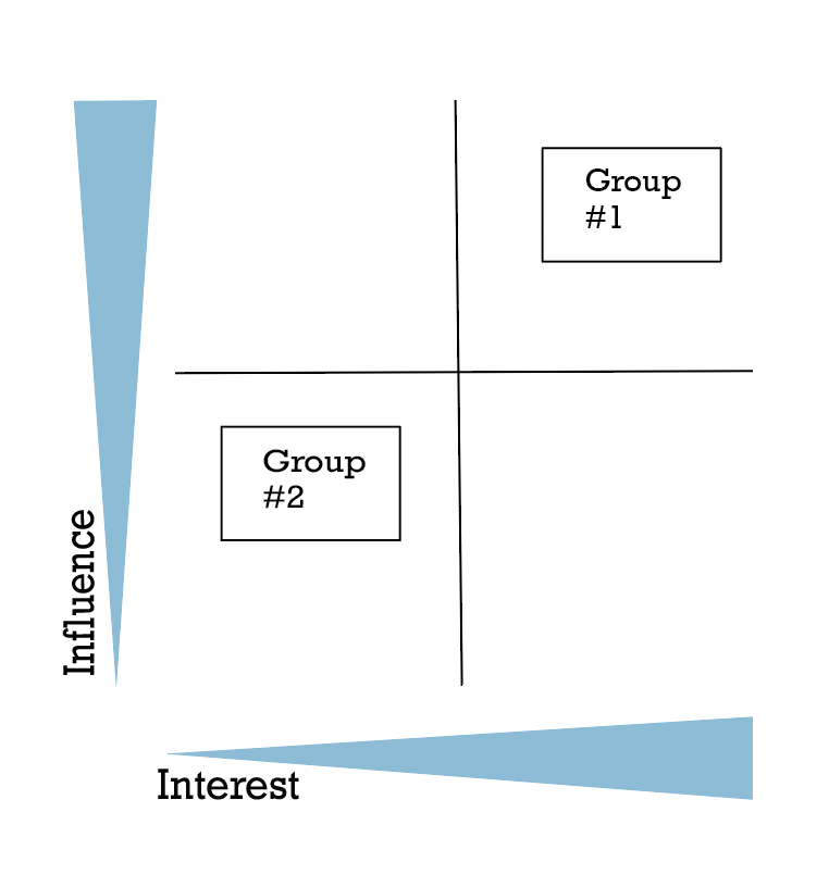
A sample Interest–Versus–Infleunce grid to map partners and community members. Group #1, a group of high interest and high influence, should absolutely be involved. Group #2, a group of low interest and low influence, would need to be engaged with to generate greater interest. Figure by Anna Calderón.
At the end of the planning meeting, it was clear that many more voices needed to be incorporated into future workshops to encapsulate the full range of issues that could affect the interested parties of Frederick County. The discussions from this meeting helped to establish a list of contacts that should be reached out for the July open house as well as best practices to generate productive discussions on what are the most important issues to the workshop participants. By doing so, we hope this participative approach can lead to an end product where those living in the Potomac Watershed feel they have the agency to improve their livelihoods.
The open house event will be held on Thursday, July 21st from 12-8pm at the Whitaker Community Commons building of Hood College.
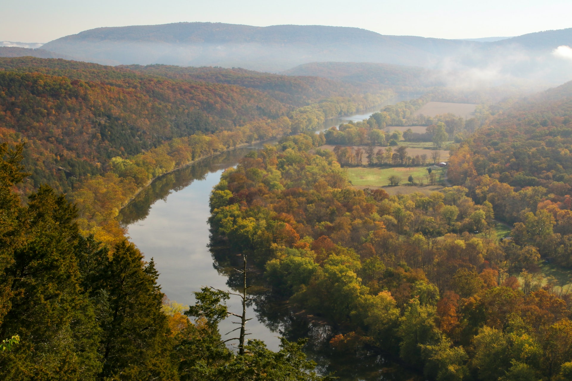 The Potomac River appears extremely majestic in the autumn, winding between misty hills, agricultural fields, and dense forest. Photo by Liz Guertin on Unsplash, Published on September 14, 2021.
You can follow the COAST Card Project on these social media platforms:
Twitter, Instagram, and Linkedin
We recognize the Indigenous and native peoples who originally occupied and tended to the land and waters of what we know today as the Chesapeake Bay Watershed. The Chesapeake Bay Watershed includes the historic lands of the Accomack, Arrohatec, Chesoenhaka (Nottoway), Chesapeake, Cuttatawomen, Doeg, Ho-de-no-sau-nee-ga (Haudenosaunee), Kecoughtan, Kiskiack, Lənape Haki-nk (Lenni-Lenape), Lumbee, Manahoac, Massawomeck, Monacan, Nacotchtank (Anacostan), Nandtaughtacund, Nansemond, Nentego (Nanticoke), Occohannock, Onawmanient, Onöndowa'ga:' (Seneca), Pamunkey, Patawomeck, Piscataway, Pissaseck, Pocomoke, Powhatan, Quiyoughcohannock, Rappahannock, Sekakawon, Susguehannock, Warraskoyack, and Youghtanund.
Blog written by: Anna Calderón and Nick An

Anna is a Global Sustainability Scholar and is working on the transnationally-focused COAST (Coastal Assessment for Sustainability and Transformation) project based at UMCES. Anna is passionate about addressing water scarcity, understanding hydrological systems in light of climate change, and participating in serendipitous community-based science. She is a senior at Wellesley College (Class of ‘23) majoring in Geoscience and Anthropology with a special interest in hydrogeology. Anna’s contact information is asofiacalderon5@gmail.com.

Nick An is a Global Sustainability Fellow and is working on the transnational Coastal Ocean Assessment for Sustainability and Transformation (COAST Card) project. Nick is a firm advocate for the One Health paradigm, the idea that the health of humans is intricately connected to the health of animals and the environment. Nick earned his B.S. in environmental science and anthropology from Emory University (Class of 2022). He is currently a MPH Candidate in environmental health at Emory University (Class of 2023). Nick’s contact information is nick.an@emory.edu.
Next Post > What's Missing, and Getting There: Diversity and the Chesapeake Bay
Comments
-
Atika 6 months ago
Thank you for sharing this great information with us, i really appreciate your post!