Talking River Basin Report Cards at the International Waters Conference, Marrakech
Heath Kelsey · 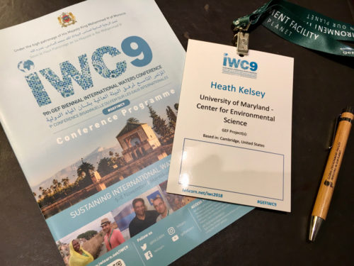
The Global Environment Facility (GEF) hosts a biennial International Waters Conference (IWC9 this year), which focuses on international water issues. Sarah Davidson and I were invited to the conference to talk about how ecosystem health report cards could support transboundary water assessments. This year the meeting was held in Marrakech, Morocco, from 5-8 November.
An important program within transboundary water issues at the GEF is the concept of Transboundary Diagnostic Assessment (TDA) and Strategic Action Programme (SAP) processes for areas where water-related issues transcend national boundaries. A TDA is an assessment of issues, and the SAP is a program initiated to address them.
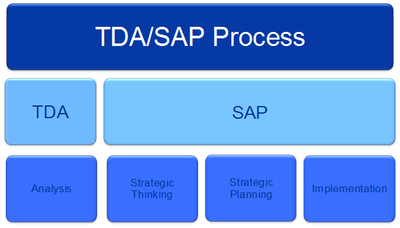
The sessions I attended early in the meeting highlighted concerns about making the TDA-SAP processes relevant to, communicating results of the SAP back to, and getting “buy-in” from local stakeholders. A SAP is often created at a multinational level and implemented nationally, which can create disconnects to the local communities where the effects of SAP requirements are felt.
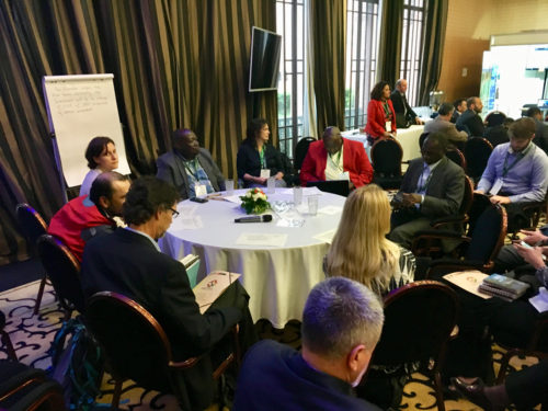
The stakeholder engagement principles that we use for the ecosystem health report card process can be helpful in addressing some of these issues. By engaging stakeholders in the process from the very beginning of the design stage, local stakeholders will co-design and co-develop the assessment, using indicators that are relevant to the local context. This way, all interested parties will “own” the process, and the acceptance of SAP recommendations will be more likely. This follows the transdisciplinary principles of relevance, credibility, and legitimacy described in Cash, et al. (2003).
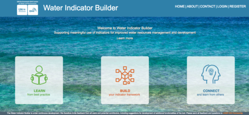
Chris Cox (UNEP- United Nations Environment Programme) had experience with IAN’s previous ecosystem health report cards in Chilika Lake, India, and in Laguna de Bay in the Philippines, which were funded in part through the UNDP Global Partnership on Nutrient Management. Chris was excited about the results of these two report cards, and suggested that the approach be used for international waters assessment. Additionally, Simon Costanzo and I had previously collaborated with a host of partners on a project led by Maija Bertule at DHI to create an “Indicator Builder,” which would assist water quality practitioners in selecting the most appropriate indicators for their purpose.
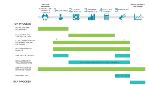
Together, Sarah Davidson (WWF), Chris Cox (UNDP), Maija Bertule (UNEP-DHI), and I designed a clinic, in which us “Doctors”, who facilitated the session, helped “Patients” solve a particular “illness”. Our clinic aimed to heal the illness of the challenge of selecting indicators that are useful for the TDA-SAP process, but are also relevant to local communities and stakeholders. I began by describing the principles of the report card process and pointed out the overlap of the report card and the 8-step TDA-SAP process. In fact, every component of the TDA-SAP process is addressed specifically or indirectly in the 5-step report card process.
We then had a fun session where the participants became stakeholders in a fictitious river basin that spans two countries with differing economies, populations and land use concerns: “Urbanlund” and “Agristaadt”. Urbanlund is highly developed and has a booming economy based on technology and service industries, but is experiencing increasing water security issues. Agristaadt has a rural, agriculture-dominated population. Agricultural output is ok, but there are increasing water security issues for them as well. Overlying all of this are increasing frequency and severity of drought and floods, adding to the water security concerns.
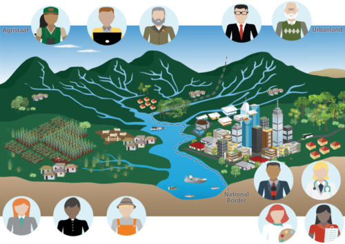
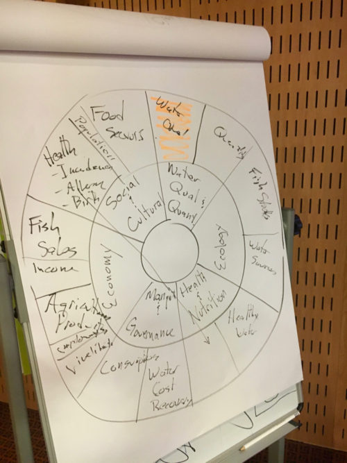
Each stakeholder was asked to consider what they value in the basin and suggest some basic indicators that would reflect that. These were placed in the reporting wheel and we began to “score” them based on our understanding of what was happening in the basin. After that, Maija introduced the Indicator Builder as a tool to help refine indicators selections, and Chris highlighted some of the benefits that he encountered while working on the Chilika Lake and Laguna de Bay projects. Maija highlighted that the Indicator Builder has great potential to help with the indicator selection process, especially if a “first cut” is taken by stakeholders in the workshop, that can then use the tool to help narrow their search. Chris highlighted the outcomes of the Chilika Lake and Laguna de Bay projects, where multiple stakeholders were involved in the assessment and which resulted in changes to lake management and monitoring.
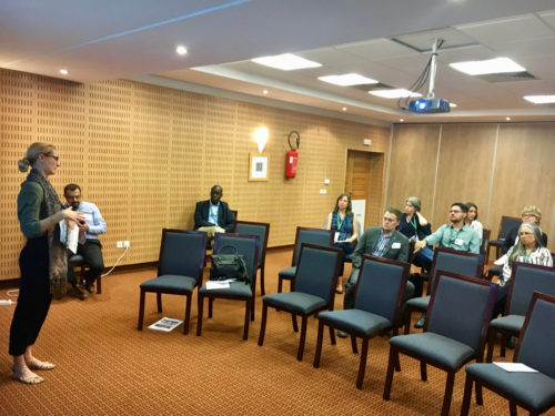
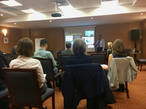
The clinic format was interesting--we were given 40 minutes to run the clinic, 10 minutes to transition to a new group, then another 40 minutes to do it again with a new set of participants. I liked the format, as it allowed people to pursue more than one topic, and it focused the presenters to be concise and creative. Our clinics had about 25 and 15 participants in the first and second rounds, respectively.
The conference was beset with IT problems, including PowerPoint issues in the plenary hall, and coordinating the timing of session beginnings and endings. Our first clinic run had two power failures, prompting us to continue discussions in the dark for a brief period, which was interesting, but we "powered" through. All in all it was a great meeting and I felt privileged to be there representing IAN and UMCES!
Reference: David Cash, William C. Clark, Frank Alcock, Nancy M. Dickson, Noelle Eckley, Jill Jäger. 2003. Salience, Credibility, Legitimacy and Boundaries: Linking Research, Assessment and Decision Making. KSG Working Papers Series, 2003.
About the author
Heath Kelsey
Heath Kelsey has been with IAN since 2009, as a Science Integrator, Program Manager, and as Director since 2019. His work focuses on helping communities become more engaged in socio-environmental decision making. He has over 10-years of experience in stakeholder engagement, environmental and public health assessment, indicator development, and science communication. He has led numerous ecosystem health and socio-environmental health report card projects globally, in Australia, India, the South Pacific, Africa, and throughout the US. Dr. Kelsey received his MSPH (2000) and PhD (2006) from The University of South Carolina Arnold School of Public Health. He is a graduate of St Mary’s College of Maryland (1988). He was also a Peace Corps Volunteer in Papua New Guinea from 1995-1998.