
Summer ecological forecast
 The EcoCheck Project (NOAA-UMCES partnership) has been working closely with the Chesapeake Bay Program (CBP) and some of its partners to forecast summer ecological conditions. Forecasts of dissolved oxygen in the Bay's mainstem, harmful algal blooms in the Potomac River, and changes in aquatic grass cover were produced this year. The forecast is part of a new communication program being implemented by the Chesapeake Bay Program. IAN and the Chesapeake Bay Program hope to collaborate with interested parties to improve forecasting capacity in coming years. For further information visit: Integration & Application Network (ian.umces.edu) and Chesapeake Bay Program (www.chesapeakebay.net/bayforecast.htm).
Wanted: Science Applications Coordinator
 The Integration and Application Network (ian.umces.edu) invites applications for a Science Applications Coordinator. The position requires a strong background in estuarine science with strong skills in quantitative and qualitative information processing and technical writing and graphics. The successful candidates will work in partnership with the NOAA Chesapeake Bay Office staff at the Cooperative Oxford Laboratory in Oxford, Maryland. Candidates should have at least a Bachelor’s degree. The successful candidate must possess demonstrated experience in two or more of the following areas; data interpretation and communication, technical writing, and ability to produce synthetic reports. This person will be responsible for producing a range of science application products related to, or resulting from, the Partnership’s development of ecological assessment and forecasting techniques. For further information, please visit the EcoCheck website.
Summer 2005 ecological forecast has mixed accuracy
 The Summer 2005 ecological forecast for Chesapeake Bay, conducted in collaboration between Ecocheck (NOAA-UMCES Partnership) and the Chesapeake Bay Program (CBP), recently concluded. This first attempt has shown how challenging it is to provide an accurate ecological forecast, with good, fair and poor accuracy this year. Based on spring nutrient loads delivered to the Bay, mainstem anoxic volume was predicted to be the fourth largest on record. However, the anoxic volume was larger than predicted, with the largest ever summer average anoxic volume occurring. Fortunately, the Potomac River harmful algal bloom forecast was incorrect, with only relatively minor concentrations of Microcystis being reported. As predicted, the low salinity aquatic grass beds expanded this summer, mostly on the Susquehanna flats. Detailed explanations of the summer conditions in relation to the forecasts will be released by the CBP in November. With the conclusion of this year’s forecast, Ecocheck is now working with the Chesapeake Bay Program to produce an annual assessment of restoration activities and ecological health. These reports will be released by the CBP in January and March of next year.
Summer water quality and aquatic grass wrap-up
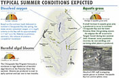
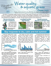 The EcoCheck Project (NOAA-UMCES partnership) in collaboration with the Chesapeake Bay Program (CBP) and some of its partners has released the latest edition of the Chesapeake Update newsletter. This edition provides an overview of water quality and aquatic grass conditions over the summer of 2005. An explanation as to why these conditions occurred is provided – largely a combination of a wet spring followed by a dry, calm, and relatively warm summer. The observed conditions are compared to those forecast to occur before the summer, and explanations for any differences are provided. The main events this summer can be summarized as severe dissolved oxygen conditions, localized harmful algal blooms, and aquatic grasses flourish in the Northern Bay.
Ecological Forecasting Symposium
 On December 1st, 2005, the Integration and Application Network, in collaboration with the Chesapeake Bay Program’s Tidal Monitoring and Analysis Workgroup, convened a symposium on ecological forecasting in Chesapeake Bay. The symposium included presentations and discussions related to forecasts of dissolved oxygen, harmful algal blooms, aquatic grasses, menhaden, and sea nettles. There was excellent turnout to the symposium, with many UMCES staff attending and presenting their work. As a result of the symposium, it is expected that the Chesapeake Bay Program’s summer forecasts, released in May each year, will be improved by addition of new forecasts (e.g., menhaden) and increasing the accuracy of others (e.g., dissolved oxygen). Presentations given at the symposium can be viewed on the Chesapeaka Bay Program website.
New IAN Personnel
 In December 2005, the EcoCheck project (UMCES-NOAA partnership) hired Caroline Wicks to be their Science Applications Coordinator, a position located at the Cooperative Oxford Laboratory in Oxford, Maryland. In this position, Caroline will produce a range of science application products related to, or resulting from the partnership's development of ecological assessment and forecasting techniques. Caroline grew up in Lansdale, PA, and completed her Bachelor of Science in Biology (with a minor in French) at UNC - Wilmington in Wilmington, North Carolina. She then came to Horn Point Laboratory for her Master's degree with Dr. Evamaria Koch on the effects of sediment characteristics on seagrass colonization and distribution along retreating marsh shorelines. In addition to being a scientist, she wants to do more environmental outreach and education. Caroline's interests outside of work include reading, gardening, traveling, and spending time with her family and friends.
EcoCheck newsletter
 EcoCheck is a partnership between the National Oceanic and Atmospheric Administration and the University of Maryland Center for Environmental Science. The group recently published a newsletter conveying their goals and approach towards improving Chesapeake Bay health. The types of projects on which EcoCheck works are also described in the newsletter.
Menhaden newsletter
 EcoCheck has also recently completed a newsletter describing their work on developing a menhaden recruitment model. The menhaden recruitment model newsletter describes an approach to explain and predict menhaden recruitment based on striped bass predation, including a novel method of checking the model through hindcasting. After further improvements, this new model has the potential to be an important tool to aid ecosystem based management of both menhaden and striped bass.
Summer ecological forecast released
 IAN and EcoCheck (NOAA-UMCES Partnership) in collaboration with the Chesapeake Bay Program and some of its partners (e.g. MD DNR) have just released the 2006 summer ecological forecast. Forecasts of Chesapeake Bay mainstem anoxic volume, harmful algal blooms in the Potomac River, and changes in aquatic grass cover over the summer period are provided. This is the second year that the forecast has been provided, with relatively accurate forecasts provided last year. A newsletter that summarizes the forecast can be found at the EcoCheck website.
Early summer rain event newsletter
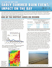 EcoCheck (UMCES-NOAA Partnership) in collaboration with the Chesapeake Bay Program has produced a newsletter, Early summer rain event: impact on the Bay, describing some of the monitoring data and the response from the Chesapeake Bay community to the high rainfall event that hit the Bay watershed from June 24th to June 28th 2006. In some areas of the watershed, up to 15 inches of rain fell, and much of the area received 7 inches or more. The Chesapeake Bay Program quickly organized an effort to monitor and analyze dissolved oxygen, turbidity, chlorophyll a and aquatic grass in the Bay.
Ecosystem health report cards: An approach to integrated assessment
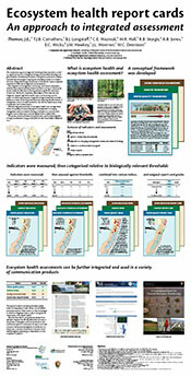 Integrated ecological assessment of the world’s coastal ecosystems is essential for effective management and remediation. The integration of management, monitoring, and science is required to solve the major environmental problems that are occurring in coastal zones around the world. Effective monitoring requires a significant investment of resources. Field work is expensive, data analysis is time-intensive, data integration requires high level scientific input, and recurring costs are subject to inflationary pressures. Integrated ecological assessment provides feedback on these monitoring investments by measuring the effectiveness of management actions. Societal momentum can then be created by successes in assessment and communication. This poster presents processes and approaches to performing integrated ecological assessments, using an example from the Coastal Bays of Maryland.
Job Vacancies
 The University of Maryland Center for Environmental Sciences (UMCES) Integration and Application Network is currently accepting applications for two positions: Science Communicator with a background in estuarine science together with strong written and oral communication skills. The successful candidate will work in partnership with the NOAA Chesapeake Bay Office staff through the EcoCheck project at the Cooperative Oxford Laboratory in Oxford, Maryland; Intern to assist with the production of visual elements and science communication products. It is expected that the successful applicant will have excellent computer skills, a background in science and a desire to be part of a dynamic team interested in solving not just studying environmental challenges. For further information, please visit the UMCES employment page.
Weather extremes lead to typical conditions (Summer lookback newsletter)
 EcoCheck (NOAA-UMCES Partnership) in collaboration with the Chesapeake Bay Program has produced a newsletter, 'Weather extremes lead to typical conditions'. The newsletter addresses the extreme weather conditions that the Bay area experienced during the spring and summer of 2006 and how these weather conditions affected the summer ecological forecast that was released in May 2006 and other aspects of Bay health. The forecast focuses on dissolved oxygen in the mainstem, harmful algal blooms in the Potomac River and aquatic grasses in three locations in the Bay. Scientists have been tracking these conditions through the summer to provide an assessment of summer conditions and to evaluate the forecast.
Ecosystem-based fisheries management newsletter
 This newsletter describes ecosystem-based fisheries management (EBFM). While the standard approach to fisheries management has been to focus on one species at a time, EBFM characterizes a greater number of ecosystem components, including the physical and chemical properties of systems. Here, we explore the current and potential applications of the ecosystem-based approach. The newsletter was a collaboration between EcoCheck and NOAA Chesapeake Bay Office.
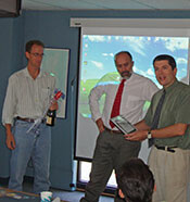
Summer forecast award ceremony raises a laugh
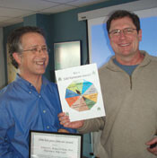 Accurately forecasting summer ecological conditions in Chesapeake Bay is not an easy task. This was especially true in 2006 when weather conditions were extreme. A lighthearted award ceremony was conducted at a recent Tidal Monitoring and Analysis Workgroup (Chesapeake Bay Program) meeting to acknowledge the individuals who produced the summer forecasts. Dave Jasinski, UMCES-CBP analyst, won the 'most accurate' award for his forecast of mainstem anoxic volume. Harmful algal blooms (HABs) in the Potomac River continued to be the most difficult parameter to predict, resulting in Peter Tango, MD DNR, receiving the 'worst forecast' award - Peter is determined to win the 'most accurate' award next year. For more information on the forecasts visit the EcoCheck and Chesapeake Bay Program websites.
2006 Chesapeake Bay Report Card
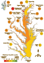 IAN and EcoCheck (a NOAA-UMCES partnership) recently released the 2006 Chesapeake Bay Report Card. The report card provides a scientifically robust — and geographically detailed — annual assessment of Chesapeake Bay habitat health. This report card rates 15 reporting regions of the Bay using six indicators that are combined into a single overarching index of habitat health. Habitat health is defined as progress of the six indicators towards established scientifically derived ecological thresholds or goals. The report card was produced in partnership with many Chesapeake Bay scientific and management organizations and individuals. The report card and supporting material can be downloaded from the EcoCheck website.
Calculating the 2006 Chesapeake Bay report card scores
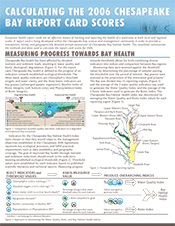 This newsletter describes the methods and approach underpinning the 2006 Chesapeake Bay Report Card. Specific topics covered include selection of indicators, the methods used to combine indicators into overarching indices and selection of reporting regions. The newsletter also summarizes how the sensitivity of the Water Quality Index was tested by comparing results from high and low nutrient load years. The newsletter can be downloaded from the EcoCheck website.
2007 Chesapeake Bay summer ecological forecast
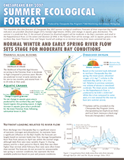 In collaboration with the Chesapeake Bay Program, EcoCheck (NOAA-UMCES Partnership) has produced the Chesapeake Bay summer ecological forecast for the third year. The EcoCheck forecast website and newsletter describe forecasts of three important Bay health indicators–dissolved oxygen (DO), harmful algal blooms (HABs), and changes in aquatic grass distribution. This summer it is predicted that (1) amount of anoxia (no dissolved oxygen) will be moderate in the Bay's mainstem and small in the Rappahannock River, (2) the extent and duration of HABs in the Potomac River will be average, and (3) aquatic grasses in the northern Bay, lower Potomac River, and Tangier Sound will undergo no or minimal recovery from losses sustained last year. For further information, visit the Chesapeake Bay Program and EcoCheck bay forecast pages.
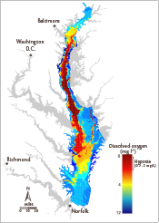
Breath of life: Dissolved oxygen in Chesapeake Bay
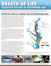 In collaboration with Dave Jasinski (CBP-UMCES), EcoCheck has produced a background newsletter about dissolved oxygen. This newsletter describes why dissolved oxygen is an important indicator of ecosystem health. It focuses on dissolved oxygen in Chesapeake Bay and its tributaries and describes the factors, such as nutrients and temperature, that affect dissolved oxygen. Additionally, the management decisions and actions that are being taken to reduce the amount of low dissolved oxygen in the Bay are described. The newsletter can be downloaded from the EcoCheck webpage. For further information on dissolved oxygen, visit the Chesapeake Bay Program's dissolved oxygen page.
Dissolved oxygen forecast update
 The dissolved oxygen forecast released last month has now been updated to include a prediction of mainstem hypoxic volume, a prediction of Potomac River summer anoxic volume, and a more confident prediction of mainstem summer anoxic volume. The hypoxic volume forecast was produced by Dr. Don Scavia of the University of Michigan. He predicts that the average volume of hypoxic water in the Bay during July will be 9.6 km3 (with a 67% probability that hypoxic volume will be between 7.0 and 11.5 km3), making this the sixth worst year since 1985. The updated anoxic forecast produced by David Jasinski, predicts that the summer anoxic volume will be 1.29+/-0.51 km3, slightly smaller than the prediction of 1.39+/-0.52 km3 made in early June. More information on the forecasts can be accessed on the EcoCheck website.
Eutrophication report released at the National Press Club
 The National Estuarine Eutrophication Assessment (NEEA) report titled "Effects of nutrient enrichment in the Nation's estuaries: A decade of change" was officially released this week at the National Press Club. The report provides an assessment of eutrophic conditions for 141 U.S. estuaries. The report was based on data and information provided by scientists and experts from around the country. Results from the assessment show that two-thirds of the estuaries evaluated exhibited moderate to high levels of eutrophication. Report production was a collaborative effort between Suzanne Bricker (NOAA NCCOS), EcoCheck (NOAA-UMCES Partnership), and IAN.
Incorporating habitat into ecosystem-based fisheries management
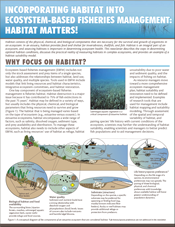 The second in a series of newsletters on ecosystem-based fisheries management (EBFM), this newsletter discusses the role of habitat in EBFM. Habitat consists of the physical, chemical, and biological components that are necessary for the survival and growth of organisms in an ecosystem. The newsletter describes the steps in determining optimal habitat conditions, discusses the practical reality of measuring habitats in complex ecosystems, and provides an example of a habitat suitability model. Produced in collaboration with NOAA's Chesapeake Bay Office.
A summer of poor water clarity, algal blooms, and fish kills (Summer lookback newsletter)
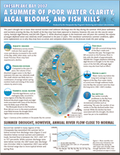 This year's drought led to lower than normal nutrient and sediment discharge into the Bay during the summer. With fewer sediments and nutrients entering the Bay, the health of the Bay may have been expected to improve, however, this was not the case for water clarity, harmful algal blooms, and fish kills. While dissolved oxygen in the mainstem was still poor this summer, the volume of oxygen depleted water was relatively small compared to the past 22 years. This newsletter summarizes summer conditions, offers some explanations as to why they may have occurred, and compares observations to the forecast made this past spring. Produced in collaboration with the Chesapeake Bay Program's Monitoring and Analysis Subcommittee.
Asian oysters: Science to inform policy decisions
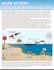 It has been proposed to introduce the Asian oyster (Crassostrea ariakensis) into Chesapeake Bay as one potential solution to the loss of the historic oyster fishery and ecological functions that oysters perform for Chesapeake Bay. This three-part series of newsletters summarizes: (1) the research topics addressed in the Asian oyster Environmental Impact Statement (EIS); (2) the current findings on interactions between the Asian oyster and the native oyster; and (3) the implications of an introduction on oyster disease. This effort was in collaboration with NOAA's Chesapeake Bay Office.
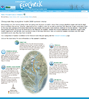
EcoCheck website summarizes Chesapeake Bay summer conditions
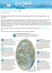 EcoCheck recently updated its website to provide a review of Chesapeake Bay health last summer. The website summarizes conditions of key indicators such as water clarity, dissolved oxygen, harmful algal blooms, fish kills, and sea nettle occurrence. Last year's drought led to lower than normal nutrient and sediment discharge into the Bay during the summer. With fewer sediments and nutrients entering the Bay, the health of the Bay may have been expected to improve, however, this was not the case for water clarity, harmful algal blooms, and fish kills. While dissolved oxygen in the mainstem was still poor this summer, the volume of oxygen depleted water was relatively small compared to the past 22 years. Produced in collaboration with the Chesapeake Bay Program's Monitoring and Analysis Subcommittee (MASC).
2007 Chesapeake Bay Report Card
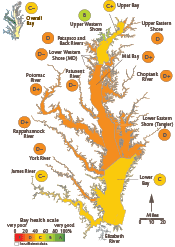 IAN and EcoCheck (a NOAA-UMCES partnership) recently released the 2007 Chesapeake Bay Report Card. The report card provides a scientifically robust - and geographically detailed - annual assessment of Chesapeake Bay health. This report card rates 15 reporting regions of the Bay using six indicators that are combined into a single overarching index of bay health. The Bay Health Index is defined as progress of the six indicators towards established, scientifically derived ecological thresholds or goals. The report card was produced in partnership with many Chesapeake Bay scientific and management organizations and individuals. The report card and supporting material can be downloaded from the EcoCheck website.
Chester and Patuxent River Report cards released
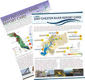 IAN and EcoCheck released the first ever Chester and Patuxent River report cards during April. These report cards are the result of a 12 month project aimed at showing how data collected by community groups and government departments can be combined into a product that engages and informs the local community. The project was supported by a grant from the Chesapeake Bay Trust. The Patuxent River estuary scored a 'D-' grade although grades ranged from 'C-' to 'F', depending on the location. Creeks flowing into the Chester River scored a 'C' grade, while the tidal region scored a 'D'. Additional partners in this project were the Maryland Department of Natural Resources, NOAA Chesapeake Bay Office, Waterkeeper Alliance and Gov4n6.
2008 Chesapeake Bay summer forecast released
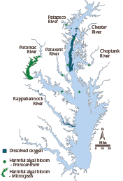 EcoCheck (NOAA-UMCES Partnership) recently released a forecast of Chesapeake Bay summer dissolved oxygen and harmful algal bloom (HAB) conditions. The forecasts are produced in collaboration with partners from USGS, Morgan State University and the University of Michigan. This year's forecast has been expanded to include a prediction of Prorocentrum harmful algal blooms in the Maryland portion of the Bay (thanks to Jon Anderson from Morgan State University). This summer it is predicted that: (1) the volume of anoxic water in the Bay's mainstem will be 1.7 ± 1.27 km3 , or the 5th largest since 1985; (2) the volume of mainstem Bay hypoxic water during July will be 9.9 km3 , or the 6th largest since 1985; (3) Microcystis blooms in the Potomac River will be of moderate severity; and (4) Prorocentrum blooms are predicted to occur in the lower reaches of the Patuxent River in late June to early July and in late June in the Lower Choptank River and Bay Bridge region. For further information, visit the EcoCheck Chesapeake Bay forecast pages.
Environmental report cards: A tool for better management, monitoring, and research
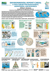 Environmental report cards are an important tool for integrating assessments of ecosystem health and for communicating scientific understanding to decision-makers and the general public. This poster won a prize in the public poster category at the recent Land Ocean Interactions in the Coastal Zone (LOICZ) conference in Cape Town, South Africa. It describes the impact that effective environmental report cards can have on management, monitoring, and research, as well as detailing the five step process used to develop a report card.
Research to improve management of Atlantic menhaden in Chesapeake Bay - newsletter
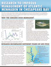 From both an economic and ecological standpoint, Atlantic menhaden are one of the most important fish species in Chesapeake Bay. Concerns over localized depletion and a need for improved understanding of the ecological role of menhaden in Chesapeake Bay led the Atlantic States Marine Fisheries Commission to identify research needed to improve menhaden fisheries management. This newsletter provides the status of some of the resulting research projects.
EcoCheck 2008 Summer Review
 EcoCheck (NOAA-UMCES Partnership) recently released the 2008 Summer Review via the EcoCheck website. Summer conditions in 2008 were variable. Despite high flows providing nutrient inputs in early spring, mainstem anoxic waters were average. There were several significant harmful bloom events and fish kills. Additionally, water clarity continued to be poor this year. Summer conditions were compared to the ecological forecasts of dissolved oxygen, Microcystis blooms, and Prorocentrum blooms that were made in June 2008. As in previous years, ecological forecasts had variable success.
Regional report card project initiated
 Report cards are increasingly being used by community organizations to assess and communicate the health of their local waterway. IAN/EcoCheck staff are taking the lead in an effort to promote synergies and uniformity among these efforts, with an aim to make report cards widely used and comparable. Staff from a variety of organizations recently met at the Annapolis Synthesis Center to start addressing issues from data analysis through to design and layout of report cards. In addition, IAN/EcoCheck will also produce two new report cards this year, one for the MD Coastal Bays and a second for the Severn River. Organizations involved in the project include: Chesapeake Bay Trust, MD Coastal Bays Program, Patuxent, Severn and West/Rhodes Riverkeepers, and the Chester River, South River and Sassafras River Associations.
Heath Kelsey joins IAN's EcoCheck team
 Heath joins EcoCheck after being an ecological modeler at NOAA's Cooperative Oxford Lab since 2006. His research interests include GIS and spatial analysis, bacterial water quality modeling, and creating model-based tools for the regulation and management community. Heath finished his doctoral research on fecal pollution modeling and bacterial source tracking in 2006, at the University of South Carolina's Arnold School of Public Health. Prior to that he was a Peace Corps volunteer in Papua New Guinea from 1995 - 1998. His move back to the Chesapeake region is a sort of homecoming - Heath received his Bachelor's Degree in biology from St. Mary's College of Maryland in 1988, and grew up in the Washington metro area, sailing and boating in Chesapeake Bay. When he's not being a modeling geek, Heath enjoys being a kid again with his wife Anne and two young children in Cambridge, MD.
Chesapeake Bay Report Card and Stream Health Newsletter
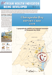 The aim of this report card is to provide a transparent, timely, and geographically detailed assessment of 2008 Chesapeake Bay health. Three water quality and three biotic indicators are combined into one overarching Bay Health Index, which is presented as the report card score. The overall health of Chesapeake Bay was poor in 2008, obtaining a grade of C-. Health of the 15 individual reporting regions varied, ranging from B- (moderate-good) to F (very poor). Additionally, for the first time, scientists present a snapshot of ecological conditions in the freshwater streams and rivers that feed the Bay. This new stream health indicator is a first step in evaluating the health of the Chesapeake Bay watershed. The Bay-wide report card production is supported by Eco-Check, a NOAA-UMCES partnership. The stream health indicator newsletter was produced with Chesapeake Bay Program partners and the U.S. Geological Survey.
Individual tributary report cards produced for the Chester, Patuxent, and Severn Rivers
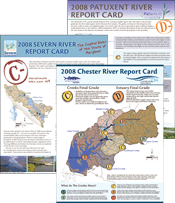 UMCES researchers worked with local Riverkeeper organizations to produce river-specific report cards for the Chester, Patuxent, and Severn Rivers. These reports, funded by the Chesapeake Bay Trust and supplemented by data collected by citizen scientists, are designed to provide the organizations with a new set of tools to better track local ecosystem health of their waterways and report them to their communities. The Chester River estuary received a D, the Patuxent River a D-, and the Severn River a C-.
Sediment organic content, hydrodynamics, and seagrasses
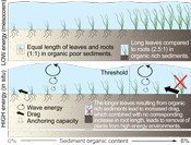 Caroline Wicks, from EcoCheck, was first author on a paper published in Marine Ecology Progress Series (378: 71-80), describing the effects of sediment organic content on seagrass growth and distribution in Chincoteague Bay, Maryland. When organic-rich sediments are found in hydrodynamically active areas, a mismatch occurs between plant morphology and the physical environment, leading to the loss of seagrasses due to uprooting. Therefore, sediment organic content limitations in seagrass habitats need to be evaluated within the local hydrodynamic settings. Fine organic sediment may be less limiting to seagrasses in quiescent waters while sand with low organic content may be required for seagrass survival in hydrodynamically active areas.
Maryland Coastal Bays Report Card
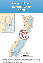 This report card provides a transparent, timely, and geographically detailed assessment of 2008 Coastal Bays’ health. Prepared annually, the report card rates six reporting regions of the Coastal Bays, using six indicators combined into a single overarching index of health. Health is defined as progress towards established scientifically derived ecological thresholds or goals. The overall health of Coastal Bays was moderate in 2008, obtaining a grade of C+. The highest ranked region was Sinepuxent Bay (B), while the lowest ranked regions were Newport Bay and St. Martin River (D+). The report card website enables you to explore the report card in more detail via the regions and indicators.
Research findings for key bay fisheries species
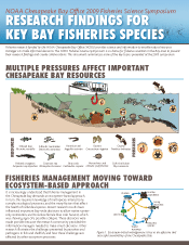 Fisheries research funded by the NOAA Chesapeake Bay Office (NCBO) provides science and information to enable natural resource managers to make informed decisions. The NCBO Fisheries Science Symposium is a chance for fisheries scientists in the Bay area to present their research findings and create collaborations. This newsletter is an EcoCheck/NCBO collaboration and summarizes some of the key topics presented at the 2009 symposium.
New EcoCheck intern - Christine Thurber
 Christine has joined EcoCheck as a Science Communication Intern. She recently graduated from Assumption College in Worcester, MA, studying biology and environmental science. Christine worked with wetland scientists for two years at an integrated services engineering firm and also volunteered as a water quality monitor through the Blackstone Valley River Coalition. After graduation she spent the summer studying harmful algal blooms at Horn Point Lab and Gallaudet University. It was through the Maryland Sea Grant Research Experience for Undergraduates at Horn Point that she learned about IAN. In the fall, Christine interned for the U.S. Fish and Wildlife Service Patuxent Research Refuge, conducting environmental education for the public. She has a wide range of interests in biology and environmental science, and is utilizing this internship to determine a course of study for graduate school. She loves photography, writing, hiking, camping, kayaking, and rock climbing, as well as recreational volleyball and frisbee.
Beach bacteria models integrate remote sensing and IOOS data to protect public health
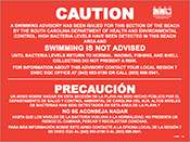 EcoCheck is developing daily forecasts for bacteria conditions at several beaches in the Myrtle Beach area of South Carolina that are impacted by stormwater. Working with partners at the South Carolina Department of Health and Environmental Control (SCDHEC), the University of South Carolina, and the South East Coast Ocean Observing Region Association (SECOORA), EcoCheck is creating updated models by integrating data from state beach program sampling data, remote sensing, and Integrated Ocean Observing System (IOOS) buoy data. These data can improve model predictions and create the potential for forecasting several days in advance. Models are developed to alert program staff to conditions that are likely to result in high bacteria counts and therefore warrant issuance of an advisory to beachgoers. This project is developing data management and processing tools to allow transfer of the approach to other beaches on the Atlantic coast.
New EcoCheck Science Communicator - Sara Powell
 Sara joined EcoCheck as a Science Communicator in February 2010. She is a South Carolina native, and received both her undergraduate (Marine Science) and graduate (Environmental Health Sciences) degrees from the University of South Carolina. Sara has worked on several research projects that link GIS, environmental management, and community outreach. She recently finished up work on a project with homeowners groups from Lake Wateree, SC, where she advocated for citizen stewardship of water resources by promoting education and enlisting local volunteers to undertake water quality monitoring. In her free time Sara enjoys traveling, reading, cooking, and spending time with friends and family.
IAN and EcoCheck bid farewell to Emily Nauman
 Emily joined IAN in 2007, and excelled in her internship. She moved on to the position of science communicator for EcoCheck where she contributed to a large number of science communication products and participated in a variety of training programs. Emily worked closely with Professor Nelson Marshall, to complete "Oceanography: An Observer's Guide", published by IAN Press. Emily also provided invaluable assistance in completing the IAN book, "Integrating and Applying Science". Emily is taking a job in Cincinnati, Ohio as a Science Communicator / Technical Writer, working in close association with the Environmental Protection Agency. This is a dream job and location for Emily, utilizing her considerable talents and being close to family and friends. Of course, she will be leaving behind good friends and close colleagues here in Maryland. We will miss Emily's wonderful smile and great attitude and look forward to finding ways to work with her in her new job. Emily is going to continue to work for IAN a day per week for the next 6 weeks to help us get through report card season.
Chesapeake Bay Report Card 2009
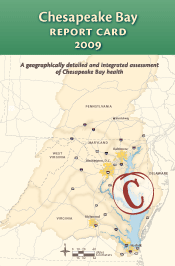 This report card provides a transparent, timely, and geographically detailed assessment of 2009 Chesapeake Bay habitat health. The overall health of Chesapeake Bay, assessed using water quality and biotic indicators, was the best it has been since 2002. The overall grade improved from C- in 2008 to C in 2009. Eight reporting regions had improved grades in 2009, four were unchanged, and two had slightly worse grades. The highest ranked region, for the third year in a row, was the Upper Western Shore (B-), while the lowest ranked region this year was the Patapsco and Back Rivers (F).
A Guide to the Mid-Atlantic Tributary Report Cards
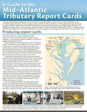 Recently, a number of groups concerned with the health of watersheds in the Chesapeake Bay region have begun to produce ecosystem health report cards much like EcoCheck's annual Chesapeake Bay report card. This newsletter highlights those local report cards as well as the efforts of the Mid-Atlantic Tributary Assessment Coalition (MTAC). MTAC emerged from the effort initiated by EcoCheck to bring members from watershed organizations and tidal monitoring networks together in order to identify core indicators that should be monitored by all groups and to develop standards for data collection, analysis, and reporting. Currently, MTAC participants are working to produce written protocols that will help ensure uniformity of monitoring, sample analysis, and data management that will in turn allow direct comparison of data and report card scores from each region.
New EcoCheck Intern - Melissa Andreychek
 Melissa Andreychek joined EcoCheck as a Science Communication Intern in May 2010. After earning her Bachelors at the University of Pittsburgh, Melissa spent several years working as an interpretive writer at Carnegie Museum of Natural History, with major projects related to the renovation of the museum's dinosaur hall and the exhibition development of Powdermill Nature Reserve. She is currently working toward the completion of her Masters in Technical and Scientific Communication at Miami University. Outside of the office, Melissa enjoys supporting canine welfare and rescue initiatives and traveling.
Nitrogen in the Chesapeake Bay: a retrospective newsletter
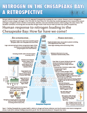 EcoCheck – with help from the Tidal Monitoring and Analysis Workgroup (TMAW), USGS, Maryland Department of Natural Resources, and Old Dominion University – has produced a newsletter that summarizes nitrogen monitoring data and trends in both the non-tidal and tidal areas of the Chesapeake Bay. Nitrogen pollution has been a primary cause of a degraded Bay ecosystem for over a century. Since the Clean Water Act of 1972, Bay monitoring programs have measured the amount of nitrogen coming from human activities on land (urban, surburban, rural, and industrial) and from natural cycling in the water column. This information is used to evaluate management actions for nutrient reduction.
Chesapeake Bay Forecast 2010
 For the past several years, Chesapeake Bay scientists have collaborated with EcoCheck (NOAA-UMCES partnership) to forecast Chesapeake Bay summer dissolved oxygen and harmful algal blooms conditions, weeks in advance, based on flow and nutrient loading conditions through May. For 2010, ecological forecasts were generated for early summer summer (June to mid-July) and late summer (mid-July to September) anoxia, July hypoxia, and July plus August hypoxia. These forecasts are generated by different Chesapeake Bay researchers and use different methods than in the past. The anoxic condition (no dissolved oxygen) in the Bay's mainstem is predicted to be moderately poor this summer. All the dissolved oxygen forecasts for this summer are for a smaller than usual region of low oxygen water. This anoxia forecast will be updated in mid-summer to provide the late summer anoxia forecast, so check back in July!
Maryland Coastal Bays Report Card 2009
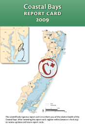 The aim of this report card is to provide a transparent, timely, and geographically detailed assessment of 2009 Coastal Bays health. Coastal Bays health is defined as the progress of four water quality indicators (TN, TP, Chl a, DO) and two biotic indicators (seagrass, hard clams) toward scientifically derived ecological thresholds or goals. The six indicators are combined into one overarching Coastal Bays Health Index, which is presented as the report card score. Detailed methods are available at https://ecoreportcard.org/report-cards/maryland-coastal-bays/health/. The overall score for the Coastal Bays was a C+ in 2009. While the northern bays and western tributaries continue to struggle, there are signs of improvement in some areas. However, the southern bays—historically the more pristine of the Coastal Bays—are showing signs of degradation.
Blue Crab Status Report
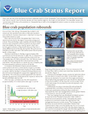 Blue crabs are one of the best-known and most celebrated symbols of the Chesapeake. Their populations in the Bay have hovered near historic lows for much of the last decade, but have recently begun to show signs of improvement. This newsletter reviews the current status of the blue crab population in the Chesapeake Bay as well as the management systems in place to monitor and protect this iconic species.
2010 Chesapeake Bay summer conditions better than average
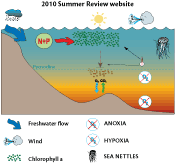 Summer conditions for 2010 were influenced by above-average winter river flow and below-average late spring and summer flow into the Bay. The timing of flow was important this year, in comparison to 2009, when the spatial pattern of flow into the Bay was important. Additionally, summer air temperatures in 2010 were above average, and combined with flow, can affect phytoplankton and fish in the Bay. 2010 summer conditions included below-average fish kills, less abundant sea nettles, and a smaller volume of low dissolved oxygen.
Expanding the diversity of the Mid-Atlantic Tributary Assessment Coalition
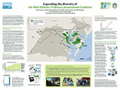 Since the 2006 release of the first EcoCheck Chesapeake Bay report card, environmental report cards have gained increasing popularity and recognition as a public-friendly and scientifically sound method for reporting the health of a waterway. Recently, a number of watershed organizations in the Mid-Atlantic region have begun producing their own tributary-specific report cards. In 2009, the Mid-Atlantic Tributary Assessment Coalition (MTAC) was formed to foster collaboration among watershed organizations and to fully develop the potential of region-specific environmental report cards. This can be accomplished through the standardization of indicators, monitoring and sampling protocols, data analysis methods, and science communication techniques.
Nanticoke and Sassafras River report cards released
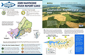 The two final tributary report cards to be released this year are from the Nanticoke and Sassafras Rivers. Both of these report cards are the first ever for their respective rivers, and are designed to look at the overall ecosystem health of their watersheds while also engaging local residents and helping them to better understand their river systems. Both rivers received passing scores, with the Nanticoke River receiving a final grade of B-minus, and the Sassafras River a grade of B. While those scores indicate that most water quality indicators met desired levels, there is still room for improvement. In particular, the Nanticoke scores showed a need for nitrogen reduction, and the Sassafras scores indicate that poor water clarity and high phosphate levels were problems of concern in 2009.
2010 Magothy River Index
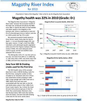 This report card is an assessment of the aquatic health of the Magothy River, and is based on data collected by the Magothy River Associationand various partners. It reports the status of vital habitats and water quality in the Magothy during 2010 based on three different indicators; water clarity (Secchi depth ≥ 1 m), dissolved oxygen (> 5 mg/L), and SAV area. The 2010 health index, 22% (D-), was the same as last year.
Melissa Andreychek moves to New York
 Melissa Andreychek joined EcoCheck in May 2010 as an intern, in partial fulfillment of her Masters degree requirements in Technical and Scientific Communication through Miami University (OH). During her time with EcoCheck, Melissa assisted in the creative development of several ecosystem health assessments and forecasts, including those of the Chesapeake and Maryland Coastal Bays, Great Barrier Reef, and Baltimore Inner Harbor. After nine months with EcoCheck as both an intern and full-time science communicator, Melissa headed north to Albany to begin work with Environmental Advocates of New York. In her new position, Melissa supports the communication strategies associated with Environmental Advocates' advocacy, coalition building, citizen education, and policy development initiatives. She also completed her Masters curriculum for spring 2011 graduation. Melissa remains on board with EcoCheck as a part-time consultant and can be reached via email at andreychek@umces.edu.
Chesapeake Bay Report Card 2010
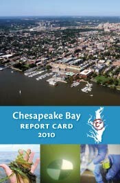 This report card provides a transparent, timely, and geographically detailed assessment of 2010 Chesapeake Bay health. The overall health of Chesapeake Bay, assessed using water quality and biotic indicators, declined slightly in 2010. The overall grade decreased from a C in 2009 to C- in 2010. Only two reporting regions (James River and York River) had improved grades in 2010, three were unchanged, and nine declined. The highest-ranked region in previous years, the Upper Western Shore, decreased to fourth highest. The Upper Bay (C+) became the top-ranked region in 2010. For further details, visit the Report Card website.
Sampling and Data Analysis Protocols for Mid-Atlantic Tidal Tributary Indicators
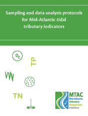 This report provides guidelines for the successful production of tidal ecosystem health report cards. Specifically, it develops clear and consistent protocols for the identification, collection, and analysis of indicators to be used by report card-producing organizations in the mid-Atlantic region.The overall objective of this protocol document is to encourage and enable comparisons of monitoring results from report card-producing organizations and to increase the scientific validity of report cards as outreach tools. It is intended for use in tidal areas only, as the ecosystem health indicators and thresholds discussed are pertinent only to tidal ecosystems.
Total Maximum Daily Loads: A citizen's guide to the Chesapeake Bay TMDL
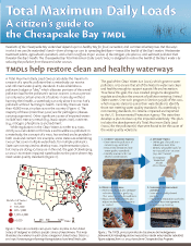 Residents of the Chesapeake Bay watershed depend upon a healthy Bay for food, recreation, and commercial enterprises. But the ways in which we use the watershed's lands—from driving our cars to spreading fertilizers—impact the health of the Bay's waters. Wastewater treatment plants, agricultural operations, and urban runoff are major sources of the nitrogen, phosphorus, and sediment pollution that threaten the Bay's health. The Chesapeake Bay Total Maximum Daily Load (TMDL) is designed to restore the health of the Bay's waters by reducing the pollution from these and other sources.
2011 Chesapeake Bay dissolved oxygen forecast
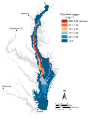 For the past several years, Chesapeake Bay scientists have collaborated with EcoCheck to forecast summer dissolved oxygen conditions, based on flow and nutrient loading conditions through May. The 2011 anoxia forecast is supported through research at Johns Hopkins University, Old Dominion University, UMCES-Horn Point Lab, and the Chesapeake Bay Program. This forecast uses the same basis as previous anoxia forecasts—nitrogen loads—but adds other elements that may provide a better understanding of anoxia in the mainstem Bay. The forecast was divided into early summer and late summer predictions because for the past several years there has been a noticeable change in anoxic volume following wind events in late June and early July. The early summer anoxia forecast predicts moderate to poor conditions, based on nitrogen loads from January to April as well as high flow in May.
2010 Maryland Coastal Bays report card
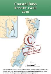 The aim of this report card is to provide a transparent, timely, and geographically detailed assessment of 2010 Coastal Bays health. Coastal Bays health is defined as the progress of four water quality indicators (TN, TP, Chl a, DO) and two biotic indicators (seagrass, hard clams) toward scientifically derived ecological thresholds or goals. The six indicators are combined into one overarching Coastal Bays Health Index, which is presented as the report card score. Detailed methods are available at https://ecoreportcard.org/report-cards/maryland-coastal-bays/health/. The overall score for the Coastal Bays was a C in 2010. All regions declined in overall health when compared to 2009.
Chesapeake Bay Summer Review
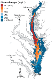 EcoCheck (NOAA-UMCES partnership) has released the 2011 summer review. This year's summer conditions were influenced by high spring river flow, hot summer air temperatures, and late summer storms. Dissolved oxygen conditions were poor this summer, with the second largest volume of anoxic waters during late July in the last 25 years. Strong winds during Hurricane Irene mixed oxygen from the surface to the bottom waters during August and the volume of anoxic waters shrunk dramatically. Tropical Storm Lee brought heavy rains to an already saturated watershed, resulting in flooding of many rivers and washing tons of dirt and debris into the system. When compared to the forecast, the anoxic volume was greater than predicted for the early summer. The late summer anoxia forecast was for larger than the observed volume, which decreased due to the hurricane-driven mixing.
Global Summit on Coastal Seas conference
 The ninth Environmental Management of Enclosed Coastal Seas (EMECS) conference was held in Baltimore, Maryland in late August. IAN helped sponsor the conference, which was attended by over 300 scientists and resource managers from 25 countries, in spite of global financial uncertainty and Hurricane Irene. The conference theme was ‘Managing for results in our coastal seas,’ and both past and present IAN staff presented a variety of topics throughout the conference. At the opening plenary, Maryland Governor Martin O’Malley presented his BayStat approach, highlighting the Chesapeake Bay report card produced by EcoCheck, the UMCES/NOAA partnership based in Oxford, Maryland.
The 1st Annual Chesapeake Bay Report Card Photo Contest
 Do you have great photos from around the Bay? We want to see them! Your photo could be on the cover of the 2011 Chesapeake Bay Report Card and become the icon of 2011 Bay health. Last year was memorable for the weather, the lack of sea nettles, and, of course, your experiences on and around the Bay. Take a few minutes to look back on what you enjoyed last year and share those memories with us. Submit your photos from 2011 weather events, water quality monitoring, or that monster fish that you caught, by March 15th and you could win $250, your photo on the cover of the report card, inclusion in the 2013 IAN calendar, and have your framed photo hang in the UMCES Annapolis Office.
Chesapeake and Atlantic Coastal Bays Trust Fund
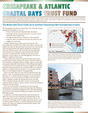 The Chesapeake and Atlantic Coastal Bays Trust Fund was created in 2007 in an effort to reduce nutrient and sediment pollution to these bays. The Trust Fund has focused its financial resources on the implementation of effective non-point (i.e., diffuse) source pollution control projects in high priority watersheds. This newsletter details examples of projects supported by the Trust Fund, including stream channel restorations, stormwater retrofits, and cover crops.
Bacteria sampling and data analysis protocol
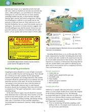 This document develops a clear and consistent protocol for the identification, collection, and analysis of the indicator of bacteria. Specifically, this document serves as an addendum to the Sampling and data analysis protocols for Mid-Atlantic tidal tributary indicators which provides guidelines for the successful production of tidal ecosystem health report cards. The bacteria protocol was written and reviewed by the MTAC group and Ecocheck. This document is intended for use in tidal areas only, as the ecosystem health indicator and thresholds discussed are pertinent only to tidal ecosystems.
2010 Trust Fund Water Quality Monitoring Strategy
 This Monitoring Strategy was designed to identify nutrient reduction efficiencies of best management practices (BMPs) and provide information to determine what type of monitoring is needed by Trust Fund recipients to evaluate the effectiveness of BMP implementation. The main objective is to provide a comprehensive protocol that serves all water quality assessment needs when monitoring urban and agricultural non-point nutrient and sediment fluxes. The methods and results of several intensively monitored case studies indicate that BMP implementation can be highly effective at reducing nutrient and sediment fluxes to receiving waters.
Photo competition reminder
Do you have great photos from around the Bay? We want to see them! Your photo could be on the cover of the 2011 Chesapeake Bay Report Card and become the icon of 2011 Bay health. Deadline for submissions is March 15.Assessing the vulnerability of the Great Barrier Reef to climate change
 Bill Dennison, Heath Kelsey, and Jane Thomas recently attended a Great Barrier Reef Foundation workshop to develop a synthetic publication that charts the vision for assessing the vulnerability to climate change. There are major climate impacts already being manifested, including sea surface temperature-induced coral bleaching, coral skeletal degradation due to ocean acidification, and relative sea level rise leading to inundation of mangroves. The development of a climate vulnerability index would provide a probability-based assessment of the likelihood of damage due to climate. This index is designed to complement the Great Barrier Reef report card.
Streamlining environmental reporting in the Pacific region
 Bill Dennison, Heath Kelsey, and Jane Thomas from IAN traveled to Nadi, Fiji to facilitate a workshop held March 20-21, aimed at streamlining environmental reporting in the Pacific region. The 2010 Pacific Islands Forum Leaders’ and Forum Economic Ministers’ directive on reporting acknowledged the need to streamline global, regional and national reporting to reduce the reporting burden at the national level. The workshop outcomes are being summarized in a publication that will provide a vision for approaching a more effective and streamlined reporting for the Pacific region.
Samoa 2012 Environmental Outlook: developing a vision for the next 50 years
 This document is the initial stage of assessment for Samoa's State of the Environment. Samoa's rich cultural heritage and future prosperity depend on a healthy environment. Over the past 50 years, Samoa's environment has been pressured by increasing population and development, agricultural expansion, invasive species of plants and animals, and disasters such as tsunamis, cyclones, and fires. A workshop was held to develop an assessment framework and assign expert assessments for six key habitats: Cloud Forest (very good) and Upland Forest (fair), Lowlands (poor), Coastal Strand (poor), Nearshore Marine (fair) and Offshore Marine (fair), and Rivers and Streams (good to poor); as well as other key resource areas such as climate change, air quality, waste disposal, renewable energy, and population pressures.
Environmental report card workshop in Surfers Paradise, Australia
 Sponsored by the Australian Water and Environmental Research Alliance (AWERA), a workshop on environmental report cards was held near Brisbane, Australia. This workshop focused on how environmental report cards have emerged as a technique to integrate data and provide feedback to a wide range of stakeholders as to the ecosystem health of a particular region. Workshop participants reviewed various environmental report cards globally, including those developed in Southeast Queensland, Australia and Chesapeake Bay, USA.
A vision for effective and streamlined reporting in the Pacific
 The burden of global, regional, and project reporting has been a longstanding concern of Pacific Island Countries and Territories, particularly on Smaller Island States. This newsletter uses an environmental case study to showcase how a simple, targeted, and strategic monitoring and reporting framework can facilitate streamlined reporting by allowing data and information to be used for multiple reporting requirements.
2011 Chesapeake Bay Report Card
 This report card provides a transparent, timely, and geographically detailed assessment of Chesapeake Bay. The overall health of Chesapeake Bay, determined using water quality and biotic indicators, declined slightly in 2011. The overall grade of D+ was a decrease for the second year in a row, down from a C- in 2010. Only two reporting regions, the Patapsco and Back Rivers, and the Lower Western Shore (MD), had improved grades in 2011. The highest-ranked region for the second year in a row was the Upper Bay, with a grade of C. For further details, visit the Report Card website.
Colonial National Historical Park Natural Resource Condition Assessment
 Colonial National Historical Park offers a vast array of cultural resources, notably the site of the first English settlement at Jamestown in 1607 and the Siege of Yorktown in 1781 that proved to be the last major campaign of the American Revolution. Four dominant habitat groupings are present within the Park, including forest, grassland, non-tidal wetland, and tidal wetland. Threats to Colonial NHP have been categorized into: internal (within the park), watershed (outside and around park boundaries), and regional (threats that impact the entire region). The combined natural resources of Colonial NHP were assessed as on the border between "degraded" and "fair", attaining 40% of desired threshold scores.
A Habitat-Based Framework for Communicating Natural Resource Condition
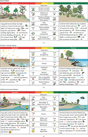 This new article in ISRN Ecology discusses how progress in achieving desired environmental outcomes needs to be rigorously measured and reported. Two major challenges in achieving this are how to synthesize monitoring data in a meaningful way at appropriate temporal and spatial scales, and how to present results in a framework that allows for effective communication to a variety of audiences. This paper presents a habitat framework, developed to assess the natural resource condition of Rock Creek Park (Washington DC), providing insight on how to improve future assessments. Vegetation and stream GIS layers were used to classify three dominant habitat types: Forest, Wetland, and Artificial-terrestrial. This approach has potential to provide assessment of resource condition for diverse ecosystems and provides a basis for addressing management questions across multiple spatial scales.
The coastal syndromes and hotspots on the coast
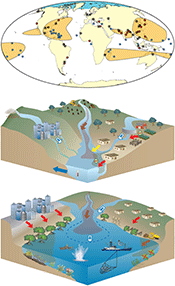 This paper by members of the Land-Ocean Interactions in the Coastal Zone (LOICZ) group, including IAN alumnus, Tim Carruthers, discusses how human intervention has resulted in a number of global and river syndromes that are mirrored by coastal syndromes. These problems are now global, with few coastal zones remaining unaffected and pristine. However, the problems are particularly severe at "hotspots" in the coastal zone. These include river-mouth systems where fluxes of water, sediment, fertilizers and contaminants are focused; urbanized coasts and megacities where vulnerable populations are concentrated; Arctic coasts where the effects of climate change are accelerating a fundamental state change; and, at low lying coasts that are at risk of flooding, storm surges, sea-level rise and subsidence such as Micronesian island states where managed realignment and setback is not an option. A range of societal responses and appropriate governance frameworks will be necessary to treat the coastal syndromes.
Chesapeake Bay Summer Forecast 2012
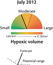 In collaboration with IAN and EcoCheck, researchers at the University of Michigan have forecasted the July hypoxic volume of the mainstem Chesapeake Bay for the sixth year. The July 2012 hypoxic volume is forecasted to be 6.4 km3, which is considered slightly below average. Unusual patterns in streamflow meant there were lower than normal total nitrogen loads from the Susquehanna River in the spring. Loads are the main driver of the forecast model.
Improving management of a Mid-Atlantic coastal barrier island through assessment of habitat condition
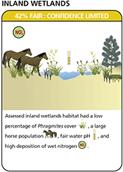 To achieve desired environmental outcomes, conditions and trends need to be measured and communicated. However, there is often a disconnect between responsive ecosystem monitoring and decision-making for strategic long-term management. Recently published in Estuarine, Coastal and Shelf Science, this paper demonstrates how historical monitoring data can be used to inform integrated resource management decision-making at Assateague Island National Seashore by using ecological reference conditions to identify monitoring needs, areas of high vulnerability, and areas with potential for improved management. This approach provides a framework that can be applied to assess the effectiveness of these management decisions on the condition of island habitats, and demonstrates effective incorporation of diverse monitoring datasets into an adaptive management cycle.
Assessing watershed health in Pipe Creek and Old Woman Creek, Ohio
 Heath Kelsey, Caroline Wicks, and Alex Fries from IAN, and Katie Foreman of the Chesapeake Bay Program, traveled to Sandusky, Ohio, to conduct a two-day workshop on the development of two local report cards. The Ohio Department of Natural Resources works with volunteers to monitor water quality in Old Woman Creek and Pipe Creek to assess the ecological health of these watersheds that flow into Lake Erie. IAN is helping to develop two related, but stand-alone report cards for these watersheds.
A vision for America's Great Watershed Report Card
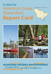 On September 26 and 27, Heath Kelsey from IAN and Jonathan Higgins from The Nature Conservancy (TNC) presented a framework and vision for a report card at the America's Great Watershed Initiative (AGWI) Summit in St. Louis, MO. The framework includes balanced information from Social, Economic, and Environmental sectors, and is intended to be transparent and clear. AGWI is led by TNC, and aims to implement integrated river basin management for the Mississippi River watershed by assessing progress toward seven broad goals. IAN will continue to work with TNC to advance the project, framework, and report card.
Rising to the Challenge: A National Park Service brochure
 As global temperatures and sea levels continue to rise, some organisms may thrive on Assateague Island while others may be replaced by more tolerant species. As storms intensify, the rate at which this Mid-Atlantic barrier island will experience overwash and rollover will increase. Ultimately, very different landscapes may change the access and experience that visitors enjoy today at Assateague Island National Seashore. While coastal areas are particularly vulnerable to sea-level rise and extreme weather events, inland areas are also being affected. This National Park Service site bulletin features the pro-active steps of adaptation, restoration, and protection being taken by the National Seashore, and also provides empowering suggestions for everyone to prepare for and cope with the effects of climate change.
Shenandoah National Park natural resource condition assessment underway
 IAN has joined forces with the University of Richmond and the National Park Service (NPS) to undertake the first Natural Resource Condition Assessment for Shenandoah National Park. The project was initiated this September with a two day trip to the Park that involved a guided tour by NPS staff highlighting the Parks resources and threats, followed by a workshop to outline project specifics. The project will run over the next 18 months with involvement from Simon Costanzo, Alex Fries, Tracey Saxby and Bill Dennison from IAN and Todd Lookingbill and Justin Madron from the University of Richmond.
Measuring effectiveness of Best Management Practices
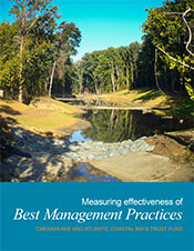 The Chesapeake and Atlantic Coastal Bays Trust Fund was created in 2007 in an effort to reduce nutrient and sediment pollution to these bays. The Trust Fund has focused its financial resources on the implementation of effective non-point source pollution control projects using best management practices (BMPs) in high priority watersheds. Examples of projects supported by the Trust Fund include stream channel restorations, stormwater retrofits, and cover crops. Evaluating BMP effectiveness is necessary for demonstrating whether projects actually reduce pollutant yields. The current monitoring strategy indicates that BMPs implemented in Trust Fund projects must demonstrate a water quality response within three years of completion. This document provides an overview of the challenges facing Chesapeake and Atlantic Coastal Bays and provides guidance to potential and current Trust Fund recipients in determining suitable approaches for measuring BMP effectiveness.
Marine Protected Areas: Guiding principles and benefits
 Marine Protected Areas (MPAs) are slices of the sea and coastline set aside because of their ecological importance. Creating an MPA requires a holistic approach that includes and integrates ecological, biological, social, and economic considerations. This approach cannot be successful without proper legislation, a functional institutional framework, financial resources, and active engagement of stakeholders. The WWF MedPAN South Project is a four-year collaborative project aimed at improving the management effectiveness of MPAs in the south and east of the Mediterranean and supporting the creation of new ones. A partnership with IAN was formed to create two documents which summarize the lessons learned from case studies in four countries with MPAs—Algeria, Croatia, Tunisia, and Turkey—currently in various stages of development and provide key actions needed to achieve success.
EcoCheck transition
 EcoCheck was formed in 2004 as a partnership between UMCES and NOAA to develop ecological forecasting and environmental reporting capacity in Chesapeake Bay. It has produced annual report cards, ecological forecasts, summer tracking, and summer review for Chesapeake Bay. EcoCheck staff led the effort on several other projects including a handbook for effective coastal ecosystem assessment, development of the National Estuarine Eutrophication Assessment, and formation of the Mid-Atlantic Tributary Assessment Coalition (MTAC). EcoCheck has been actively promoting the use of environmental report cards globally in locations such as the Great Barrier Reef, the South Pacific islands, Gulf of Mexico, and the Mississippi River basin. The next chapter for EcoCheck includes relocation of staff to the UMCES Annapolis Office and the main IAN building in Cambridge, MD. Future projects include a major revision of the Chesapeake bay report card, various other report card projects, and support for NOAA's Coral Reef Conservation Program.
The 2nd Annual Chesapeake Bay Report Card Photo Contest
 Do you have great photos from around the Bay? We want to see them! Your photo could be on the cover of the 2012 Chesapeake Bay Report Card. Last year was memorable for the hot, dry summer, Hurricane Sandy late in the year, and, of course, your experiences on and around the Bay. Submit your photos from 2012 weather events, water quality monitoring, or that monster fish that you caught, by March 15th and you could win $250, your photo on the cover of the report card, inclusion in the 2014 IAN calendar, and have your framed photo hang in the UMCES Annapolis Office. Like us on Facebook and watch as we share the winners and runners up from last year.
Old Woman Creek and Pipe Creek Report Cards
 The aim of these two report cards is to provide a transparent, timely, and geographically detailed assessment of the watershed health for Old Woman Creek and Pipe Creek in 2012. Old Woman Creek, on the south-central shore of Lake Erie, is one of Ohio's few remaining examples of a natural estuary and is designated as a National Estuarine Research Reserve and an Ohio State Nature Preserve. Pipe Creek is a small tributary to Sandusky Bay on the south-central shore of Lake Erie to the west of Old Woman Creek. Old Woman Creek and Pipe Creek watershed health is defined as the progress of three water quality indicators (nitrate, soluble reactive phosphorus, and turbidity) toward scientifically derived ecological thresholds or goals. These three indicators are combined into one overarching Health Index, which is presented as the report card score. Detailed methods and results are available from the Firelands Coastal Tributaries Watershed Program. The overall score for Old Woman Creek was a C in 2012, and for Pipe Creek was a C- in 2012.
Chesapeake Bay Report Card Photo Contest
Do you have great photos from around the Bay? We want to see them! Your photo could be on the cover of the 2012 Chesapeake Bay Report Card. Submit your photos from 2012 by March 15th and you could win $250, and have your photo on the cover of the report cardSampling and data analysis protocols for Mid-Atlantic non-tidal stream indicators
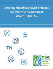 EcoCheck, in collaboration with the Mid-Atlantic Tributary Assessment Coalition, prepared this document which provides guidelines for the successful production of non-tidal stream health report cards. Specifically, it develops clear and consistent protocols for the identification, collection, and analysis of indicators to be used by report card-producing organizations in Mid-Atlantic rivers and streams. The overall objective of this protocol document is to encourage and enable comparisons of monitoring results from report card-producing organizations and to increase the scientific validity of report cards as outreach tools. This document is intended for use in non-tidal areas only, as the ecosystem health indicators and thresholds discussed are pertinent only to river and stream ecosystems.
Baltimore Healthy Harbor Report Card rates a C- for 2012
 The Waterfront Partnership of Baltimore and Blue Water Baltimore published this Healthy Harbor Report Card to help lead the public, government, and businesses toward a healthy Baltimore Harbor, one that is swimmable and fishable by 2020. Using water quality indicators, the health condition of the Harbor was determined for 2012. Human health indicators are also discussed in the report card. This newsletter provides the overall results, and describes how the public has been helping clean up their Harbor as well.
2012 Chesapeake Bay report card
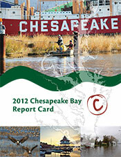 This report card provides a transparent, timely, and geographically detailed assessment of Chesapeake Bay. In 2012, the methods for the report card have changed to include five water quality indicators and two biotic indicators. In 2012, the overall grade for Chesapeake Bay is a 47%, a C. This means the Bay is in moderate health. Fisheries indicators as well as trajectories of reporting region health are also presented. For further details, visit the Report Card website.
Maryland Coastal Bays report card 2012
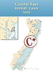 The aim of this report card is to provide a transparent, timely, and geographically detailed assessment of 2012 Coastal Bays health. Coastal Bays health is defined as the progress of four water quality indicators (total nitrogen, total phosphorus, chlorophyll a, dissolved oxygen) and two biotic indicators (seagrass, hard clams) toward scientifically derived ecological thresholds or goals. These six indicators are combined into one overarching Coastal Bays Health Index, which is presented as the report card score. Detailed methods and results are available on the EcoCheck Coastal Bays report card website. The overall score for the Coastal Bays was a C+ in 2012, with a slight improvement since 2011.
Chesapeake Bay dissolved oxygen forecast for summer 2013
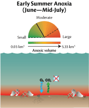 For the past several years, Chesapeake Bay scientists have collaborated with the Integration and Application Network to forecast Chesapeake Bay summer dissolved oxygen conditions, based on flow and nutrient loading conditions through May. Ecological forecasts provide resource managers with information that can be used to guide restoration, enable proactive communication of Bay conditions, and help direct research activities. The average summer (June to September) hypoxia forecast predicts better than average conditions for 2013. This forecast is based on Susquehanna River flow (January to May) and wind direction and speed across the Bay.
Chesapeake Bay health remains steady in 2013
 Despite a year of above-average rainfall and record heat, the overall health of Chesapeake Bay held steady in 2013. Overall, the Chesapeake scored a C, nearly the same score as the previous year, which was up from a D+ and C- in previous years. The heavy rainfall in 2013 contributed to murkier water conditions, in addition to a higher amount of chlorophyll. Total nitrogen scores are improving over time, while aquatic grasses rebounded from lower scores assessed in 2012. The report card rates 15 reporting regions of the Bay using seven indicators that are combined into a single overarching index of health. This year's report card also introduces a Climate Change Resilience Index to measure the resilience of Chesapeake Bay to the impacts of climate change. Resiliency is the ability of an ecosystem to withstand change in its environment. The Climate Change Resilience Index links several climate change impacts to key indicators in the Bay.
Baltimore Healthy Harbor Report Card scores a 51% for 2013
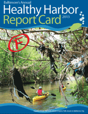 The Waterfront Partnership of Baltimore and Blue Water Baltimore published the Healthy Harbor Report Card to help lead the public, government, and businesses toward a healthy Baltimore Harbor, one that is swimmable and fishable by 2020. Using water quality indicators, the health condition of the Harbor was determined for 2013. This score of 51% was an improvement over the 2012 score of 40%. This was the first year that Baltimore Harbor's streams and watershed were also monitored and evaluated. Baltimore Harbor Watershed scored a 57% in 2013. Human health indicators are also discussed in the report card. This newsletter provides the overall results, and describes how the public has been helping clean up their Harbor as well.
Chesapeake Bay health improved in 2014
 Strong improvements were seen in 2014 Bay health as almost all indicator scores improved. Overall, Chesapeake Bay scored 50%, up from the previous year's score of 45% (both C's). While the improvements are promising, most regions still have poor to moderate scores. The highest scoring indicator was dissolved oxygen (89%, an A), and the lowest scoring indicator was water clarity (15%, an F). Aquatic grass scores improved or stayed the same in all regions, due to the expansion of Ruppia. Both nitrogen and phosphorus are showing significantly improving trends over time, while chlorophyll a and water clarity have declining trends. This report card includes an analysis on the resiliency of coastal wetlands to current and future sea level rise rates as part of a Climate Change Resilience Index study. For further details, visit the Report Card website.
Chesapeake Bay receives a score of C in 2016
 The Chesapeake Bay received a C grade in the 2015 UMCES Chesapeake Bay Report Card, which was released May 17 at the Annapolis Maritime Museum. 2015 marks the 10th anniversary of the UMCES Chesapeake Bay Report Card. The score of 53 was the highest since 2002, and the third highest score since they've been calculated. This is despite near normal rainfall and high agricultural production in the watershed. The most important increases in scores were in nitrogen, water clarity, and aquatic grasses. Improvements in Bay health are Bay-wide; scores in almost every reporting region improved from 2014 to 2015.