

Blog Highlights
- Engaged participants made the Indian River Lagoon Report Card workshop a pleasure to facilitate!
- A picture is worth a thousand words… but what about a conceptual diagram?
- 4 ways sea level rise and climate change are reshaping the coast
- Evolution's hero vs. a historical footnote: A new Narrative Index sheds light on Darwin vs. Wallace
Natural Resource Condition Assessment for George Washington Memorial Parkway
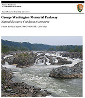 IAN worked with the National Park Service to develop a Natural Resource Condition Assessment for George Washington Memorial Parkway (GWMP). This report uses air quality, water quality, biodiversity, and landscape data to assess the current condition of the park. Significant natural areas occur throughout GWMP that are extremely rich in biodiversity and historical context. The park provides islands of refuge for many rare and unique plant and animal species in the highly urbanized Washington, D.C. metropolitan area, protecting a variety of cultural and natural resources. The park even includes plant community types found nowhere else on earth. Natural resources in GWMP are in degraded condition overall, and are under threat from surrounding land use, regionally poor air quality, deer overpopulation, and exotic species and pests.
Laguna de Bay Ecosystem Health Report Card, the first in the Philippines, was launched
 February 5, 2016 marked the first ever release of the Ecosystem Health Report Card for Laguna de Bay. The launch was held at the Laguna Lake Development Authority (LLDA) headquarters in Quezon City, Philippines. Laguna de Bay is the largest inland body of water in the Philippines, and is an important multi-use water resource. The lake features three distinct bays: West Bay, Central Bay, and East Bay which all converge at the South Bay. Therefore, water quality and fisheries scores were calculated for the whole Lake and for each of the sub-bays. Overall Laguna de Bay scored a low passing mark, a C-, in water quality and a failing mark, an F, in fisheries.
New Science Visualization course
 IAN is offering a new 2 credit graduate course in Science Visualization through the Marine, Estuarine and Environmental Science program this semester. The course employs a 'flipped classroom' in which lectures are recorded prior to class and made available on the Integration and Application Network YouTube channel. The IAN team of science communication practitioners is teaching this course. Classtime discussions are summarized in a weekly blog, posted on Wednesdays on the IAN website. Students in this hands-on course will be creating conceptual diagrams, data visualizations, maps and photographs in the initial section. The second section of the course focuses on storyboarding and assembling posters, reports, web materials and oral presentations. Course materials (recorded lectures and blogs) are being made available to anyone interested in developing more effective science visualization skills.
Orinoco River Report Card Highlighted in World Wildlife Magazine
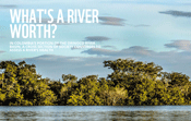 The WWF UMCES Partnership continues to successfully grow and expand with the release of a magazine article on the Orinoco River Report Card. The article: What's a river worth? In Colombia's portion of the Orinoco River Basin, a cross section of society converges to assess a river's health, was published in the Spring 2016 version of the quarterly magazine. The Orinoco River Report Card is currently being developed, with a scheduled July 2016 release, and the article highlights some of the stories in the Orinoco region. You can view the article on WWF's website.