Skip to main content
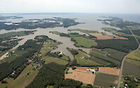
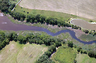
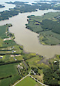
Harris Creek, a tributary of the Choptank River
Harris Creek, a tributary of the Choptank River
Harris Creek, a tributary of the Choptank River
Harris Creek, a tributary of the Choptank River
Harris Creek, a tributary of the Choptank River
Harris Creek, a tributary of the Choptank River
Harris Creek, a tributary of the Choptank River
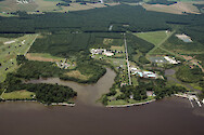
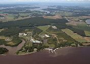
Horn Point Laboratory
Horn Point Laboratory
Horn Point Laboratory
Horn Point Laboratory
Multiple sediment plumes converging in the mid-Bay
Multiple sediment plumes converging in the mid-Bay
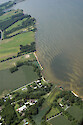
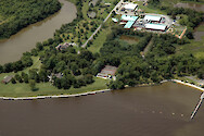
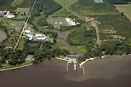
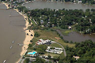
Offices of the Chesapeake Bay Foundation
Offices of the Chesapeake Bay Foundation
Offices of the Chesapeake Bay Foundation
Offices of the Chesapeake Bay Foundation
Offices of the Chesapeake Bay Foundation
Offices of the Chesapeake Bay Program, Annapolis…
Offices of the Chesapeake Bay Program, Annapolis…
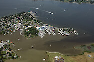
Oxford, Maryland
Oxford, Maryland
Oxford, Maryland
Plumes of water around the Chesapeake Bay Bridge