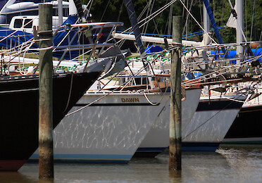
Boats on the Chester River ... Moored boats along the Chester River ... birds, Chesapeake Bay, Chester River, Eastern, Shore, estuary, Kent County, MarylandPlants, Queen, Annes County, tidal, trees, water, quality, wildlif...
...attails (Typhus spp) at Blackwater National Wildlife Refuge ... Blackwater National Wildlife Refuge, Chesapeake Bay, Dorchester County, marsh, MarylandPlants, wetlands ... Jane Thomas...
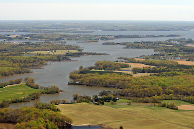
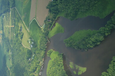
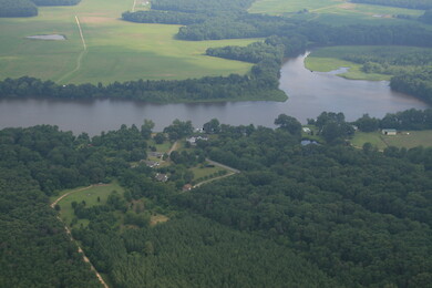
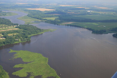
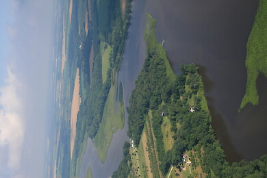
Chester River ... Looking down the West Fork of Langford Creek towards the Chester River ... aerial, flyover, langford creek, river, tributary, langford, water body ... Jane Thomas...
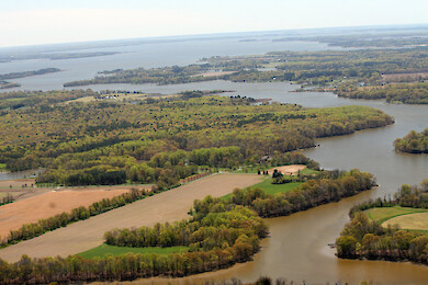
Chester River ... West Fork, Langford Creek looking towards the Chester River ... aerial, flyover, creek, langford, water body, tributary ... Jane Thomas...
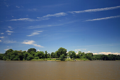
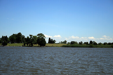
Chester River ... Landscapes along the shores of the Chester River ... birds, Chesapeake Bay, Chester River, Eastern, Shore, estuary, Kent County, MarylandPlants, Queen, Annes County, tidal, trees, water, quality, wildlif...
Chester River ... Landscapes along the shores of the Chester River ... birds, Chesapeake Bay, Chester River, Eastern, Shore, estuary, Kent County, MarylandPlants, Queen, Annes County, tidal, trees, water, quality, wildlif...
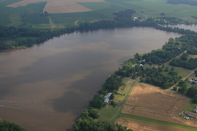
Chester River ... Upper Chester River, just west of Route 301 ... aerial, agriculture, Chesapeake Bay, Eastern, Shore, estuary, farms, fields, forest,...
Chester River ... Upper Chester River, just west of Route 301 ... aerial, agriculture, Chesapeake Bay, Eastern, Shore, estuary, farms, fields, forest,...
Chester River ... Upper Chester River, just west of Route 301 ... aerial, agriculture, Chesapeake Bay, Eastern, Shore, estuary, farms, fields, forest,...
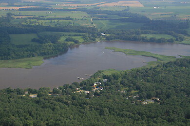
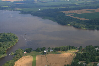
Chester River ... Upper Chester River, between Crumpton and Route 301 ... aerial, agriculture, Chesapeake Bay, Eastern, Shore, estuary, farms, fields,...
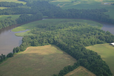
Chester River ... Upper Chester River near Crumpton ... aerial, agriculture, Chesapeake Bay, Eastern, Shore, estuary, farms, fields, forest, Kent Count...
Chester River ... Upper Chester River near Crumpton ... aerial, agriculture, Chesapeake Bay, Eastern, Shore, estuary, farms, fields, forest, Kent Count...
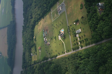
Chester River ... Development on the upper Chester River near Crumpton ... aerial, agriculture, Chesapeake Bay, Eastern, Shore, estuary, farms, fields, forest, Kent Count...
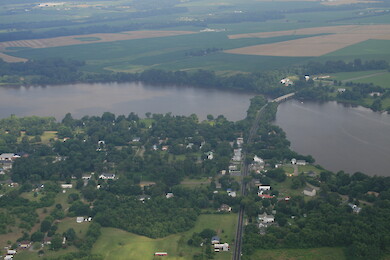
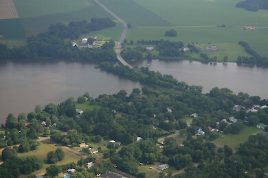
Chester River ... Crumpton, Maryland, and the Route 290 bridge on the Chester River ... aerial, agriculture, Chesapeake Bay, Eastern, Shore, estuary, farms, fields, forest, Kent County, landuse, Ma...
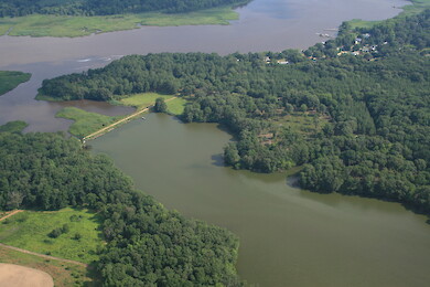
Chester River ... Foreman Branch Dam with the Chester River in the background ... aerial, agriculture, Chesapeake Bay, Eastern, Shore, estuary, farms, fields, forest, Kent C...
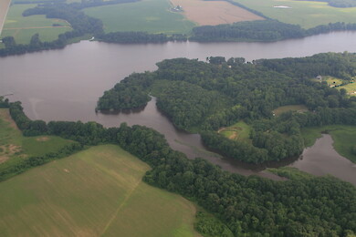
Chester River ... Red Lion Branch in Crumpton, a tributary of the Chester River ... aerial, agriculture, Chesapeake Bay, Eastern, Shore, estuary, farms, fields, forest, Kent County, landuse, Ma...
Chester River ... Red Lion Branch in Crumpton, a tributary of the Chester River ... aerial, agriculture, Chesapeake Bay, Eastern, Shore, estuary, farms, fields, forest, Kent County, landuse, Ma...
Chester River ... Crumpton, Maryland, and the Route 290 bridge on the Chester River ... aerial, agriculture, Chesapeake Bay, Eastern, Shore, estuary, farms, fields, forest, Kent County, landuse, Ma...
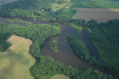
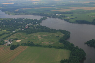
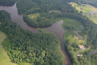
Chester River ... Pearl Creek (foreground) draining into the Chester River near Crumpton ... aerial, agriculture, Chesapeake Bay, Eastern, Shore, estuary, farms, fields, forest, Kent Count...
Chester River ... Crumpton, Maryland, and the Route 290 bridge on the Chester River ... aerial, agriculture, Chesapeake Bay, Eastern, Shore, estuary, farms, fields, forest, Kent County, landuse, Ma...
Chester River ... Crumpton, Maryland, and the Route 290 bridge on the Chester River ... aerial, agriculture, Chesapeake Bay, Eastern, Shore, estuary, farms, fields, forest, Kent County, landuse, Ma...