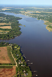
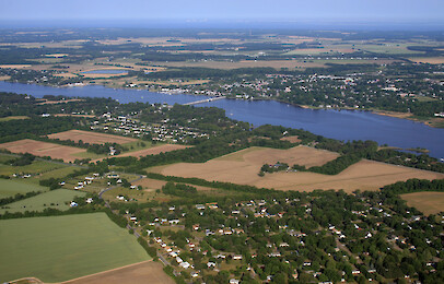
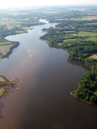
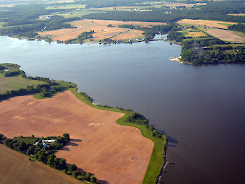
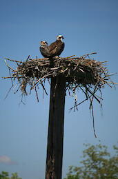
• All
  • People
  • Publications
  • Media Library
  • Blog Posts
  • Enewsletter Articles
  • Media Library

    131 results for "chester river":

    • Chestertown
      Chestertown ... Looking across the Chester River towards Chestertown and the Route 213 bridge ... aerial, agriculture, Chesapeake Bay, Eastern, Shore, estuary, farms...
    • Chestertown
      Chestertown ... Looking across the Chester River towards Chestertown and the Route 213 bridge ... aerial, agriculture, Chesapeake Bay, Eastern, Shore, estuary, farms...
    • Chestertown
      Chestertown ... Chestertown on the Chester River ... shoreline river, Chesapeake Bay, agriculture ... Jane Thomas...
    • Chestertown
      Chestertown ... Chestertown on the Chester River ... shoreline river, Chesapeake Bay, agriculture ... Jane Thomas...
    • Chestertown
      Chestertown ... Chestertown on the Chester River. The Route 213 bridge is in the background. ... shoreline, farms, fields, Chesapeake Bay, agriculture ... Jane Thoma...
    • Chestertown
      Chestertown ... Chestertown on the Chester River. The Route 213 bridge is in the background. ... shoreline, farms, fields, Chesapeake Bay, agriculture ... Jane Thoma...
    • Chestertown
      Chestertown ... Chestertown on the Chester River, with the Route 213 bridge. ... Chesapeake Bay, Chester River, agriculture, farms, shoreline ... Jane Thomas...
    • Corsica River
      Corsica River ... Corsica River, a small tributary to the Chester River, on the Eastern Shore of the Chesapeake Bay in Maryland. ... Corsica, Chester river, tributary, aerial ... Ben Longs...
    • Corsica River Mouth
      Corsica River Mouth ... Mouth of the Corsica River, on the Chester River, flowing into the Chester River, Eastern Shore, Chesapeake Bay ... river, mouth, Chester, Corsica, Chesapeake Bay, aerial ... Ben Longstaff...
    • Corsica River Mouth
      Corsica River Mouth ... Mouth of the Corisca River, flowing into the Chester River, Eastern Shore, Chesapeake Bay. The river is surrounded by agriculture. Some buffer zones are visible. ... aerial .....
    • Custom House, Chestertown
      Custom House, Chestertown ... The historic Custom House on the Chester River in Chestertown ... Chesapeake Bay, Chester River, Eastern, Shore, estuary, Kent County, MarylandPlants, Queen, Annes County, tidal, trees, water, quality ... Jane Th...
    • Eastern Neck
      Eastern Neck ... Looking across Eastern Neck which separates the Chester River (foreground) from the mainstem of the Chesapeake Bay (background). Grays Inn Creek is at the far right. ... Chesapea...
    • Eastern Neck National Wildlife Refuge
      ...ldlife Refuge. Kent Island and the Bay Bridge are in the background. ... Chesapeake Bay, aerial, agriculture, farms, Chester River, shoreline ... Jane Thomas...
    • Farm Land
      Farm Land ... near Rock Hall, Maryland ... aerial, flyover, agriculture, land, rock hall, private, chester river, managment ... Jane Thomas...
    • Grassed waterways (best management practice)
      Grassed waterways (best management practice) ... Grassed waterways (best management practice) near Chester River ... aerial, flyover, management, land use, practice, creek, river, ecosystem, farm, private ... Jane Thomas...
    • Grassed waterways (best management practice)
      Grassed waterways (best management practice) ... Grassed waterways (best management practice) near Chester River ... aerial, flyover, management, land use, practice, creek, river, ecosystem, farm, private ... Jane Thomas...
    • Grassed waterways (best management practice)
      Grassed waterways (best management practice) ... Grassed waterways (best management practice) near Chester River ... aerial, flyover, management, land use, practice, creek, river, ecosystem, farm, private ... Jane Thomas...
    • Kennedyville
      Kennedyville ... Kennedyville, Kent County, in the Chester River watershed ... aerial, agriculture, Chesapeake Bay, Eastern, Shore, estuary, farms, fields, forest, Kent County, land...
    • Kennedyville
      Kennedyville ... Kennedyville, Kent County, in the Chester River watershed ... aerial, agriculture, Chesapeake Bay, Eastern, Shore, estuary, farms, fields, forest, Kent County, land...
    • Kent Island and the Chester River
      Kent Island and the Chester River ... Looking north from the north shore of Kent Island over the mouth of the Chester River. Castle Marina is in the foreground. ... Chesapeake Bay, aerial, agriculture, farms, Chester River, shoreline ... Ja...
    • Kent Narrows
      .... The Kent Island bridge and Bay Bridge are visible. Eastern Bay is on the southern (left) side of Kent Narrows; the Chester River is on the northern (right) side. ... Chesapeake Bay, aerial, agriculture, farms, Chester River, shoreline ... Jane T...
    • Kent Narrows
      ...s to Kent Island. The Kent Island bridge is visible. Eastern Bay is on the southern (left) side of Kent Narrows; the Chester River is on the northern (right) side. ... Chesapeake Bay, aerial, agriculture, farms, Chester River, shoreline ... Jane T...
    • Living shoreline
      Living shoreline ... Living shoreline construction along the Chester River ... birds, Chesapeake Bay, Chester River, Eastern, Shore, estuary, Kent County, MarylandPlants, Queen, Annes County, tidal, trees, water, quality, wildlife ....
    • Osprey and nest
      Osprey and nest ... Osprey (Pandion haliaetus) and nest on the Chester River ... birds, Chesapeake Bay, Chester River, Eastern, Shore, estuary, Kent County, MarylandPlants, Queen, Annes County, tidal, trees, water, quality, wildlife ....
    • Osprey and nest
      Osprey and nest ... Osprey (Pandion haliaetus) and nest on the Chester River ... birds, Chesapeake Bay, Chester River, Eastern, Shore, estuary, Kent County, MarylandPlants, Queen, Annes County, tidal, trees, water, quality, wildlife ....