Brisbane 2011: Living with Floods and Dancing with Dugongs: Part 7- Examples of Flooding in the United States
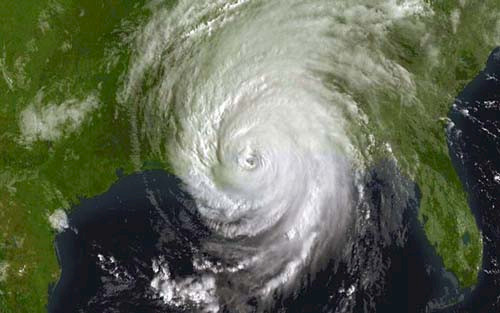
Bill Dennison · | Queensland Floods |Let me talk about Hurricanes Katrina and Rita in southern Louisiana. It was scheduled that some Louisiana people were going to come up to work with us the day that Katrina hit, then we re-scheduled for us to go down to Louisiana the day Rita hit. So we decided that we'd wait until hurricane season was over. So we went down there, into a room full of angry people. They were very angry that nobody had been listening to them, so we started off talking about how to reduce flood damage, and then we moved into enhancing the landscape integrity, so basically, the story there is that about a kilometer and a half of lateral marsh results in about thirty centimeters less storm surge. So, these marshes are horizontal levees.

That was the rationale that we were building. Then we started the societal discussion of do you restore, or do you retreat? Retreating wasn't a very good option in Louisiana because it's a major fishery for the U.S., (the biggest fishery other than Alaska) and oil and gas. People were in harms way because of the offshore gas and offshore fisheries. So, that wasn't going to be a total retreat, but a managed retreat. So that set the scene.


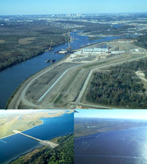
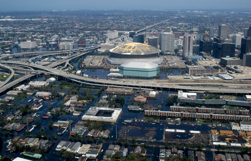
One other point I want to make: there were fourteen hundred deaths. It was truly tragic. New Orleans just reached fifty percent of its population pre-Katrina. You would walk down the streets in the French Quarter, and every third shop is boarded up. It had a devastating impact: billions of dollars in damage. So what are they doing now? I just did an overflight in December before I came here and I got to see the damage. They are building this huge levee in billion dollar sections with federal government money to protect New Orleans and putting in huge pumps. So the entire New Orleans surrounds is now going to be protected by this levee with the allegedly biggest pump in the world. They then took the canals that were allowing the excursion of water in, and they are plugging them up. So they're damming the canals, and they're building hardened structures offshore to protect the barrier islands as well. So, they're doing a lot of diking, pumping, diversions, dams, and billions of dollars of hard infrastructure. Interestingly, they're now turning their attention, in the next year, to developing this master plan. This is where they take the Mississippi River water, which is sediment laden, because it drains half of North America, and they're going to divert it into the marsh and let that sediment settle out, accumulate, and be used for marsh creation. Now they are arguing over who gets the dirt. So the contentious thing is prioritizing the diversions.
This blog post was created from a presentation by Bill Dennison, delivered at the historic Customs House in Brisbane, Australia on 8 July, 2011 (full powerpoint presentation can be accessed on IAN Press.
About the author
Bill Dennison

Dr. Bill Dennison is a Professor of Marine Science and Vice President for Science Application at the University of Maryland Center for Environmental Science.