The Bonnet Carre Spillway and the Spectacle of Climate Change
Bill Nuttle ·
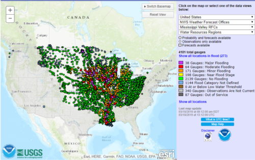
Television crews were on hand, on February 27, to witness the spectacle of the Corps of Engineers opening the Bonnet Carre spillway on the Mississippi River. Runoff from record precipitation in the Midwest this winter feeds a flood that is making its way down the river. The spillway, located 12 miles west of New Orleans, serves as a safety valve meant to protect the city during extreme floods. But, this is the third time in four years that it has been necessary to open the Bonnet Carre spillway, and it is the first time ever in back-to-back years. There is concern that climate change will make extreme flooding on the Mississippi River more likely. Has this happened? Has the opening of the Bonnet Carre spillway become, like the off the chart heat waves in Australia and the polar vortex in North America, another spectacle of climate change?

Mississippi River floods are a disruptive force in coastal Louisiana. Life in New Orleans will go on pretty much as usual, thanks to the protection provided by the spillway. But, the huge quantity of water diverted into Lake Pontchartrain disrupts the ecology of this normally-brackish lagoon. Flooding also disrupts navigation along the river, which is a vitally important transportation corridor, and the high rates of sedimentation that come with flooding make it difficult for engineers to keep navigation channels open at the mouth of the river. And, thousands of homes could be flooded in the Atchafalaya Basin, west of the Mississippi River, if rising water compels engineers to open a second relief spillway, the Morganza spillway, as happened during a major flood in 2011.
The opening of the
Bonnet Carre spillway gives TV reporters something that they can lean-in to. River
floods lack the drama and photogenic quality of the hurricanes that also
threaten coastal Louisiana, but they can be just as destructive. Mississippi
River floods are a slow-motion disaster. They gather strength over a period of
weeks or months, fed by winter precipitation in the Midwest, and it takes weeks
or months for the immense volume of water to make its way through the river
system. The signature event is the 1927 flood, which overwhelmed the flood
control levees all along the Mississippi River and still ranks as the most
destructive flood in the history of the US. This year’s flood reached a maximum
level 0.08 feet higher than the 1927 flood level at the confluence of the
Mississippi and Ohio Rivers on March 1st.

The Bonnet Carre spillway was constructed in 1931 to deal with flooding on the magnitude of the 1927 Flood. The spillway consists of a mile and a half long concrete weir extending along the east bank of the Mississippi River. Water that passes over spillway takes a shortcut route to the sea, bypassing the approximately 100 miles of river channel between the city and the Gulf of Mexico. This reduces the height of the flood at New Orleans. Engineers open part or all of the spillway, as needed, to regulate the amount of water that continues down the river, so that flood waters never threaten to overtop the levees that protect the city. Initially, the spillway was opened to about 60% of its maximum extent, and with additional flooding now occurring on the Missouri River, it could remain open until May.
Has climate change
increased flooding on the Mississippi River? Looking at when and how often engineers
have opened the Bonnet Carre spillway suggests that it has. In all, the
spillway has opened a total of 13 times since it was constructed due to
flooding, but these events are not distributed evenly over time. Openings have
occurred about twice as frequently in the last quarter of the spillway’s
88-year lifetime – 5 times in the last 22 years – than in the first three
quarters of its life – 2 to 3 times per 22 years. While this pattern of
openings is what one might expect if climate change is causing an increase in flooding,
it is not definitive proof.

As it turns out, finding a clear link between Mississippi River floods and climate change is difficult. The most recent National Climate Assessment finds that climate change has increased rainfall in the Midwestern US, and the amount of water flowing down the Mississippi River also is increasing. But, effect of climate change is obscured by other changes on the watershed that also affect stream flow. These include changes in forest cover, changes in agricultural practices, urban development, and flood management activities. However, looking forward, the effect of climate change on precipitation in the Midwest and in the southeast, where it is increasing heavy precipitation, point to increased risk of river floods in Louisiana, including the lower Mississippi River.”
“Climate change has brought us to the threshold of a new world. At New Orleans, the Mississippi River is confined within a distance of half a mile, the distance between the levees on either bank. The water flowing through this narrow corridor is the result of an altered climate acting on a watershed that covers about half the area of the continental US. For residents of New Orleans, the opening of the Bonnet Carre spillway signals that they are safe within the city’s flood protection levees. The flood is under control. For the people outside the levees and for the industries that directly rely on the river and the coastal waters it empties into, the opening of the spillway signals a future that is becoming more and more uncertain.

