Upper Mississippi River: Environmental Literacy
Bill Dennison · | Environmental Literacy |'Environmental literacy' series
The seven environmental literacy principles for the Upper Mississippi River are the following:
- The Upper Mississippi River is regulated with a series of locks and dams, extending from St. Louis, IL to Minneapolis, MN.
- The Upper Mississippi River watershed includes forests and lakes in the northern regions and corn/soy croplands in the southern regions.
- Navigation on the Mississippi River is connected to the Great Lakes via the locks and dams of the Illinois River.
- Runoff from croplands and sewage effluent from urban centers (e.g., Minneapolis/St. Paul, St. Louis, Chicago) contribute to eutrophication in the Upper Mississippi River.
- The Upper Mississippi River and its tributaries are major recreational areas, with popular boating, swimming, fishing and hunting areas.
- The Upper Mississippi River has a rich history of human settlement, with Native American paleo-Indians, hunters and gathers, potters and mound builders, and farmers, followed by French explorers, European fur trappers, and farmers and merchants.
- Major tributaries enter the Upper Mississippi River, including the Missouri, Illinois and Ohio Rivers.
1. The Upper Mississippi River is regulated with a series of locks and dams, extending from St. Louis, IL to Minneapolis, MN.
There are 27 dams on the Upper Mississippi River which, in combination with locks to allow barge traffic, serve to maintain year round navigable water north of St. Louis. The Upper Mississippi River has over 1,200 navigable miles, when the Illinois River is included. Each year, over 100 million tons of commodities is transported in the Upper Mississippi River basin. There are ecological consequences of impeding river flow through the lock and dam system, emphasizing the importance of good watershed management practices in this region.
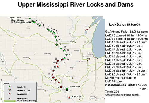
2. The Upper Mississippi River watershed includes forests and lakes in the northern regions and corn/soy croplands in the southern regions.
The watershed includes the forested lake country of Minnesota and Wisconsin with abundant recreational opportunities. The lakes were created by the last continental glaciation about 10,000 years ago. The Upper Mississippi River also passes through some of the most productive agricultural land in the nation, with corn and soybean rotations, wheat and other grains and an active animal husbandry industry as well. The Ozark Mountains are in the southern region of the Upper Mississippi River, with more intact forests and less agriculture.

3. Navigation on the Mississippi River is connected to the Great Lakes via the locks and dams of the Illinois River.
A major engineering feat was accomplished in 1848 when the headwaters of the Illinois River were physically connected to Lake Michigan through a canal that enters the lake south of Chicago, IL. In response to a series of beach closures on the Chicago lakefront in the 1870s, a dramatic engineering works was initiated to reverse the course of the Chicago River that passes through current day downtown Chicago. Instead of flowing from west to east, discharging into Lake Michigan, a series of canals and dams were constructed to force to Chicago River to flow into the Illinois River from east to west. The water flows into the Chicago and Illinois Rivers influence the lake level in Lake Michigan.
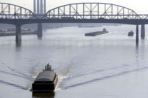
4. Runoff from croplands and sewage effluent from urban centers (e.g., Minneapolis/St. Paul, St. Louis, Chicago) contribute to eutrophication in the Upper Mississippi River.
The intense agricultural development of the Upper Mississippi River which includes heavily fertilized crops, fields with drainage tiles to enhance runoff, animal production and animal waste leads to high nutrient runoff during rain events. Furthermore, there are 30 million people living in the Upper Mississippi River watershed, and 80% of these people live in metropolitan areas. The largest metropolitan areas are Chicago, Minneapolis/St. Paul and portions of St. Louis (some of St. Louis is in the Missouri River watershed), and the Quad Cities produce large sewage inputs to the Upper Mississippi River. Due to the reversal of the Chicago River, the treated sewage discharges and stormwater runoff from Chicago now eventually flow into the Upper Mississippi River via the Illinois River.
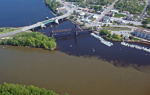
5. The Upper Mississippi River and its tributaries are major recreational areas, with popular boating, swimming, fishing and hunting areas.
The lake country of Wisconsin and Minnesota is a popular destination for recreational uses, largely in summer, but increasingly, year round residences. The high water quality due to a primarily forested watershed, low population density and lack of major industry makes this region particularly attractive for boating, swimming, fishing and hunting.
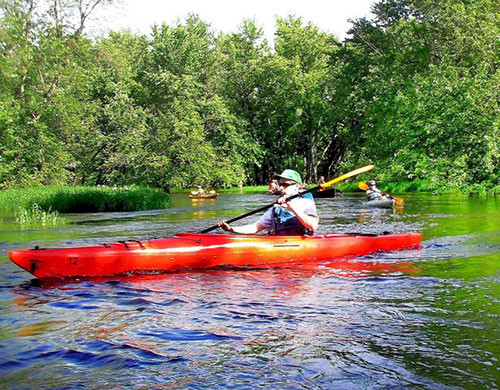
6. The Upper Mississippi River has a rich history of human settlement, with Native American paleo-Indians, hunters and gathers, potters and mound builders, and farmers, followed by French explorers, European fur trappers, and farmers and merchants.
Native American human settlement into the Upper Mississippi River occurred via different waves. The first humans to arrive were the paleo-indians who were mostly nomadic, hunting big game. The hunters and gathers came next and they made permanent settlements and began using the river for transportation. The potters and mound builders who came next had a more highly developed societal structure. Native American farmers were the last group to inhabit the region and they were largely displaced by waves of European immigration. The first Europeans to arrive were French explorers and fur trappers. They were followed by farmers and merchants and both the Great Lakes and the Mississippi River were used to transport Europeans into the region.
7. Major tributaries enter the Upper Mississippi River, including the Missouri, Illinois and Ohio Rivers.
The Upper Mississippi River is where the largest tributaries flow into the Mississippi River. The Ohio River, which includes the Tennessee River, joins the Upper Mississippi near Cairo, IL. Both the Missouri and the Illinois Rivers join the Upper Mississippi near St. Louis, MO. These major tributaries dramatically increase the navigable distances available for water transportation. They also provide significant water flow (e.g., Ohio River), nutrient inputs (e.g., Upper Mississippi River) and sediments (e.g., Missouri River).

About the author
Bill Dennison

Dr. Bill Dennison is a Professor of Marine Science and Vice President for Science Application at the University of Maryland Center for Environmental Science.