

Expanding the diversity of the Mid-Atlantic Tributary Assessment Coalition
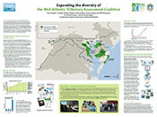 Since the 2006 release of the first EcoCheck Chesapeake Bay report card, environmental report cards have gained increasing popularity and recognition as a public-friendly and scientifically sound method for reporting the health of a waterway. Recently, a number of watershed organizations in the Mid-Atlantic region have begun producing their own tributary-specific report cards. In 2009, the Mid-Atlantic Tributary Assessment Coalition (MTAC) was formed to foster collaboration among watershed organizations and to fully develop the potential of region-specific environmental report cards. This can be accomplished through the standardization of indicators, monitoring and sampling protocols, data analysis methods, and science communication techniques.
Nanticoke and Sassafras River report cards released
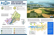 The two final tributary report cards to be released this year are from the Nanticoke and Sassafras Rivers. Both of these report cards are the first ever for their respective rivers, and are designed to look at the overall ecosystem health of their watersheds while also engaging local residents and helping them to better understand their river systems. Both rivers received passing scores, with the Nanticoke River receiving a final grade of B-minus, and the Sassafras River a grade of B. While those scores indicate that most water quality indicators met desired levels, there is still room for improvement. In particular, the Nanticoke scores showed a need for nitrogen reduction, and the Sassafras scores indicate that poor water clarity and high phosphate levels were problems of concern in 2009.
NPS Kaloko-Honokohau groundwater brochure
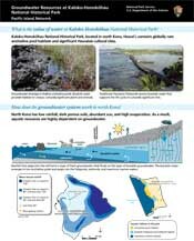 A collaboration between the National Park Service's Inventory and Monitoring Program, Kaloko-Honokohau National Historical Park, on the big island of Hawai'i, and IAN has produced this brochure intended for the informed audience of local land use planners and government officials, as well as informed park visitors. The focus is on the fragile natural and cultural resources such as anchialine pools, fishponds, and the nearshore marine areas that are reliant, to varying degrees, on the groundwater that filters through the park. Increasing withdrawal of groundwater by development wells upslope may cause changes to freshwater flow, with potential impacts upon these fragile ecosystems.
Booklet summarizing monitoring at Shenandoah National Park released
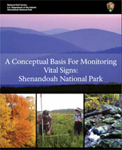 As a 200,000-acre natural oasis in the densely populated mid-Atlantic region, Shenandoah National Park is a refuge for both wildlife and people. Recently, in a partnership between IAN and Shenandoah National park, a booklet illustrating the unique natural resources in the park and demonstrating the need for natural resource monitoring was released. Understanding the natural processes and disturbances that influence natural resources and assessing the human-caused threats to those resources is the foundation for sound monitoring. This booklet explores how this understanding is gained, and also investigates the selection of vital signs—indicators of natural resource conditions.