

Land use and cover has management implications
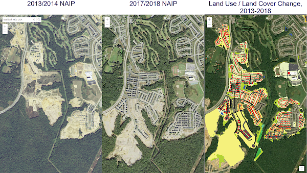
In partnership with the USGS, the IAN team produced a summary of the Chesapeake Bay Program's new Land Use/Land Cover (LULC) Project. The summary includes:
- The need to have a 1-m resolution data set
- The methods for data collection, synthesis, and mapping
- The major findings of the new data set analysis. The characterization of the types of land use show that turf grass is the largest “crop” in the watershed. The land-change analysis reveals that timber harvest produced the largest land change in the watershed
- Some management implications for the Chesapeake Watershed Agreement Goals and outcomes, including those for water quality, land conservation and healthy watershed, and vital habitat
You can view the summary on the USGS website. The LULC data sets are also available online, with 2013/2014 and 2017/2018 comparative maps.