

Kickoff of the Willamette River Report Card
 IAN, in collaboration with the Meyers Memorial Trust, has begun the development of the Willamette River Report Card. The 187-mile-long Willamette River is located entirely in Oregon and is a major tributary of the Columbia River. Flowing northward between the Oregon Coast Range and the Cascade Range, the Willamette River basin contains two-thirds of Oregon's population, including the state's largest city, Portland, positioned near the confluence of the Willamette and Columbia Rivers. Heath Kelsey, Tracey Saxby, and Simon Costanzo held introductory workshops in Portland and Corvallis, OR with eminent scientists in the area and relevant stakeholders associated with the management and use of the Willamette River and its watershed. Pam Wiley, from the Meyer Memorial Trust, hosted and gave an excellent tour of the lower and mid Willamette River. A workshop to fully develop the Report Card will be held in September 2014 with a draft available for review in December 2014.
Willamette River report card stakeholder workshop
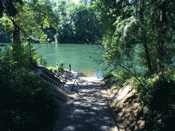
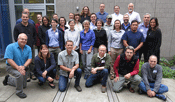 IAN, in collaboration with the Meyer Memorial Trust, held the first stakeholder workshop to develop the Willamette River Report Card. The first day of the workshop included a tour to visit key locations along the Willamette River, such as the Delta Ponds in Eugene, Berggren Demonstration Farm, Lookout Point Dam & Reservoir, and the Willamette Confluence Project. The 187-mile long Willamette River is located entirely in Oregon and is a major tributary of the Columbia River. Flowing northward between the Oregon Coast Range and the Cascade Range, the Willamette River basin contains two-thirds of Oregon's population, including the state's largest city, Portland, positioned near the confluence of the Willamette and Columbia Rivers. Heath Kelsey, Tracey Saxby, and Simon Costanzo conducted the workshop with eminent scientists and stakeholders associated with the management and use of the Willamette River and its watershed. It is anticipated that the report card will be released in spring 2015.
Blog and Video Highlights
Video
- Anne Bowser's "An Overview of Citizen Science and Crowdsourcing in Federal Agencies" is now available on our seminar series page and YouTube
Blog
- Webstock 2015: One day of peace & the internet
- Reginald V. Truitt in his own words: A visit to the Maryland Room archives
- In memory of Jay Zieman, University of Virginia seagrass ecologist
- Willamette River Report Card - I can see the light at the end of the tunnel
Willamette River Report Card released
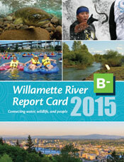 The Willamette River Report Card was released on Wednesday December 2, after a 1.5 year project involving the Willamette River Initiative at Meyer Memorial Trust and many partner organizations in the region. The project began with workshops in Corvallis and Eugene, OR, designed to illustrate the main features, processes, and pressures that affect the river and assign indicators to evaluate the rivers condition in the Upper, Middle, and Lower Willamette River segments. The Willamette scored a B- on the report card, based on indicators evaluating Water Quality, Fish and Wildlife, Habitat, Water Flow, and People and the River. The report card is accompanied by a detailed document that fully describes the process, indicators, and data analysis that were used in the report card process.