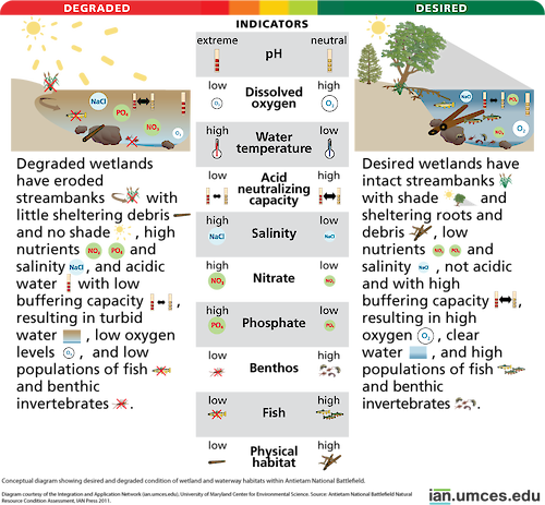
Diagram illustrating desired and degraded condition of wetlands and waterways within Antietam National Battlefield
Diagram illustrating desired and degraded condition of wetlands and waterways within Antietam National Battlefield.
diagram National Park Service Civil War National Capital Region Network Maryland Virginia| Property | Value |
|---|---|
| Author(s) | Jane Thomas |
| Author Company | Integration and Application Network |
| Date Created | 2010-12-31 |
| Album | Ecosystems > Other |
| Type | Graphic |
| Publication | Antietam National Battlefield Natural Resource Condition Assessment |
| Project(s) | ANTI-MONO-MANA Natural Resource Condition Assessments |
| Dimensions | 999 x 926 |
| Filesize | 194.1 kB |
| Number of Downloads | 333 |
| Filetype(s) | PNG |
| License | Attribution-ShareAlike 4.0 International (CC BY-SA 4.0) |
| Required Attribution | Jane Thomas, Integration and Application Network (ian.umces.edu/media-library) |