

History of Florida land area
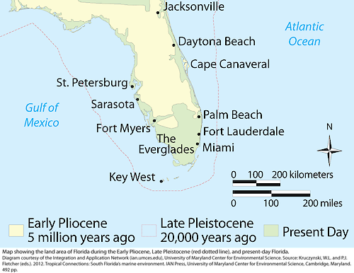
Map of the land area of Florida during the Early Pliocene, Late Pleistocene (red dotted line), and present-day Florida.
map illustration florida era pliocene south land historical| Property | Value |
|---|---|
| Author(s) | Kate Bentsen |
| Author Company | Integration and Application Network |
| Date Created | 2012-01-01 |
| Album | Ecosystems > Maps |
| Type | Photo |
| Publication | Tropical Connections: South Florida's marine environment |
| Project(s) | South Florida Ecosystem Synthesis |
| Dimensions | 1000 x 772 |
| Filesize | 115.7 kB |
| Number of Downloads | 389 |
| Filetype(s) | PNG |
| License | Attribution-ShareAlike 4.0 International (CC BY-SA 4.0) |
| Required Attribution | Kate Bentsen, Integration and Application Network (ian.umces.edu/media-library) |