

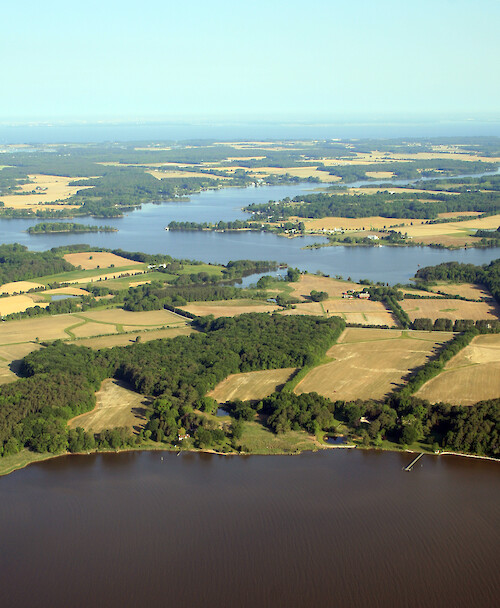
Quaker Neck
Looking across Quaker Neck to Broad Neck, which separates the West Fork of the Langford Creek (background) from the East Fork (mid-ground). Comegys Bight (Chester River) is in the foreground.
Chesapeake Bay aerial agriculture farms Chester River shoreline| Property | Value |
|---|---|
| Author(s) | Jane Thomas |
| Author Company | Integration and Application Network |
| Date Created | 2007-05-24 |
| Album | Ecosystems > Coastal/Marine |
| Type | Photo |
| Dimensions | 2191 x 2664 |
| Filesize | 3.8 MB |
| Number of Downloads | 301 |
| Filetype(s) | JPG |
| License | Attribution-ShareAlike 4.0 International (CC BY-SA 4.0) |
| Required Attribution | Jane Thomas, Integration and Application Network (ian.umces.edu/media-library) |