

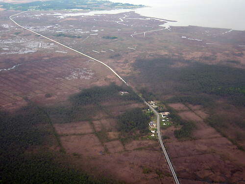
Route 363, Deal Island Road
Looking west alone Route 363, Deal Island Road. Mongrel Neck and Saint Peters Marsh are situated between the road and Monie Bay to the north. Pigeonhouse Creek and then Dames Quarter Creek can be seen in the background.
aerial Chesapeake Bay National Estuarine Research Reserve Deale Island Wildlife Management Area Dames Quarter Creek Pigeonhouse Creek NERR Monie Bay Somerset County Marylandcreek ditches forest marsh protected riparian buffer rural development tree| Property | Value |
|---|---|
| Author(s) | Ben Fertig |
| Author Company | Integration and Application Network |
| Date Created | 2008-05-01 |
| Album | Ecosystems > Coastal/Marine |
| Type | Photo |
| Dimensions | 3264 x 2448 |
| Filesize | 5.2 MB |
| Number of Downloads | 301 |
| Filetype(s) | JPG |
| License | Attribution-ShareAlike 4.0 International (CC BY-SA 4.0) |
| Required Attribution | Ben Fertig, Integration and Application Network (ian.umces.edu/media-library) |