

Blue River Report Card
Blue River Report Card
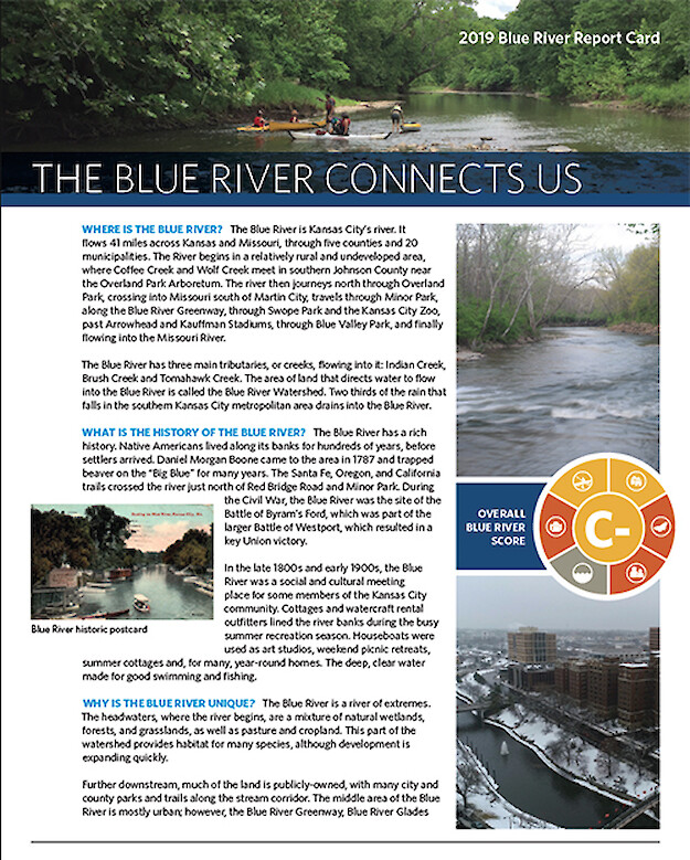
The Heartland Conservation Alliance proactively conserves, protects, and restores natural lands and open space within the Kansas City region, benefitting the community and future generations by improving water quality, creating recreational opportunities, protecting life and property, and preserving natural and cultural heritage. The Blue River is located in Greater Kansas City. The headwaters begin in Johnson County, Kansas, and the river flows through Kansas City, Missouri, to its confluence with the Missouri River. From the Missouri-Kansas state line to its confluence with the Missouri River, the Blue River meanders through more than 20 miles of suburban and urban neighborhoods, industrial areas, brownfields, wetlands, and forest. In 2017, the Heartland Conservation Alliance Conservation Work group reviewed report cards on rivers and watersheds from other communities, compiled data, and outlined measures to describe the Blue River Watershed. In Spring 2018, Heartland Conservation Alliance teamed up with UMCES to further progress the status of the report card, creating a format for reporting that educates, inspires actions, and maintains accountability. This includes a report card training course for a group of Heartland Conservation Alliance staff and partners and a report card workshop with key stakeholders, as well as continued consultation throughout the development of the Blue River Report Card.
Key Personnel


Timeframe
- Start: 2018-08-01
- Finish: 2020-01-01
- Duration: 1 year, 5 months