A Report Card for Coastal Yucatán
Heath Kelsey · | Environmental Report Cards | Science Communication |In Early August, Jane Hawkey and I traveled to Mérida and Sisal, to help initiate an ecosystem health report card for the Yucatán State coast of Mexico. We facilitated a two-day workshop with approximately 30 participants from around the State to begin the process of identifying the many values and issues important to the people in the coastal areas of Yucatán. This project also serves as a pilot for report cards in other Mexican Gulf States, which ultimately, we hope, will integrate into an ecosystem health report card for the entire Mexican Gulf Coast!
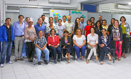
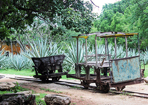
Our host, Dr. Paulo Salles Afonso de Almeida, organized the workshop in Sisal – made famous for the cactus grown in the area and the fiber that was exported and named after this port town – at the Laboratorio Nacional de Resiliencia Costera, Unidad Académica Sisal del Instituto de Ingeniería de la UNAM. The facilities were very nice and provided a great coastal backdrop for our discussions.
The workshop went very well, and the participants were all engaged and excited about the prospect of a report card for the coast of Yucatán. We did recognize that there were a few more perspectives that may be needed – the audience in our meeting was mostly from the science community, but it did have a small contingent from management agencies and the state government. We’ve recommended that additional community–based stakeholders also be included in future meetings to create a report card that is relevant to as many values and perspectives as possible. This is important, as it is a fundamental component of creating both buy-in from the larger community, but also because it generates a common vision among all parties, and is more likely to identify practical solutions that will be accepted by the community.

The coast of Yucatán is fascinating. It has karst geology, meaning it is mostly limestone, and is fractured with many underground rivers and subsurface water flow. The area has many “cenotes”, which are spots where the limestone has fallen in to reveal water holes below the surface. Historically, cenotes served as the major source of water for Mayan communities living in the region. Additionally, it is thought that the meteorite that struck the Earth about 66 million years ago, which may have led to the extinction of the dinosaurs, occurred just to the northwest of Yucatán, in the Gulf of Mexico. The resulting Chicxulub Crater created a ring of cenotes that follows the outer rim of the crater, forming a semicircular pattern centered just north of the coast.
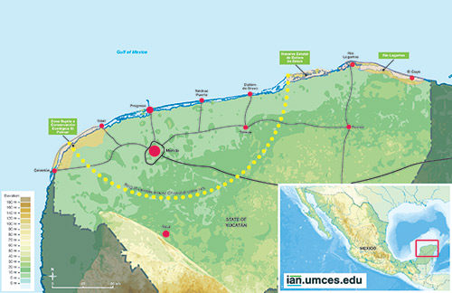
All of this geology is not just important for historical reasons and beautiful swimming holes. Because of the porous bedrock, there are no real rivers in the Yucatán State. Instead, water travels underground from the south to north, taking pollution from urban areas like Merida, villages with poor wastewater treatment facilities, and industry. The water travels much slower than rivers, of course, but also much faster than in other groundwater systems. Much of the water exits the subsurface into the coastal wetlands of the Gulf in two major springs that are associated with the outline of the Chicxulub Crater. Coastal water quality appears to be degraded in these areas because of it.

Other major issues on the Yucatán coast include unregulated development and fisheries, tourism (both positive effects to the economy and negative impacts from overuse), habitat destruction, coastal erosion, and of course severe storms and sea-level rise. The report card will address each of these items as we began to assess the state of knowledge around each of these issues.
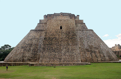
On the weekend, our wonderful hosts, Paulo and fellow scientist and wife, Irina, showed us some of the best and most interesting destinations in the area, including the port of Progresso, lunch at a beautiful sisal hacienda, and the Mayan ruins at Uxmal. The whole day, and indeed the whole trip, was fabulous, and I can’t wait to get back to Yucatán.
About the author
Heath Kelsey

Heath Kelsey has been with IAN since 2009, as a Science Integrator, Program Manager, and as Director since 2019. His work focuses on helping communities become more engaged in socio-environmental decision making. He has over 15-years of experience in stakeholder engagement, environmental and public health assessment, indicator development, and science communication. He has led numerous ecosystem health and socio-environmental health report card projects globally, in Australia, India, the South Pacific, Africa, and throughout the US. Dr. Kelsey received his MSPH (2000) and PhD (2006) from The University of South Carolina Arnold School of Public Health. He is a graduate of St Mary’s College of Maryland (1988), and was a Peace Corps Volunteer in Papua New Guinea from 1995-1998.