Australian cities and waterways: Brisbane, Moreton Bay and the Brisbane River
Bill Dennison · | Australian cities and waterways |Brisbane, Australia's third largest city, straddles the Brisbane River and is adjacent to Moreton Bay. Brisbane and Brisbane River are named after Sir Thomas Brisbane, a Premier of New South Wales before Queensland was created. Moreton Bay was named by Captain James Cook as he sailed by in 1770. Cook named it Morton's Bay after Lord Morton, President of the Royal Society, but a subsequent misspelling, Moreton, became the standard.

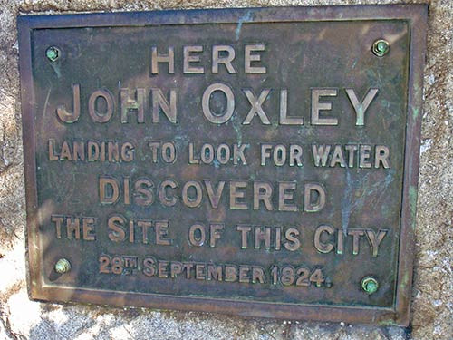
Matthew Flinders sailed into Moreton Bay in 1799 but did not find the mouth of the Brisbane River due to shoals and mangroves. The European explorer who discovered the Brisbane River was John Oxley in 1823, with the benefit of some escaped convicts, including Thomas Pamphlett, who had gotten lost and stumbled onto the Brisbane River. There is a recent entertaining book about searching for the location of Oxley's landing in the Brisbane region by Matt Condon. He reaches the conclusion that the Oxley marker in the city is not in the correct position.

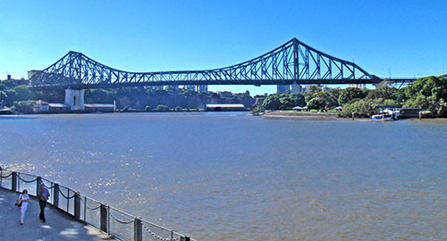
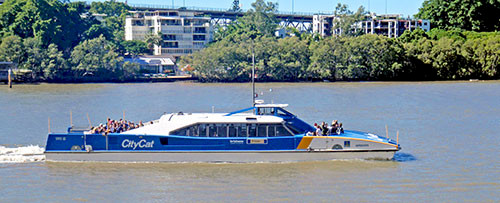
The Brisbane River, like Melbourne's Yarra River is muddy brown in color, although there are historical reports of good water visibility as recently as the mid twentieth century. Brisbane has recently embraced the river and there are well used bikeways along the river, a vibrant Southbank precinct with museums, theaters, restaurants and coffee shops, and popular passenger ferries known as City Cats.

Brisbane city is located at the site of adequate freshwater supplies (now known as Creek Street), and is over twenty kilometers upriver from the mouth at Moreton Bay. The Port of Brisbane is located at the mouth along with the airport and various industrial developments.
The floods of 2011 have given Southeast Queensland residents a strong reminder about the dangers of living on a flood plain in a variable climate. The Brisbane River went from a benign slowly moving estuary to a powerful and rapidly moving river. This transformation was recognized in the Healthy Waterways books which use the term 'river/estuary' to denote the dual nature of the Queensland rivers. For the vast majority of the time, they operate as estuaries, with salt water extending far up into the river reaches and the freshwater and salty water mixture sloshing back and forth with the tides. For short periods of time when the rivers are in flood, water is actually flowing, and the system acts like a river.

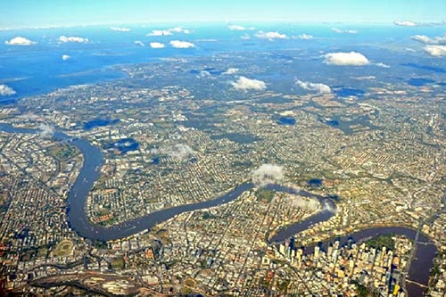
The Brisbane River snakes around the floodplain, confining the central business district to a small footprint, and providing each different reach with different vistas. The river has been celebrated with various festivals and is the location of various fireworks displays. The creeks that feed into the river also wind through the city and flying fox colonies nest in the mangroves along the river and creeks. There are a plethora of rowing clubs that use the river, particularly early in the morning.

Moreton Bay is Brisbane's playground, with large marinas, ferries to the various islands and swimming beaches. The water quality issues are largely in western Moreton Bay, and eastern Moreton Bay supports dugong and sea turtle populations. The juxtaposition of dugongs and sea turtles with a major city skyline is globally unique.
Moreton Bay has had blooms of toxic cyanobacteria (Lyngbya majuscula), and the increased turbidity due to sediments derived from the watershed have detracted from its use for recreational swimming. Historically, the western shore beaches were very popular, but now people generally travel to the ocean beaches of the Sunshine or Gold Coasts for swimming.
The relationship that Brisbane people have with the river has evolved, due to the devastating floods and due to increasing perception of the river as a lifestyle amenity. The office buildings and residential homes and apartments have begun to focus on the river, providing views and access. Similarly, Moreton Bay is seen as an increasingly attractive place to live, with developments along the foreshores, islands and access points in the streams and rivers.
References:
Condon, M. Brisbane. 2010. University of New South Wales Press, Sydney. 312 pp.
About the author
Bill Dennison

Dr. Bill Dennison is a Professor of Marine Science and Vice President for Science Application at the University of Maryland Center for Environmental Science.