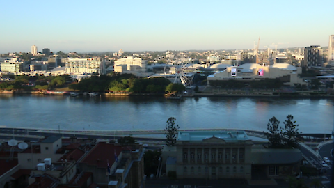
The tires squeaked as the airplane touched down. A few … minutes later, I stepped out into steaming air on the far side of the world. Even in the middle of winter, Brisbane can feel almost tropical. Heat shimmered … on the tarmac in the morning light. Flocks of lorikeets flashed yellow, red and … green as they raced each other through the treetops. In the distance, Moreton … bay glinted deep orange, reflecting the hazy outline of the rising sun. Brisbane Skyline.
The Brisbane skyline, as seen from our hotel balcony. Image credit: James Currie … I recently had the opportunity to travel with Dr. Bill Dennison to Brisbane, Australia. We planned to conduct a variety of interviews with scientists, stakeholders, and policymakers on the Healthy Waterways Project. It was to be my first time ‘down under,’ and I was excited to glimpse the southern hemisphere. When we arrived, the first thing that struck me was the heat.
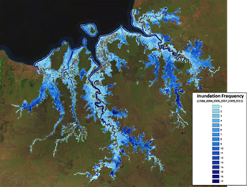
I met Jane Hawkey in Brisbane May 18-19 to facilitate a synthesis workshop on floodplains research in Northern Australia under the National Environment Research Program Northern Hub (NERP Northern). Our goal is to piece together the larger story being told by individual research components.
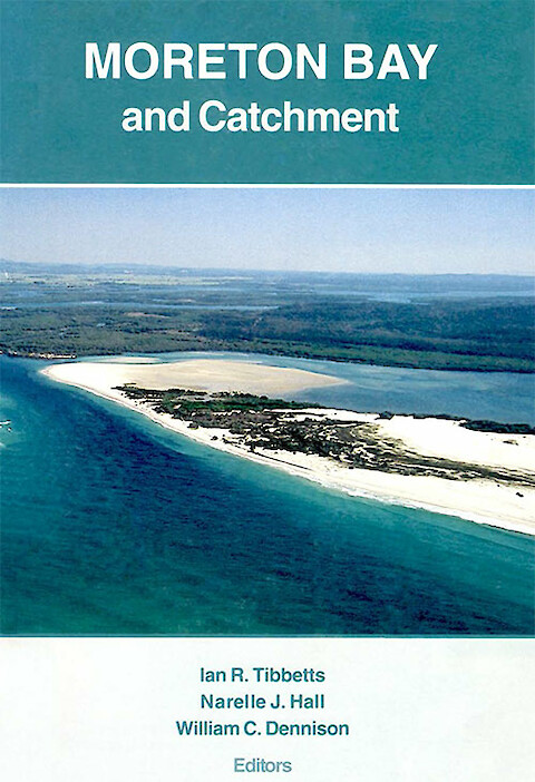
This book was produced by the fledgling School of Marine Science, The University of Queensland at the outset of a rekindled scientific interest in Moreton Bay, its tributaries and its catchments, or watersheds. Previous conferences regarding the Brisbane River and Moreton Bay resulted in short conference proceedings books; Brisbane River: A Source Book for the Future, Future of Marine Science in Moreton Bay, and Moreton Bay in the Balance.
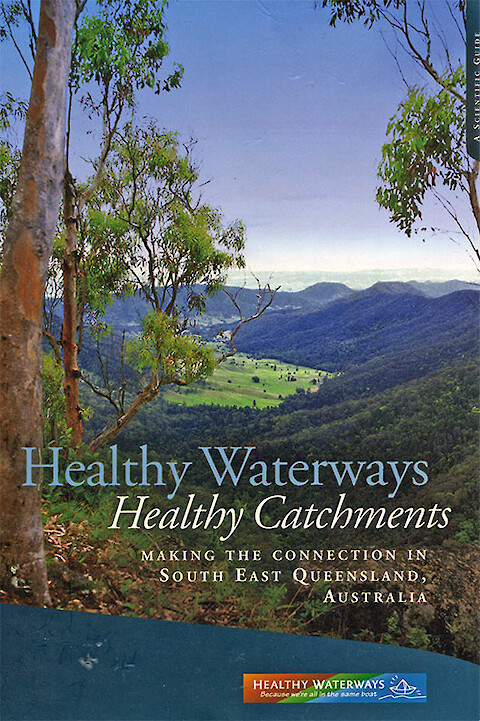
Healthy Waterways Healthy Catchments is now available for free in PDF format from IAN press. Healthy Waterways Healthy Catchments: Making the connection in South East Queensland, Australia … This 238 pp. book was the fourth in a series of four books produced as part of the Healthy Waterways campaign in Southeast Queensland. It was published in 2005 and summarized the scientific findings from a variety of different projects that were conducted as part of Phase 3 of the Healthy Waterways program.
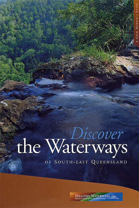
Discover the Waterways is now available for free in PDF format from IAN Press. Discover the Waterways of South-East Queensland … This book was the third of a series of four books produced as part of the Healthy Waterways campaign in Southeast Queensland. It was published in 2001 and was intended to provide citizens with enough context to view key ecosystem features from different vantage points around Southeast Queensland.
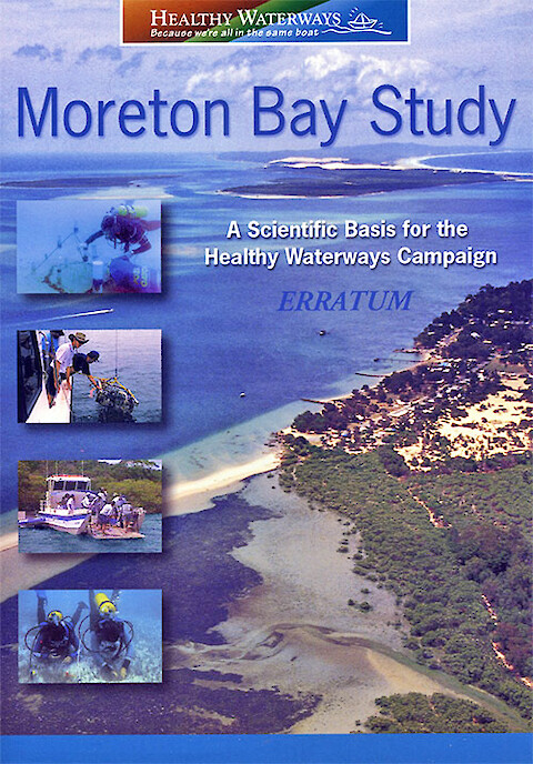
Moreton Bay Study is now available for free in PDF format from IAN Press. Moreton Bay Study: A Scientific Basis for the Healthy Waterways Campaign … This book was the second of a series of four books produced as part of the Healthy Waterways campaign in Southeast Queensland. It was published in 1999 and was the first summary of the scientific findings of Healthy Waterways.
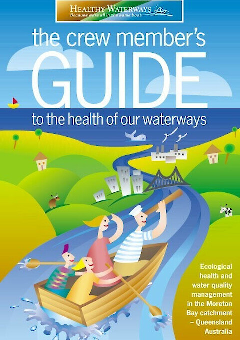
The crew member's guide to the health of our waterways is now available for free in PDF format from IAN Press. The crew member's guide to the health of our waterways … This short book (~100 pp.) was the first of a series of four books produced as part of the Healthy Waterways campaign in Southeast Queensland. It was published in 1998 and was a key component of the campaign in a variety of ways. First, the book was inexpensively priced to encourage wide dissemination.
Melbourne, the second largest Australian city, straddles the Yarra River near the mouth where it joins Port Phillip Bay. The location of Melbourne's central business district is adjacent to the first waterfall (since removed) at the site of the Princes Bridge, built in 1888. The Port of Melbourne, Australia's busiest port, is located at the mouth of the Yarra River. Port Phillip Bay is a large bowl with a narrow opening into Bass Strait which separates Australia from Tasmania.
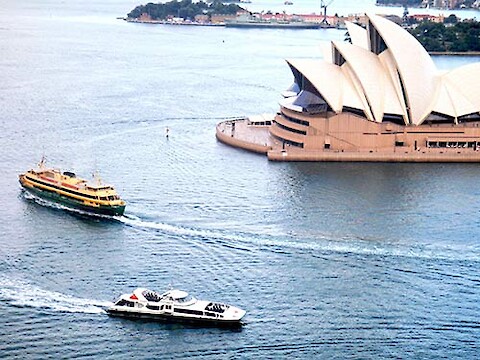
Sydney, Australia's largest city, is built around Sydney Harbour. The original European visit to the area by Captain James Cook on the Endeavour was when he anchored just south of Sydney in Botany Bay in 1770. Cook named it Botany Bay in honor of his botanists on board, led by Sir Joseph Banks. Botany Bay is now where Sydney airport is located and is fairly industrialized.