Australian cities and waterways: Melbourne, Port Phillip Bay and the Yarra River
Bill Dennison · | Australian cities and waterways |Melbourne, the second largest Australian city, straddles the Yarra River near the mouth where it joins Port Phillip Bay. The location of Melbourne's central business district is adjacent to the first waterfall (since removed) at the site of the Princes Bridge, built in 1888. The Port of Melbourne, Australia's busiest port, is located at the mouth of the Yarra River. Port Phillip Bay is a large bowl with a narrow opening into Bass Strait which separates Australia from Tasmania. Melbourne is named after William Lamb, 2nd Viscount Melbourne, a British Prime Minister. The Yarra River is named after an aboriginal (Wurundjeri people) word 'Yarrak', meaning waterfall. Port Phillip Bay is named after Arthur Phillip, the first Governor of New South Wales who arrived with the ‘First Fleet’ in Sydney Harbour in 1788.
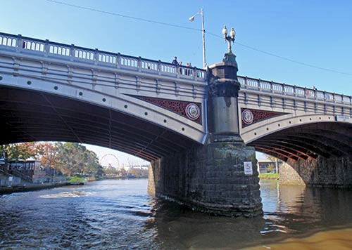
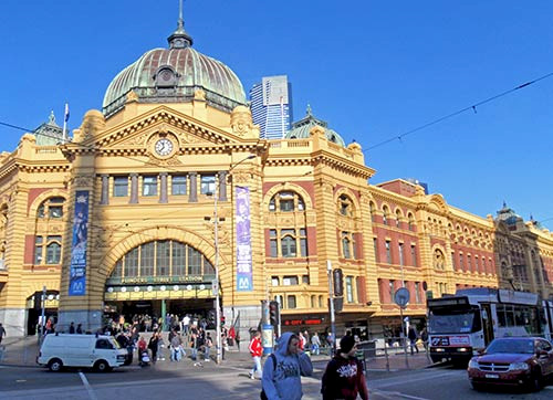
There are many bridges across the Yarra River which include pedestrian bridges and vehicle bridges. Since the port is located downstream and the Yarra water level does not vary appreciably, the bridges in the central business district are quite low and the boats need to be correspondingly low to the water. Melbourne, like Brisbane and Sydney have parks and bikeways along the waterways with tour boats that ply the waterways. They have an annual Moomba Festival which celebrates the river. Melbourne has a Southbank precinct with entertainment venues and museums across the Yarra River from the business district. Melbourne's iconic Flinders Street Station is along the Yarra River, and it is a busy transportation hub for the city.
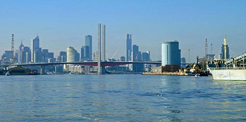
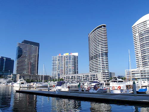
On a boat ride from downtown to the Port of Melbourne, I could see Melbourne Cricket Ground, the largest cricket stadium in Australia that has hosted many famous sporting events. The Rod Laver Arena (in Melbourne Park) is also located along the Yarra River, the site of the annual Australian Open tennis tournament. Melbourne hosted the 1956 Summer Olympics. The Melbourne Aquarium is on the Yarra River, as well various modern residential buildings with river views and marinas in the Melbourne Docklands section. There were live aboard boats along a stretch of the river near the Port of Melbourne. The container port area was active with container ships being loaded and unloaded, tugboats and a cement ship heading upriver.
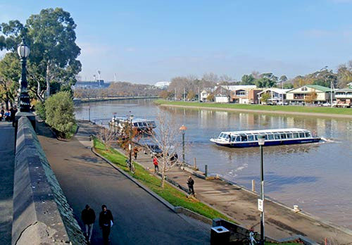
The Yarra River is very brown and muddy, sometimes referred to as the 'river that runs upside down'. The catchment is not particularly large, but the clay soils and urbanized land use contribute to the brown water color. There are litter traps along the river and regular occurrences of bacterial contamination. It has been estimated that some 350,000 cigarette butts find their way into the river every year. Ian Kiernan, the man responsible for a very successful program called "Clean Up Australia Day", told me a few years ago that cigarette butts had become the largest litter item collected.
Port Phillip Bay is a fairly circular bowl, except for Geelong Arm at the nine o'clock position. Melbourne and the Yarra River are located at the twelve o'clock position and the mouth of the Bay connecting it to Bass Strait is located at the seven o'clock position. The mouth of Port Phillip Bay has Point Lonsdale on the west near the town of Queenscliff and Point Nepean on the east near the town of Sorrento. A vehicular ferry regularly crosses the mouth, which saves a long drive through Melbourne around the Bay. The European discovery of Port Phillip Bay was by John Murray and shortly followed by Matthew Flinders in 1802.
Considering the long residence time of Port Phillip Bay (circa 400 days), and the large size of Melbourne (4+ million residents), the most amazing thing is the relatively good environmental condition of Port Phillip Bay. Melbourne residents regularly travel to the St. Kilda beaches via their famous trams for a swim. The biggest problem is the rapidly changeable weather due to Bass Strait fronts, but the swimming beaches are remarkably safe and clean. One of the most forward thinking engineering works by Melbourne Water was to purchase a large tract of Port Phillip Bay beach front in the ten o'clock position, over 10,000 hectares in size. The Western Treatment Plant, located near the town of Werribee, has been able to grow as Melbourne grew, develop advanced wastewater treatment techniques, use large treatment ponds and land application of wastewater. The success of the Western Treatment Plant shows that if you have a long residence time in receiving waters, it is necessary to have long residence times in wastewater treatment (thereby reducing the nutrient release).
About the author
Bill Dennison

Dr. Bill Dennison is a Professor of Marine Science and Vice President for Science Application at the University of Maryland Center for Environmental Science.