Developing a Mississippi River report card: Upper Mississippi River workshop in the Quad Cities
Bill Dennison · | Environmental Report Cards |The IAN crew (Bill Dennison, Heath Kelsey, Bill Nuttle, Caroline Wicks) traveled to Moline, Illinois to facilitate the first of a series of workshops that will occur throughout the massive Mississippi River watershed. This workshop was focused on the Upper Mississippi River watershed - extending from Minnesota and Wisconsin in the north,including large portions of Illinois, Iowa and Missouri, and extends to the junction of the Missouri River near St. Louis, MO. The Quad Cities of Moline and Rock City, IL and Davenport and Bettendorf, IA are fairly central in the Upper Mississippi watershed and were a good choice for the workshop location.

Our hotel was on the banks of the Mississippi River, we listened to the many trains that passed through, and we visited the John Deere Pavilion. The location of the Quad Cities has a lot to do with the location of the first railway crossing of the Mississippi River. The Quad Cities are in the center of the United States corn (and soy) belt, and Moline is the site of the original John Deere factory, producing tractors and other farm equipment.

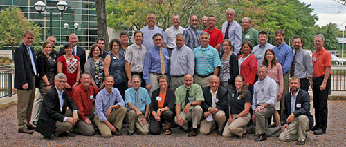
The workshop was held in a light and airy conference room next door to the John Deere museum. Our Nature Conservancy colleagues (Barbara Allison, Jordy Jordhal, and Jonathan Higgins), organized the venue and put together a diverse and experienced suite of participants. The knowledgeable participants gave us a crash course on Upper Mississippi issues.

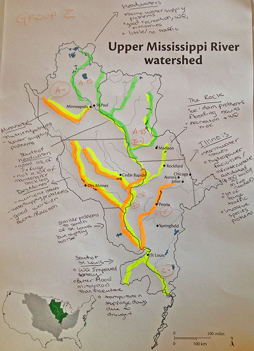
The population centers of Chicago, Minneapolis/St. Paul and the Quad Cities produce sewage and storm water runoff. The fertilizer and chemicals used to produce corn, soy and other crops contribute to agricultural runoff. The Mississippi River is actually a series of lakes and navigation locks that produce a couple of dozen stair step water levels between Minneapolis/St. Paul and St. Louis. In addition, the Illinois River is another series of lakes and locks between Lake Michigan/Chicago and St. Louis. The upper part of the watershed in Minnesota and Wisconsin is largely forested 'lake country'. The lower part of the watershed is prone to flooding with levees that both protect riverside properties and serve to constrain the river.

Mark Twain, who grew up alongside the Mississippi River and piloted a steamboat up and down the river, wrote a book "Life on the Mississippi". He wrote in that book, "But the basin of the Mississippi is the body of the nation." He is making reference to the watershed of the Mississippi River, which includes parts of 31 U.S. states and two Canadian provinces. He also wrote "The Mississippi is well worth reading about. It is not a commonplace river, but in contrast is in all ways remarkable." Twain also called the Mississippi the ". . . crookedest river in the world."
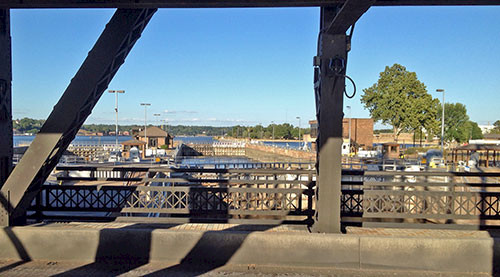
The Quad Cities were a good location to view key features of the Upper Mississippi River. We visited the John Deere museum and saw a John Deere monument, a testament to the corn (and soy) belt in this region. We walked several miles along the riverbank and saw several sewage overflow pipes, a product of the urban footprint of the Quad Cities. We also saw lotus lily pads, ducks and herons. We walked across a double decker swing bridge, with a rail line on the upper deck and automobile lanes on the lower deck. We crossed the bridge from Illinois to Iowa and could see one of the many dams and navigation locks of the Mississippi River.

In order to summarize the workshop, I adapted the song Ol' Man River from "Show Boat", made famous by Paul Robeson:
Ol' Man River
Ol' man river,
Dat ol' man river
We mus' know sumpin'
But don't say nuthin',
We jes' keeps gradin'
We keeps on gradin' along.
We get our data
We make our maps,
An' dem dat grades 'em
is soon forgotten,
But ol' man river,
He jes keeps rollin' along.
You an' me, we sweat an' strain,
Brains all achin' an' racket with pain,
Make that grade!
For each subbasin!
Git some indicators
An' you make a grade.
Don't get weary
An' sick of tryin'
Ah'm tired of gradin'
An' skeered of failin',
But ol' man river,
He jes' keeps rolling' along.
Ol' man river,
Dat ol' man river
We mus' know sumpin'
But don't say nuthin',
We jes' keeps gradin'
We keeps on gradin' along.
About the author
Bill Dennison

Dr. Bill Dennison is a Professor of Marine Science and Vice President for Science Application at the University of Maryland Center for Environmental Science.