Did you know the Willamette River flows north?
Tracey Saxby · | Environmental Report Cards |One of the things I love most about my job is that I’m constantly learning about different places, working with local experts that share their knowledge and passion for the place they live, and the science they do. Right now I’m learning about the Willamette River in Oregon, as the IAN team is working in partnership with Meyer Memorial Trust to develop an Ecosystem Health Report Card for the main stem of the Willamette.
The Willamette River is a major tributary of the Columbia River, flowing northward in a wide river valley between the Cascade Range and the Oregon Coast Range. To get us all up to speed on the features of the river and some of the challenges it faces, Meyer Memorial Trust invited local and regional experts and stakeholders together for a tour of some of the key locations along the Willamette, followed by a science workshop in Eugene, Oregon.
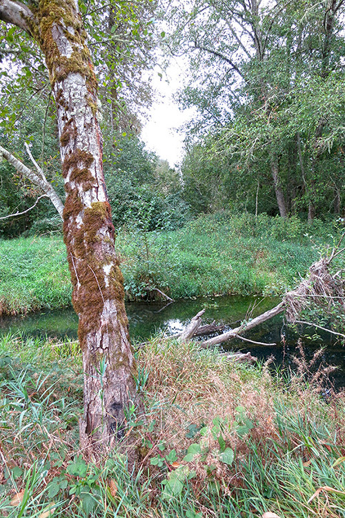
The first stop on our tour was the Delta Ponds in Eugene, which are currently being restored by the City of Eugene to reconnect this former side-channel back to the main stem of the river. One of the biggest challenges for the Willamette River is that flood control, development, and land use practices have restricted the river and where and how it flows. The complex network of side channels, ponds, and wetlands have been lost over time, along with more than 60% of the original floodplain forest that bordered the river. By restoring the Delta Ponds as a side channel of the Willamette River, it provides critical habitat types that are very important for salmon, turtles, beavers, river otters, and birds.


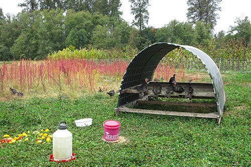
Next up was the Berggren Demonstration Farm, an organic 30-acre farm along the Mackenzie River (one of the key tributaries for the Willamette). The property has an extensive and intact network of side channels and a healthy floodplain forest. The farm has partnered with the Eugene Water and Electric Board to showcase how sustainable agriculture can be integrated with habitat conservation and restoration efforts. Efforts to remove invasive species in the floodplain forest has resulted in an interesting role reversal: instead of the farm being the source of nutrients, pesticides, or other toxicants, any chemicals used to eradicate invasive plants in the surrounding forest have to consider the impacts on the farm!


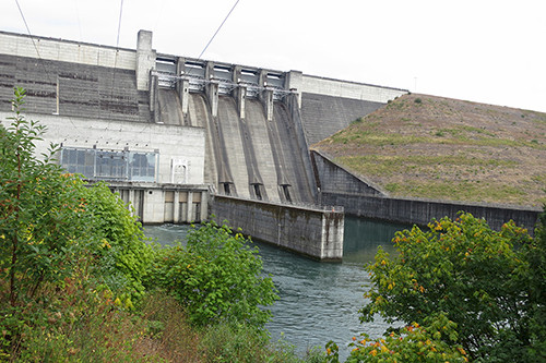
I mentioned earlier that flood control has in part restricted the flow of the Willamette River; in fact, there are more than 371 dams throughout the Willamette River Basin, although only one on the main stem of the river itself. These dams provide water for irrigation, generate hydro-electric power, and protect against floods. Our next stop was to check out one of these dams: Lookout Point Dam. This was the first time I’d ever been inside a dam wall, and it was pretty awe-inspiring to see the hydro-electric generator units, as well as the control room. One of the biggest challenges with dams is that they prevent salmon from being able to travel up the river to key spawning grounds. At present, adult salmon are literally scooped out of the river below the dam and transported by truck up and around the dam. Scientists and engineers are still trying to figure out how to deal with the juvenile salmon or fry returning on their way down the river.


Last stop of the day was at the Willamette Confluence Project, which is over 1000 acres of property acquired by The Nature Conservancy with the goal to reconnect the river to its historic floodplain. The site has been mined extensively for gravel, and there are several old gravel pits of various depths with steep banks throughout the property. Our group was invited to help fill one of these in by throwing rocks into the pit… amazing how such a simple pleasure can make everyone feel like a big kid again.


Back on the bus one last time, but now with a much better understanding of some of the key issues and challenges facing the Willamette River. I’m looking forward to seeing the results of the workshop as we work together with all the various stakeholders to produce this report card.
How healthy do you think the Willamette River is?