Environmental literacy for the Assabet, Sudbury and Concord Rivers
Bill Dennison ·As part of a report card project that we recently initiated with our partner organization, OARS for the Assabet, Sudbury and Concord Rivers, we reviewed the essential features and major issues associated with these rivers. They are presented as seven environmental literacy principles:
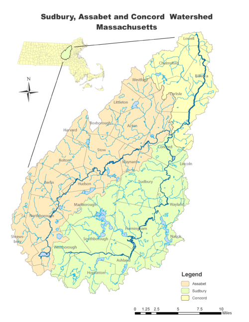
- The Assabet, Sudbury and Concord Rivers (SuAsCo sub-basin) are tributaries to the Merrimack River in the metropolitan fringe of Boston, Massachusetts.
- The Assabet, Sudbury and Concord Rivers traverse a glacial landscape in which kettle ponds, drumlins, and shallow bedrock predominate.
- The watershed of the SuAsCo river system supports mixed land use that includes remnant forest patches, agriculture, residential housing, and extensive wetlands.
- The Assabet, Sudbury and Concord Rivers have had various phases of human interaction which contribute to its current status: agrarian, transportation, industrial, wastewater conveyance, and recreation phases.
- The Assabet, Sudbury and Concord Rivers are challenged by significant domestic wastewater flows, superfund sites, legacy sediment contamination, dams, and emerging contaminants.
- The Assabet, Sudbury and Concord Rivers provide quality recreational opportunities near a large metropolitan center and serve as a drinking water supply in lower reaches.
- The significant historical and literary features of the region led to a Wild and Scenic River designation and serve to attract visitors to the Assabet, Sudbury and Concord Rivers.
The Assabet, Sudbury and Concord Rivers (SuAsCo sub-basin) are tributaries to the Merrimack River in the metropolitan fringe of Boston, Massachusetts.
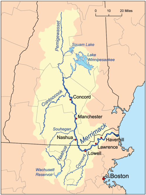
The Merrimack River is 117 miles (188 km) long, flowing southward through New Hampshire into Massachusetts and emptying into the North Atlantic Ocean near the New Hampshire/Massachusetts border. The Assabet, Sudbury and Concord Rivers form a northward flowing tributary which joins the Merrimack River in Lowell, MA, about 50 miles (80 km) upstream from the Atlantic Ocean. The SuAsCo river system is in the metropolitan fringe of Boston, MA, about 20 miles (32 km) from downtown Boston.
The Concord River is 16 miles long (26 km) between the Merrimack River and the confluence of the two major tributaries of the Concord River, the Assabet and Sudbury Rivers. The confluence is located at Egg Rock, in the town of Concord.
The Assabet, Sudbury and Concord Rivers traverse a glacial landscape in which kettle ponds, drumlins, and shallow bedrock predominate.
Continental glaciers covered the region until ca. 10,000 years ago and the landscape was shaped by the retreat of the glaciers. Kettle ponds were formed when blocks of ice broke off the receding glacier, were buried in the outwash sediments and eventually melted, forming a depression. The relief is gentle in the region, but there are drumlins - small elongated hills - which were formed near the margin of continental glaciers and are composed of clay, silt, sand, gravel and boulders. The glacial landscape resulted in shallow bedrock, which means the groundwater reserves are limited, but recharge quickly.
The watershed of the SuAsCo river system supports mixed land use that includes remnant forest patches, agriculture, residential housing, and extensive wetlands.
The watershed supports remnant Eastern broadleaf forest patches, dominated by red oak, red maple, sugar maple, black birch, white pine and hemlock trees. Once extensively forested, the remnant forests are largely secondary growth. Agriculture in the region is mostly small family farms. Agricultural products include hay farming, greenhouses, nurseries, vegetables and horses. The region is typified by low density residential housing, although there are some more densely populated town centers. There are extensive wetlands associated with the rivers, including the Great Meadows National Wildlife Refuge, and the Assabet River National Wildlife Refuge.
The Assabet, Sudbury and Concord Rivers have had various phases of human interaction which contribute to its current status: transportation, agrarian, industrial, wastewater conveyance, and recreation phases.
The Native Americans that inhabited the SuAsCo region used the rivers for fishing and transportation. “Assabet” comes from an Algonquian word for “the place where fishing nets are made,” and the Algonquian name “Musketaquid,” which means “grassy plain,” referred to the region where Concord is located. European settlers came early to the region, in 1635, and founded Concord: the oldest inland town in the Massachusetts Bay Colony.
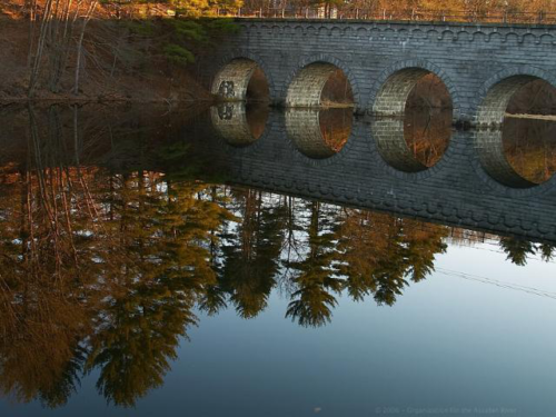
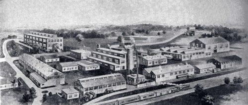
Early settlers learned to grow corn from the Native Americans, and returned the favor by decimating them with smallpox that they brought from England. The SuAsCo rivers were important transportation corridors until the construction of mills which supported the industrialization of the region. Sawmills, gunpowder mills and cotton mills using water power in the rivers led to dam construction in the 17th and 18th centuries.
As the population grew, the rivers became largely conveyances for wastewater. The rivers are still conveyances for wastewater, but sewage treatment and groundwater infiltration have lessened the impact on water quality. The rivers have been, and continue to be highly valued for recreation. Currently, paddling, fishing, biking, bird watching and hiking are popular recreational activities.
The Assabet, Sudbury and Concord Rivers are challenged by significant domestic wastewater flows, stormwater inputs, superfund sites, legacy sediment contamination, dams, and emerging contaminants.

At low flows, the water flow in the Assabet River is predominately comprised of treated wastewater. As a legacy of the industrial phase, there is chemical contamination. The Nyanza Chemical Waste Dump Site is a Superfund site, and mercury contamination in sediments occurs in the Sudbury River. These mercury levels result in contaminated fish and permanent non-consumption advisories. Impervious surfaces near the rivers heighten the effect of stormwater runoff. The dams and canals that were built for the mills impede fish passage and cause sediment build up. Emerging contaminants in the water result in intersex fish, and have other unknown consequences.
The Assabet, Sudbury and Concord Rivers provide quality recreational opportunities near a large metropolitan center and serve as a drinking water supply in lower reaches.
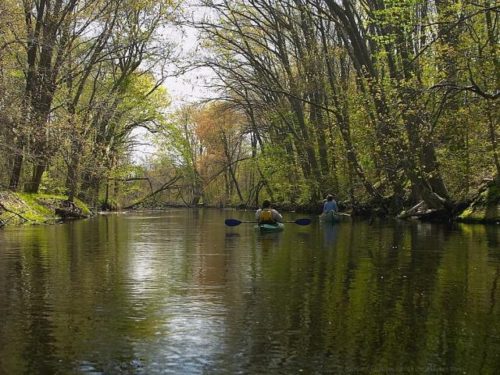
The SuAsCo rivers provide recreational opportunities for local residents and visitors. Paddling canoes and kayaks is a popular activity and there is a boat rental facility on the Sudbury River. Fishing for trout and bass is popular. Bird watching is popular, with iconic birds like osprey, bald eagles and blue herons, and many species of smaller birds. There are an increasing number of hiking and bike paths along the rivers, which are popular ways to view the rivers. Historically, the rivers were drinking water sources for local communities, and for Boston. Now the only drinking water source directly from the rivers is the Billerica dam and water treatment facility on the Concord River.
The significant historical and literary features of the region led to a Wild and Scenic River designation and serve to attract visitors to the Assabet, Sudbury and Concord Rivers.
The Battles of Lexington and Concord were the first of the American Revolutionary War. Ralph Waldo Emerson wrote “Concord Hymn” in 1837, a poem commemorating this battle. The famous term “a shot heard round the world” came from this poem. Henry David Thoreau (1817-1862) was born and raised in Concord and he spent a considerable amount of time on and around the rivers. Thoreau’s first book was A Week on the Concord and Merrimack Rivers, which recounts his voyages on the waterways with his brother.
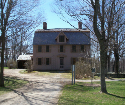
Walden Pond is an example of a kettle pond near the Sudbury River that has a lot of history. Thoreau spent 2 years, 2 months and 2 days living in a small cabin on Walden Pond in the Sudbury River watershed, resulting in his book Walden: or Life in the Woods. While living there, Thoreau wrote the influential essay “Resistance to Civil Government (Civil Disobedience).” The famous American author Emerson (1803-1882) lived in houses adjacent to the rivers, even housing Thoreau for some time. A contemporary prolific author was Nathaniel Hawthorne (1804-1864) also lived in the region.
About the author
Bill Dennison

Dr. Bill Dennison is a Professor of Marine Science and Vice President for Science Application at the University of Maryland Center for Environmental Science.

