Exploring an Ecosystem in Transition: On the Road to Flamingo II
Bill Nuttle ·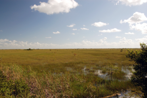
We saw possible signs of the Everglades’ response to accelerated sea level rise at our next stop, the Pay-hay-okee overlook. Beyond Taylor Slough the road continues west through rocky pineland upland habitat before heading south through freshwater marl prairie. The overlook is built on the edge of Shark River Slough, the park’s other, larger flow way. This is the “River of Grass" made famous by writer and environmental activist Marjory Stoneham Douglas. Shark River Slough is the dominant feature on the landscape of Everglades National Park. At Pay-hay-okee, Shark River Slough is about ten miles wide. From the observation tower we could see only a very small portion of the slough even though the landscape stretches to the horizon.
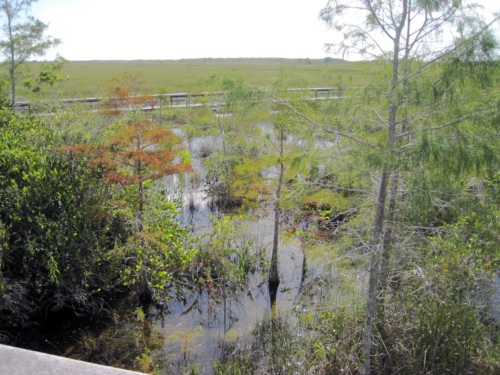
The Pay-hay-okee observation tower sits in a marl prairie, and we got a close-up look at this habitat and a cypress dome along the boardwalk between the parking lot and the tower. Small cypress dot the prairie. Cypress trees create conditions that favor their growth when they grow close together, and stands of cypress take on a characteristic domed profile. The prairie was wet on the day of our visit. Periphyton collected in discontinuous mats around sawgrass stems, which protruded about two feet above the water surface, fish swimming below. Periphyton is a calcareous alga, which means that it becomes encrusted with carbonate minerals. It is also a key indicator of the health of the ecosystem. During the dry season, when water levels recede, the periphyton mat dries out and decomposes to produce a muddy sediment – marl.
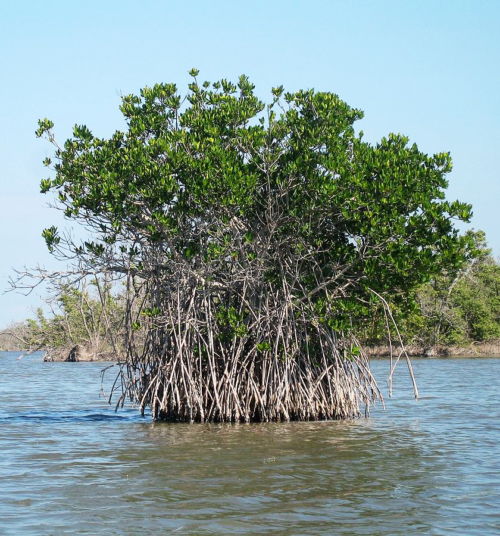
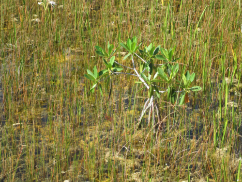
Something caught my eye while walking along the boardwalk back to the car: a small red mangrove tree stood alone in the sawgrass, clearly out of place. The red mangrove is immediately identifiable from its roots, which grow out and down from the trunk like the flying buttresses of a gothic cathedral. The roots of the red mangrove provide the support needed to remain upright when growing along the unstable banks of coastal creeks, their usual habitat. Why was this salt-tolerant tree here, in the marl prairie, over twenty miles inland from the coast? Possibly, this is the advanced guard in the invasion of the Everglades by the sea. In any case, the mangrove was a reminder that, if current projections of sea level rise are correct, the Gulf of Mexico coast will migrate inland to Pay-hay-okee within our lifetimes.
During our drive, the transition from freshwater marl prairie into estuarine mangrove swamp occured gradually over an interval of several miles. At first, the scattered small cypress trees were replaced by scattered dwarf mangroves. Closer to the coast, the marl prairie merged completely into a landscape of continuous mangrove swamp, open water ponds, and mosquitoes. Flamingo is known throughout South Florida because of the ferocity of its mosquitoes.
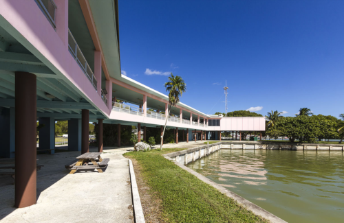
The road emerged from the mangroves at Flamingo, located on the north shore of Florida Bay and the eastern edge of Cape Sable. It was here that we learned about an experiment that foreshadows the possible future impacts of accelerated sea level rise on the Everglades. Whitewater Bay is the largest in a vast network of interconnected lakes that provide access to the interior of the mangrove coast all the way from Cape Sable 50 miles to the northern limit of the park at Everglades City. When Everglades Park first opened, traveling to Whitewater Bay from Flamingo required a 40-mile boat trip. However to the south, only a five-mile-long mangrove forest separates Florida Bay, Flamingo from Whitewater Bay.
In 1957, workers constructed the Buttonwood Canal to provide direct access, by boat, between the two locations. Opening a broad, deep water channel between Whitewater Bay and Florida Bay immediately revealed two things about the coastal mangrove swamp. First, the mangroves provide an effective barrier to water flow between the lakes in their interior and the coastal marine waters of Florida Bay. Second, the ecological health of both systems depends on limiting this exchange. The ecology of Whitewater Bay suffered from the injection of salty marine water by tidal flow through the Buttonwood Canal, and the ecology of Florida Bay suffered from the injection of fresh nutrient-rich water in the outflow from the canal when water level were high in the Everglades. A plug was installed in the Buttonwood Canal at Flamingo in 1982. The canal no longer connects directly to Florida Bay; although it still provides boat access from Flamingo to Whitewater Bay.
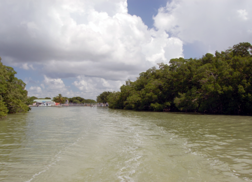
Coastal mangroves impede the intrusion of salt water into the Everglades both directly, their roots and trunks providing a barrier to water movement, and indirectly, by trapping sediments and raising the level of the shoreline. Here, the mangrove swamp, called the Buttonwood Ridge, built a distinct topographic feature along the north shore of Florida Bay. At about a foot and a half above sea level, the Buttonwood Ridge is a natural tidal barrier that holds back salty marine water from the freshwater Everglades.
The Buttonwood Ridge is not a perfect barrier against the intrusion of saltwater from Florida Bay. Freshwater flowing south through Taylor Slough and sheetflow across the marl prairie is impounded behind the Buttonwood Ridge. The flow of freshwater toward Florida Bay through the Buttonwood Ridge provides an additional hydraulic barrier to the intrusion of salt water, and the freshwater impounded behind the ridge buffers the impacts salt water that makes its way across the ridge into the freshwater ecosystem. Reduced freshwater flow from the Everglades decreases the effectiveness of this hydraulic barrier and increases the vulnerability of the Everglades to saltwater intrusion. So does rising sea level. Under current projections of accelerated sea level rise, the natural barrier of the Buttonwood Ridge will be completely overtopped sometime between 2050 and 2075.
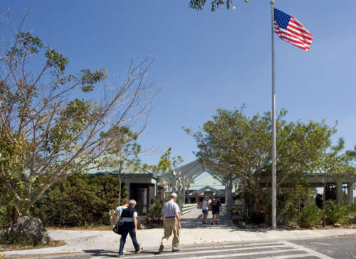
The last stop on our visit to the park, the Ernest F. Coe visitor center, provided a new perspective on the transformation of the Everglades ecosystem, and a fresh angle to ponder on IAN’s creation of an Everglades environmental report card. On the day of our visit, the Everglades artist in residence program had mounted a photography exhibit by Adam Nadel. Entitled “Getting the Water Right: the Culture and Politics of Water in the Everglades,” the exhibit explores the interdependence and mutual transformation between the Everglades ecosystem and people living nearby. People have transformed the Everglades, but the Everglades also has transformed the culture and politics of South Florida.

One photograph that made a lasting impression on me shows lawmakers assembled for a meeting of the Florida House Appropriations Committee. Restoration efforts, like CERP, have transformed the Everglades into a hybrid system. Its boundaries extend beyond the geographic limits of South Florida as far as to include the federal and state lawmakers who are responsible for funding the pumps that feed Taylor Slough and a myriad of other measures now required to maintain the health of the ecosystem. Our objective in creating an Everglades report card is equivalent to improving the function of a feedback loop that is essential for maintaining this hybrid ecosystem. Our aim is to communicate more effectively information on conditions in the ecosystem to decision-makers like those shown in this photograph. This makes us part of the transformed Everglades, too.
***
Hurricane Irma was not on anyone’s radar when the IAN team visited the Everglades in August. The possibility of a hurricane is always a consideration for people in Florida this time of year. I can remember my relief that we had successfully completed three workshops in South Florida in August without the logistical complications that a tropic storm can cause. As I am writing this my thoughts are with our colleagues in South Florida, who now must reassemble their lives in a landscape that has been transformed, literally, overnight.
Today’s blog post completes our drive along the road to Flamingo and explores some of the consequences of sea level rise on the mangrove coast. Near the Pay-hay-okee overlook we passed a sign marking a high point in the park’s topography that could be considered the continental divide of South Florida. The sign reads “Rock Reef Pass, elevation 3 feet.” That’s 3 feet above mean sea level. Irma’s eastern eyewall passed within miles of Flamingo on Sunday, September 10, 2017. This most destructive part of the storm then scythed a path through the entire mangrove forest that comprises the western edge of Everglades National Park. The storm surge predicted for Flamingo was 5 feet above mean sea level. A surge of over 11 feet was predicted for Everglades City, at the northern edge of the park’s mangrove coast. If the sea did not inundate the freshwater cypress stand at Pay-hay-okee, then this was mostly due to the presence of the mangrove forest.
A healthy stand of mangroves is nearly impenetrable to anyone on foot, and it is an effective, time-tested barrier against hurricane storm surge. Hurricane Andrew was a category 5 storm that hit South Florida in 1992. Andrew cut like a buzz saw perpendicularly across this same coast. The mangroves in the relatively narrow path of this storm were completely stripped of their leaves, and the mangroves near the center were flattened completely. The level of destruction from Irma may not be as complete, at its worse, but undoubtedly Irma has had a much greater cumulative impact on the mangrove forest. The future evolution of the Everglades in the face of accelerated sea level rise depends now on the ability of the mangroves to recover and on the timing of the next storm.
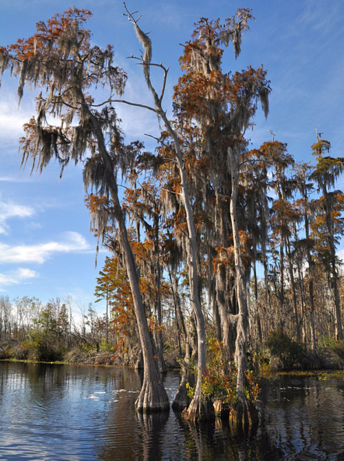
Taxodium ascendens in the Black Water, Okefenokee, created by Clinton Steeds, licensed under 2.0 Generic (CC BY 2.0)
Red mangrove-everglades natl park, created by Andrew Tappert, licensed under GNU free documentation license
Flamingo Visitor Center FL1, created by Acroterion, licensed under Attribution-ShareAlike 3.0 Unported (CC BY-SA 3.0)
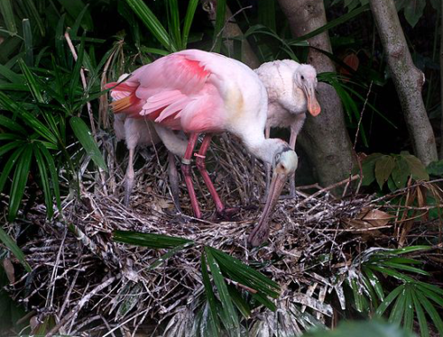
Platalea ajaja -parent and two chicks on nest-8a, created by ladydragonflycc, licensed under
Attribution 2.0 Generic (CC BY 2.0)
Ernest F Coe Visitor Center (2), NPSPhoto (9101957110), created by National Park Service, licensed under Public Domain

