Field Trips in Puerto Rico…. with a mission
Jason Howard · | Science Communication |The Integration and Application Network has been involved in a series of workshops in partnership with U.S. Geological Survey to identify and communicate drought impacts across regions of the United States. The latest of this series took place in San Juan, Puerto Rico on May 30-31, focusing on vulnerabilities and draught-related issues specific to Puerto Rico and the US Virgin Islands. Bill reflected on the two-day workshop through a couple blogs that can be found here and here so rather than rehashing his workshop summaries, this post will focus on the field trips that followed the workshop. Field trips are typical for conferences and workshops; they’re a fun way to network with colleagues, and they help establish context for the material discussed during the sessions, though this time we had a specific agenda: we needed video footage of the island.
Periods of drought are predicted to intensify in Puerto Rico and the US Virgin Islands, creating new hardships for people and the natural environments on which they depend. If these islands are to thrive in an environment that is becoming increasingly hostile, every tool in the toolbox needs to be used to help understand and manage the effects of drought. USGS, USDA, and university partners involved in these workshops use tools like ecological and hydrological measurements and climate forecast models to explore the topic of drought. This workshop introduced oral histories as an additional method to capture drought-related information. Just as scientific instruments record data, oral histories capture information that can be used to better understand events and situations by examining the personal experiences of those involved. Throughout the workshop, Jamie Currie worked closely with Aranzazu Lascurain and Melody Hunter-Pillion to record a series of oral history interviews on experiences with the extreme 2015 drought in Puerto Rico. These interviews documented topics and perspectives related to island drought that are unlikely to be part of other records and datasets. Oral histories are an established tool for information acquisition, but with the correct editing, these interviews could be restructured into the type of personal narrative that IAN has long promoted for effective science communication. The bones of an interesting narrative about island drought existed in the video interviews, but if they were to be assembled into a compelling visual story, we needed footage of things, people and places in Puerto Rico to add texture and context. This was the mission for our field trip.
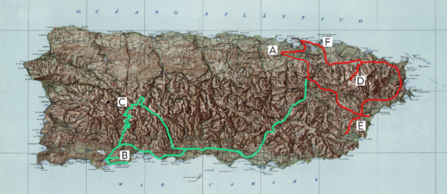
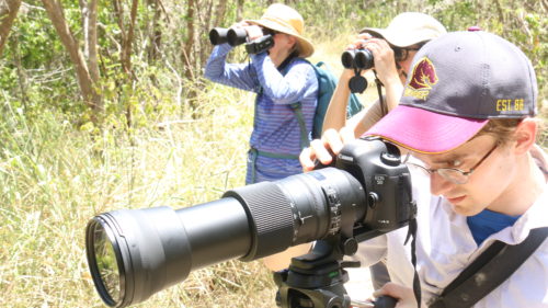
We formed a caravan with other workshop participants from NC State and USGS outside San Juan, and drove the two hours across the island to meet our tour guide, Amarilys Irizarry Torres, near the entrance to Guánica State Forest. This is considered to be one of the best preserved subtropical forests in the Caribbean and was designated a United Nations Biosphere Reserve in 1981. We entered the reserve, but by the time we started our hike, the sun was high and the temperature was too hot for many of the animals to make a conspicuous presence. Jamie managed to get a great shot of a Pearly-eyed Thrasher but most of our footage ended up being landscape and vegetation.
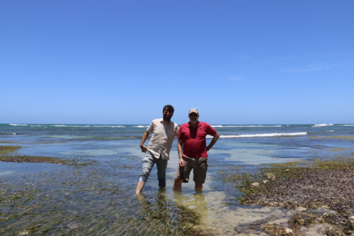
From there we traveled to the adjacent ecosystems on the coast, stopping at Playa Tamarindo. Bill and I, both being seagrass ecologists, quickly ran out to the dense meadows of Thalassia testudinum (turtle grass) that lined the beach. There were other species as well but the Thalassia stood out; I had never seen it thrive in areas so close to the beach before. At this point I heard, “focus guys!” shouted across the beach; this was a drought-focused field trip after all, so we had to leave the halophytes to explore more relevant areas.
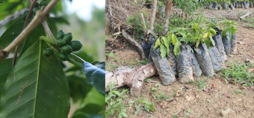
We left the southern coast for the mountainous western interior region of the island. This is the primary coffee producing region, with a number of small scale coffee growers set up across the high altitude landscape. We visited "Finca El Remanso" in Yauco, where our guide Amarilys showed us the coffee trees interspersed with the plantation’s other species of vegetation. This was an important stop following a drought workshop; the changing patterns of precipitation are threatening a number of crops in Puerto Rico. Just a couple days earlier, Bill Gould presented models predicting the decreased area on the island suitable for coffee growing due to decreasing precipitation. Puerto Rico as a whole imports 85% of its food, however local agricultural crops are still important contributors to the local economy and culture.
The trip from the southern coast up to the coffee plantation was an almost 3000ft change in elevation in just over just 13 miles. The elevation change and complex topography made for the most extreme driving I’m done in recent years. We had intentions to visit a couple more locations but the extended network of switchbacks proved to be too much for our worn out jeep, the car-sick passengers and our schedule that was already overbooked. We headed back to San Juan where we met up with Horn Point professor Jamie Pierson and his crew for dinner.
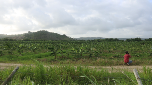
Jamie Currie and I continued collecting footage the following day, focusing on the eastern part of the island. This was the region most severely impacted by the 2015 drought and then again battered by Hurricane Maria in 2017. We hoped to get footage at El Yunque National Forest, though most of it was still closed due to hurricane damage. From there, we traveled towards Humacao, stopping from time to time for footage of agriculture, wildlife, and everything else that could be used to establish or augment the context for a scene.
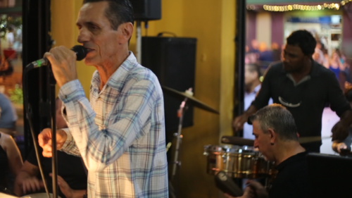
We ended the field trip at la Placita de Santurce where we had made arrangements to record a concert by the local salsa band Saravá. The band set up in the corner of a small bar, and we quickly realized that the best shots of the musicians were conveniently next to the bartender. Qué suerte. Music can play an important part in developing story and emotion in film, and through a lucky series of connections we were granted an opportunity to record a musical score for the drought workshop videos.
The impact of extreme weather events was seen throughout our travels. Cisterns dot the residential landscape as a way to control water availability when the public distribution systems can’t meet demand. About half of the water flowing through Puerto Rico’s leaky water systems is lost in transport and the 2015 drought stopped municipal water delivery in multiple regions. Across the island, blue tarps still cover houses, marking the continued damage imposed by hurricane Maria. The two-day workshop covered scientific and social information required for the island to endure through the changing climate, and our field trips made it clear that research is sorely needed.