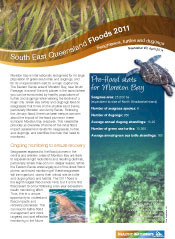
Flood newsletter on seagrasses, turtles and dugongs
Bill Dennison ·This newsletter was interesting to assemble, as it involved talking with lots of active scientists about their current knowledge of seagrasses, sea turtles and dugongs. The flood impacts on these Moreton Bay icons was of concern to everyone involved. I also made visits to eastern Moreton Bay where the densest concentrations of seagrasses, turtles and dugongs are found (see previous blogs: Feb. 16 & Apr. 6).
For the seagrass risk map, I worked with Mitch Lyons, Chris Roelfsema and Stuart Phinn at the University of Queensland. They turned a concept into reality by first obtaining a digital bathymetry map of Queensland and creating a map of Moreton Bay. They next took the seagrass cover map that their remote sensing group had created in 2004 by using a combination of remote sensing images and groundtruthing by swimming transects, taking underwater photographs of the bottom and having accurate global positioning system locations. The flood plume map was created by searching through all of the remote sensing imagery available for the flood period and choosing a relatively cloud free image at the peak of the flood plume. The reflective colors detected with the satellite were converted to light attenuation using previously established algorithms. The seagrass risk map was then produced by overlaying the bathmetry, seagrass cover and light attenuation maps, and using the 10-20% minimum light requirements for seagrasses. The seagrass risk map identified several areas of concern, in particular, Deception Bay, portions of Waterloo Bay and southern Moreton Bay. Mitch, Chris and Stuart have initiated a monthly seagrass survey to monitor potential impacts in eastern Moreton Bay.
Two graduate students working on their PhDs, Paul Maxwell at Griffith University, Gold Coast and Peter Hanington at the University of Queensland, had been sampling in Moreton Bay, and their data on underwater light fields represented an opportunity to validate the seagrass risk map. They were very forthcoming with their independently collected data and it worked out that the three sites where they sampled confirmed what the risk map predicted—seagrasses in Deception Bay are getting 'hammered' by the flood plume, Waterloo Bay was affected to a lesser degree and eastern Moreton Bay (Pelican Banks) was the least affected.
The Moreton Bay flood impact on seagrasses and dugongs was reminiscent of the 1992 Mary River flood that impacted Hervey Bay, north of Brisbane. The Hervey Bay floods were devastating to the resident dugong population, and this case study was presented as a cautionary tale for the Moreton Bay floods. The Hervey Bay case study was fortuitously well documented because Dr. Tony Preen had just moved there to begin his postdoctoral research under the supervision of Prof. Helene Marsh, James Cook University. Tony showed that the double flood and cyclone caused massive seagrass loss and dugong essentially starved to death or migrated out of Hervey Bay.
The Queensland turtle expert is Dr. Col Limpus with the Queensland Department of Environment and Resource Management and his decades of experience tagging and studying marine turtles made him the obvious candidate to talk with about the Moreton Bay green sea turtles. Col is busy fitting turtles and dugongs with satellite tags and collating data on strandings. He was particularly concerned about the movement of turtles and dugongs into areas that they don’t normally reside and the need to expand the ‘go slow’ zones in Moreton Bay.
I also spoke with the Moreton Bay dugong expert, Dr. Janet Lanyon, who has been actively studying dugong in Moreton Bay for twenty years. Janet is busy with her dugong tagging program and she has tagged most of the Moreton Bay dugongs so a large immigration from Hervey Bay or other areas in Queensland impacted by floods could be detected. Janet will be collecting dugong blood samples in May/June for contaminant levels. She also will be sampling stable isotopes of seagrasses and dugongs to assess possible dietary shifts by comparing to pre-flood data.
An exciting discovery that I made researching the newsletter was historical accounts of dugong sightings several months following previous major floods. The Thomas Welsby description of a large herd of dugongs several months after the 1893 floods and George Heinsohn’s account of dugongs following the 1974 flood are powerful anecdotes that support the conclusion reached in this newsletter that due to currents, position and oceanic flushing, the seagrasses and the green sea turtles and dugongs that they support will likely be relatively unaffected.
About the author
Bill Dennison

Dr. Bill Dennison is a Professor of Marine Science and Vice President for Science Application at the University of Maryland Center for Environmental Science.


