Maryland’s inaugural State of the Coast conference
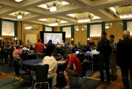
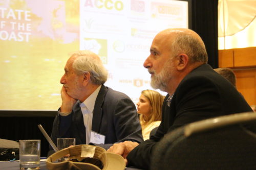
Bill Dennison ·The Maryland state agencies initiated the inaugural "Maryland State of the Coast: Connecting People, Innovation and Opportunity" conference from May 21-23, 2018. This conference brought scientists, resource managers and practitioners together to discuss the coastal issues in Maryland. The conference was held at the Hyatt in Cambridge on the Choptank River.


As part of the opening plenary, Ricky Arnold, a Maryland native and graduate of the Marine Environmental & Estuarine Science (MEES) program, provided an amazing video welcome, filmed in the International Space Station where Ricky is currently stationed. Ricky did his Master’s research in the Chesapeake Bay, so he has a very personal connection to the Bay.
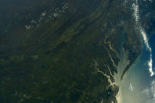
I provided a scientific overview of the state of the Maryland coastal regions as part of the opening plenary, the subject of this blog. I started out with a couple of photographs that Ricky took from the International Space Station, highlighting the different coastal regions. Maryland has multiple coastal regions, including the Atlantic Ocean, the Maryland Coastal Bays, and Chesapeake Bay and its tributaries. The vulnerability of Chesapeake Bay to runoff, based on the turbidity in the Chesapeake tributaries is clearly visible from space.

The Coastal Atlantic Ocean: increasing interest, emerging concerns and sparse data.
The broad, shallow continental shelf offshore from Fenwick and Assateague Islands is a region of increasing interest, largely due to the potential wind farm development. The canyons at the edge of the shelf are biodiversity ‘hot spots’ and the shelf is not simply a sandy plain devoid of life. To illustrate the three dimensional habitats, I used spectacular video footage from Rebecca Wenker, a current University of Maryland Eastern Shore (UMES) graduate student in the MEES program, in which the beautiful soft corals, sponges, fish and mussels are visible at sites on the continental shelf. I also highlighted some of the maps of drifters that Katie Fitzenreiter, another UMES student in the MEES program, deployed in Ocean City inlet. These drifter trackers showed the water movement into the Maryland Coastal Bays, as well as water movement that crossed the Gulf Stream and entered the Sargasso Sea. In addition, some of the hydrodynamic modeling that Dr. Meng Xia, associate professor at UMCES, is doing which shows the influence of wind direction and intensity on the movement of coastal waters. In short, northwest winds cause water to flow into the Ocean City inlet, while southwest winds cause water to flow out of the Ocean City inlet. These wind fields functionally flush the Maryland Coastal Bays with the Atlantic Ocean, more so than the small semi-diurnal astronomical tides.
Maryland Coastal Bays: discovered and not forgotten, triple threats to water quality and ongoing degradation.
The shallow coastal bays are not globally unique, as shallow lagoons separated from the ocean by a low, sandy barrier island are a common coastal feature. The Ocean City inlet was formed naturally in 1933. The inlet was then stabilized with rock jetties and maintenance dredging. In addition, Fenwick Island where Ocean City is located is maintained in its 1933 position with regular sand pumping from offshore to the beach. In contrast, Assateague Island, managed by the National Park Service, is allowed to migrate shoreward, making the contrast between the two coastlines more and more evident.

The Maryland Coastal Bays have been characterized as the “forgotten bays,” particularly in contrast to the highly celebrated Chesapeake Bay and the ocean beaches. But the forgotten bays are being discovered with increasing recreational, science and management activities. The triple threats of nutrient sources that are leading to eutrophication impacts were identified.
- Threat 1: Agricultural runoff. The increase in the poultry industry on the Delmarva peninsula has led to very high levels of dissolved nitrogen and phosphorus concentrations in the streams that flow into the coastal bays.
- Threat 2: Ocean City sewage discharge. Sewage from the seasonal summertime populations of Ocean City is treated with biological nutrient removal, but not to the higher enhanced nutrient removal levels as is instituted throughout Chesapeake Bay. The offshore discharge location is in relatively shallow water (<40’), not far from shore (<2 mi).
- Threat 3: Chincoteague Island septic runoff. The town of Chincoteague Island, VA is located on a sandy island within Chincoteague Bay. The town does not have sewers or a sewage treatment plant, rather it relies on septic systems. Traditional septic systems do not effectively remove nutrients and septic runoff plumes in Chincoteague Bay are evident using macroalgal biological indicators and stable isotopes.
These eutrophication threats have resulted in ongoing water quality degradation in Newport Bay and in Chincoteague Bay near Chincoteague Island.
I highlighted several restoration efforts that are underway, including island creation for nesting birds using sediments from navigational dredging. In addition, mosquito ditch filling to reduce marsh erosion and the removal of the Bishopville dam to enhance fish passage have enhanced coastal bays habitats.
Forecasting the future, new inlets connecting the coastal ocean with the coastal bays will become a new permanent feature. In fact, new temporary inlets have occurred following major storms. With the high rates of relative sea level rise, it is inevitable that permanent inlets will result, akin to the new inlet on Fire Island and Great South Bay on Long Island that occurred in 2012.
Assateague Island has a few unique issues that the Natural Park Service is dealing with, including avoiding light pollution that impairs night sky viewing, overgrazing by wild ponies and deer, and maintaining rare, threatened and endangered species like piping plovers. A key feature of the Maryland Coastal Bays is the series of scientific syntheses that have been occurring since 2004.
Chesapeake Bay: large, iconic & unique, data-rich, restoration progress evident.
Hurricane Agnes in 1972 had a profound effect on Chesapeake Bay, disrupting the natural seasonal eco-rhythms of the Bay. Hurricane Agnes also ushered in the beginning of a wet phase and many negative impacts became evident. In response to water quality degradation and aquatic grass declines, the newly formed Environmental Protection Agency funded scientific studies to discern the cause(s) of the degradation. The Chesapeake Bay Program was formed in 1983, with various multi-state agreements to reduce nutrient inputs.
At the conference, I provided a brief timeline history of key activities associate with Chesapeake Bay. I based this on a public talk I gave at the Chesapeake Bay Maritime Museum, described in a previous blog. I added an update of the recent submerged aquatic vegetation publications in which we linked nutrient reductions to the resurgence of aquatic grasses.
I spoke about the the oyster restoration project in Harris Creek, Choptank River, where we produce hatchery oysters, place them into a strategically located sanctuary, and end up with a large vibrant population of oysters. I also highlighted the Chesapeake Dolphin Watch program, led by Helen Bailey at the Chesapeake Biological Laboratory. I provided a preview of the 2017 Chesapeake Bay report card since the data had recently been calculated, and it was gratifying to report that the overall Bay trends are significantly improving for the first time since we began reporting Bay health. The success of water quality improvements due to sewage treatment upgrades and air quality improvements needs to be expanded to include improvements in stormwater runoff from both urban and rural areas.
I summarized the state of the Maryland coast as the following:
- We have varying degrees of understanding of the diverse Maryland Coasts, but all coasts are actively being studied.
- Chesapeake Bay (C) and Maryland Coastal Bays (C+) receive similar grades, but are on different trajectories.
- Partnerships with adjoining states and with diverse stakeholders remains crucial.
- Maryland has responded effectively to historic challenges, preparing us for emerging concerns like climate change.
- Maryland coastal protection and restoration has and should continue bipartisan.
To wrap up my State of the Coast talk, I suggested that we, as a group, send a video back to Ricky Arnold in the International Space Station. We played a karaoke version of a song, “Bye, Bye, Miss Chesapeake Bay,” and everyone sang along.
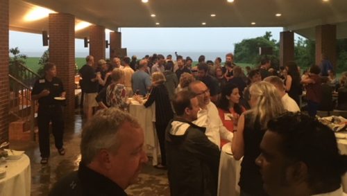
Later that evening, the University of Maryland Center for Environmental Science hosted a very nice dinner reception at the pavilion at Horn Point Laboratory. We had live music, freshly shucked oysters, and locally produced beer. I caught up with Lou Etgen who filled me in on his trip to Moscow and Kazakhstan to watch Ricky’s launch aboard the Russian Soyuz spacecraft. Lou and I took our families to Florida back in 2009 to watch Ricky’s launch aboard the Discovery space shuttle, so it was nice to compare and contrast with the Russian launch.
All in all, I very much enjoyed the "Maryland State of the Coast: Connecting People, Innovation and Opportunity" conference. One of the reasons the conference was a success was because Kristin Saunders and Kristen Fleming put together a stellar program. The Integration and Application Network team, led by Ken Barton and Dottie Samonisky, provided critical support. I look forward to future iterations of this conference.

About the author
Bill Dennison

Dr. Bill Dennison is a Professor of Marine Science and Vice President for Science Application at the University of Maryland Center for Environmental Science.

